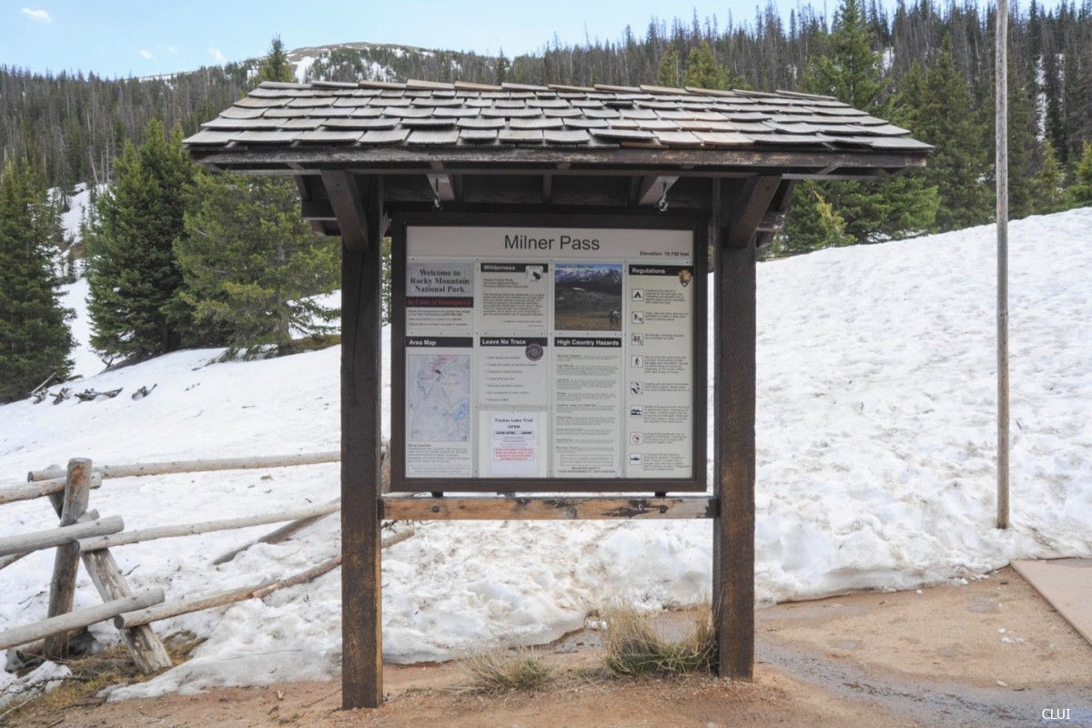
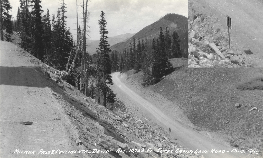
Milner Pass
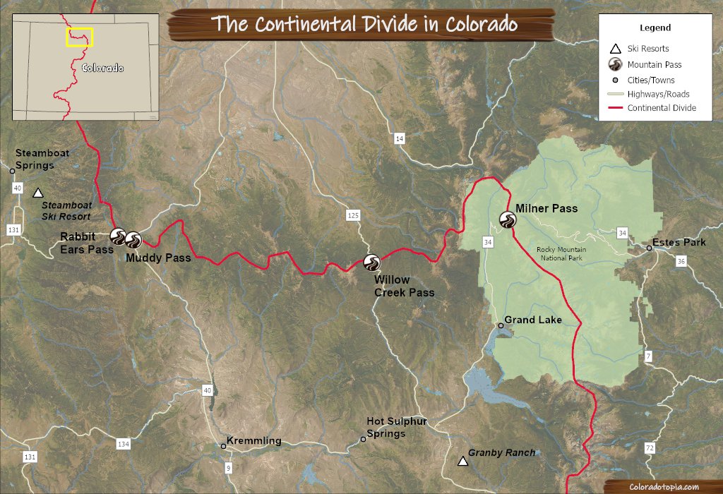
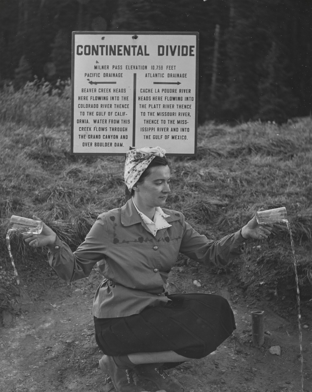
Located just one ridge to the southeast of La Poudre Pass, you’ll find Milner Pass at the NE corner of Rocky Mountain National Park. This part of the Continental Divide is partially defined by Poudre Lake, which flows to the east towards the Atlantic right from the top of the divide. Milner Pass is located near the lower elevations of Trail Ridge Road. This pass is also part of the scenic byway that winds through the park.
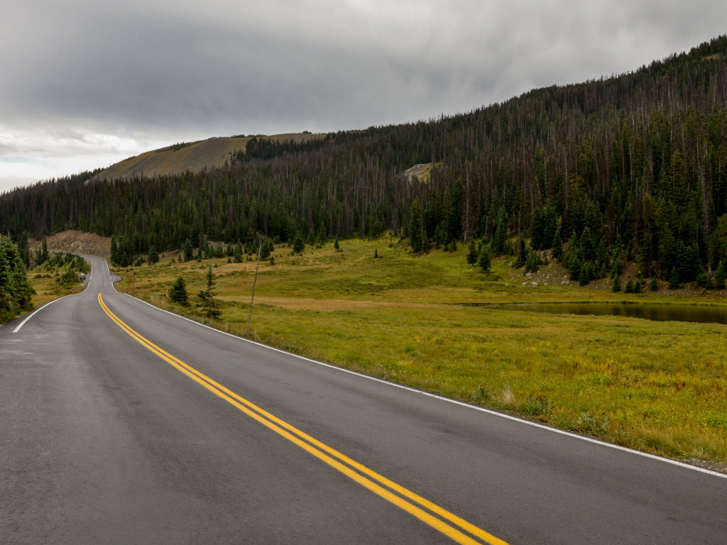
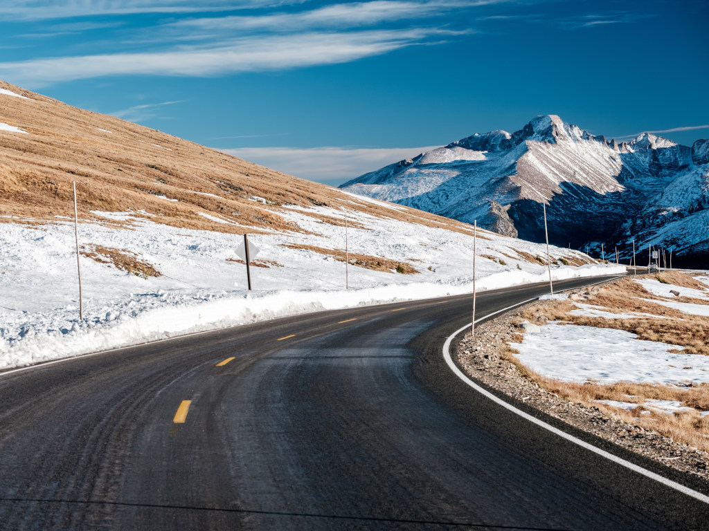
Just beyond the top of Milner Pass, you will ascend above treeline and into the alpine tundra on Trail Ridge Rd. The road is paved for the entire length through the park, and it has numerous overlooks and where you can pull off for photos. This ascent is where you will find the Alpine Visitor Center for Rocky Mountain National Park. Once you are above 12,000′, the road flattens out and winds around the landscape before finally starting to descend again.
Seasonal Info
Milner Pass is closed during the winter.
Milner Pass Info
- Road Elevation: 10,759'
- Surface: Paved
- Mtn Range: Front Range
- Roadways Names: CO Highway 34, Trail Ridge Rd.
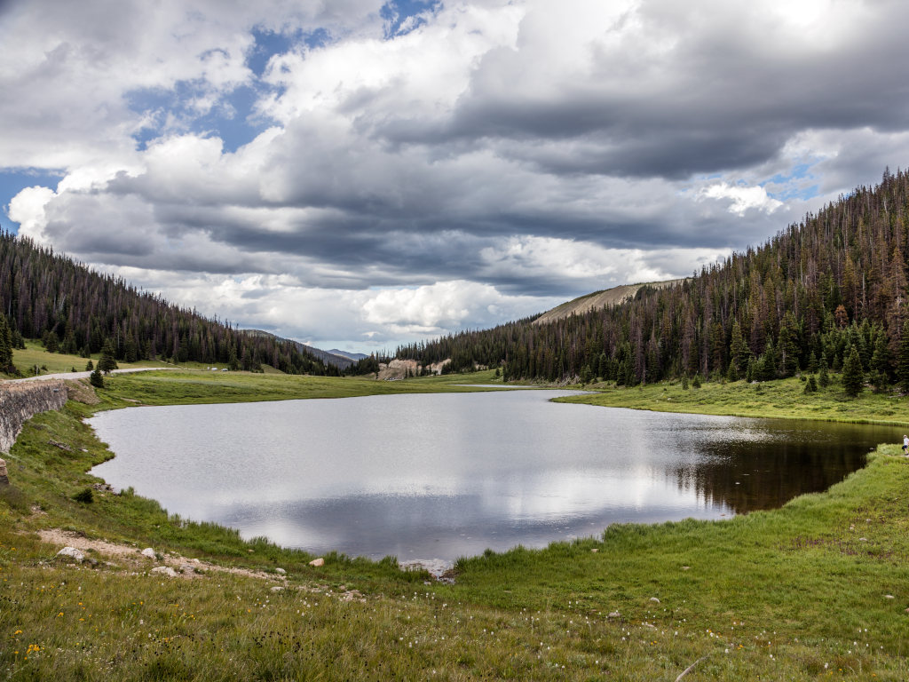
Poudre Lake can be seen on the right of the photo above, as the roadway heads further into Rocky Mountain National Park. This photo was taken while facing east, just past the divide. Poudre Lake drains into Cache La Poudre Creek as it crosses under the road straight ahead, where it begins its journey to the Gulf of Mexico. Take note, La Poudre Pass is located 1 valley to the north from here, over Specimen Mountain.

Recreation on Milner Pass
There are several hiking trails that pass through the surrounding area on Milner Pass. This includes the Ute Trail; parts of which date back hundreds of years to when the route was used by the Ute tribes. This DOES NOT include the Continental Divide Trail. The CDT route traverses this area to the south of the pass, closer to Grand Lake.
Hiking Trails
- Ute Trail
- Poudre River Trail
- Lake Irene Trail
Fishing
- Poudre Lake
- Lake Irene
Milner Pass FAQ
This is a catch + keep lake and there are reports of fish being caught here.
Yes, although “the pass” in this case generally refers to the area of the roadway and hiking trails rather than the actual roadway.
Milner Pass History
A wagon road through the Kawuneeche Valley (leading up to the west side of Milner Pass) existed as early as the 1880s. This road did not extend all the way up to the pass.
An article from the Boulder Daily Camera in 1912 describes planning for a road on the pass as follows: “The proposed highway will have Denver and Estes Park as destination points and will be built from Estes Park west up the Fall River crossing the Continental Divide at Milner pass.”1
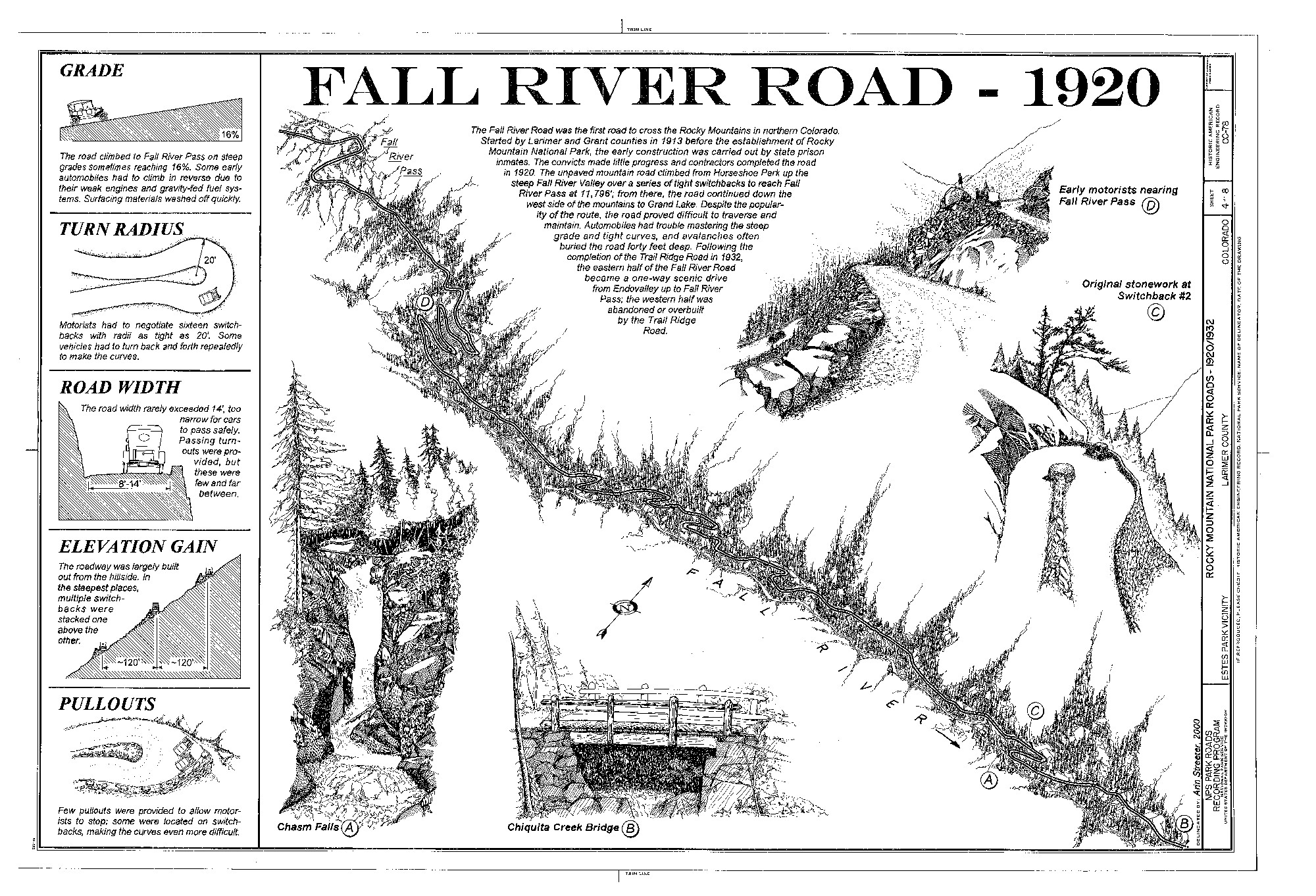
Rocky Mountain National Park was created in 1915, and Fall River Road was completed in 1920. This roadway provided a path through the park and across the Continental Divide at Milner Pass.
Construction of Trail Ridge Rd. began in September of 1929, and this road was intended to replace the old Fall River Rd. Once construction was completed, the western portion of the old road was abandoned, and the portion located to the east of the Alpine Visitor Center was turned into the one-way road which is now known as Old Fall River Road.2 This road is still maintained as a dirt road today.
Construction of Trail Ridge Rd. was largely completed by 1933, but finishing touches of the high elevation portions continued into 1935.3 The new road was opened incrementally. Trail Ridge Rd./US HWY 34 is still the main road over Milner Pass today.
Did You Know?
Milner Pass was named for T.J Milner. Milner surveyed this area for a potential railroad in the 1800s.
Getting to Milner Pass
This pass is located on the western side of Rocky Mountain National Park. You can either get here by traveling through the park on Trail Ridge Rd., or you can travel here from Grand Lake.
The directions below will get you from Interstate 70 to Milner Pass on the western side of the park.
- Exit I-70 at Exit 232
- Co Hwy 40 North to Granby
- Co Hwy 34 North to Grand Lake
- Continue on Hwy 34 into Rocky Mountain National Park
You can also get to Milner Pass by traveling on Trail Ridge Rd. through Rocky Mountain National Park. The photo below gives you a good idea of what the high alpine environment is like in this area. This area is covered with permafrost, and constructing this road was a massive engineering achievement.
References & Credits
1. Boulder Daily Camera (Boulder, CO), Volume 22, Number 172, October 5, 1912, p. 1. Colorado Historic Newspapers Collection. Colorado State Library.
2. Historic American Engineering Record, Undated. National Park Service. U.S. Department of the Interior. View.
3. Multiple Resource Nomination for Rocky Mountain National Park National Register of Historic Places Inventory Nomination Form, June 5, 1987. United States Department of the Interior. National Park Service. View.
Images Credits: Library of Congress Prints & Photographs Division/Carol M. Highsmith [LC-DIG-highsm-33355] [33358], Center for Land Use Interpretation, Coloradotopia Archives, Harold Sanborn, Peter Novitt | More info