Eisenhower-Johnson Tunnel Info
The Eisenhower-Johnson Tunnel is Colorado’s main artery that brings Interstate 70 through the Continental Divide. It is located approximately 60 miles to the west of Denver and is actually two separate tunnels. Traffic in the Eisenhower Tunnel runs east to west, and the Johnson Tunnel traffic flows in the opposite direction. On the eastern side you will find the Front Range and on the western side you will find Summit County.
Loveland Ski Area is located on the eastern side of the divide and this ski resort rises up above both sides of the interstate. Travelers should be aware that the tunnel will close throughout the year, and weather is a frequent cause of closures during the winter months.
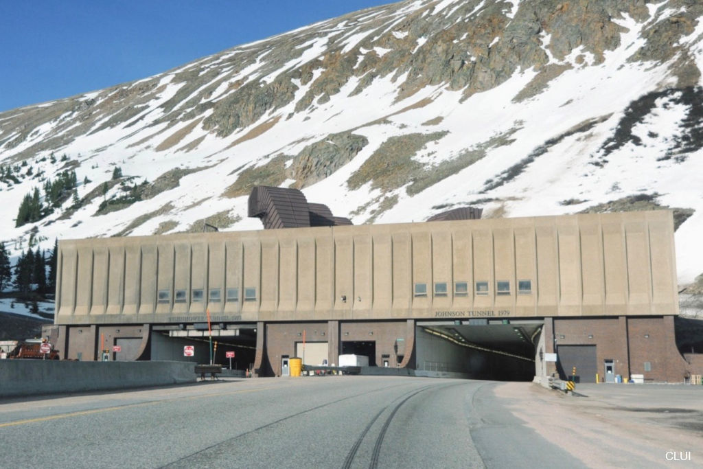
Quick Facts
- Official name: Eisenhower–Edwin C. Johnson Memorial Tunnel
- Clearance: 13' 11"
- Elevation, East Entrance: 11,013'
- Elevation, West Entrance: 11,158'
- Annual Traffic: 11 Million to 13 Million Vehicles
Eisenhower Tunnel
- Direction: Westbound
- Opened 1973
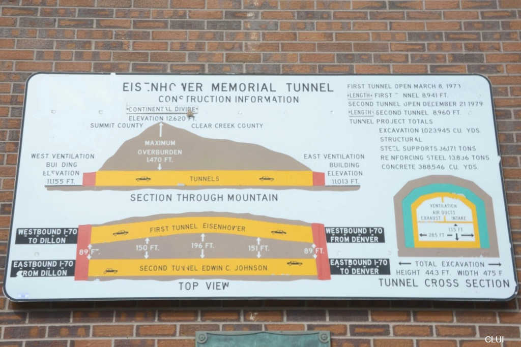
- Length: 1.693 Miles
Johnson Tunnel
- Direction: Eastbound
- Opened 1979
- Length: 1.687 Miles
There has never been a fatality in the tunnel since it opened. With more than 50 years of operation and no fatalities since construction finished, this is one of America’s safest sections of interstate.
Travel Closures & Alternate Routes
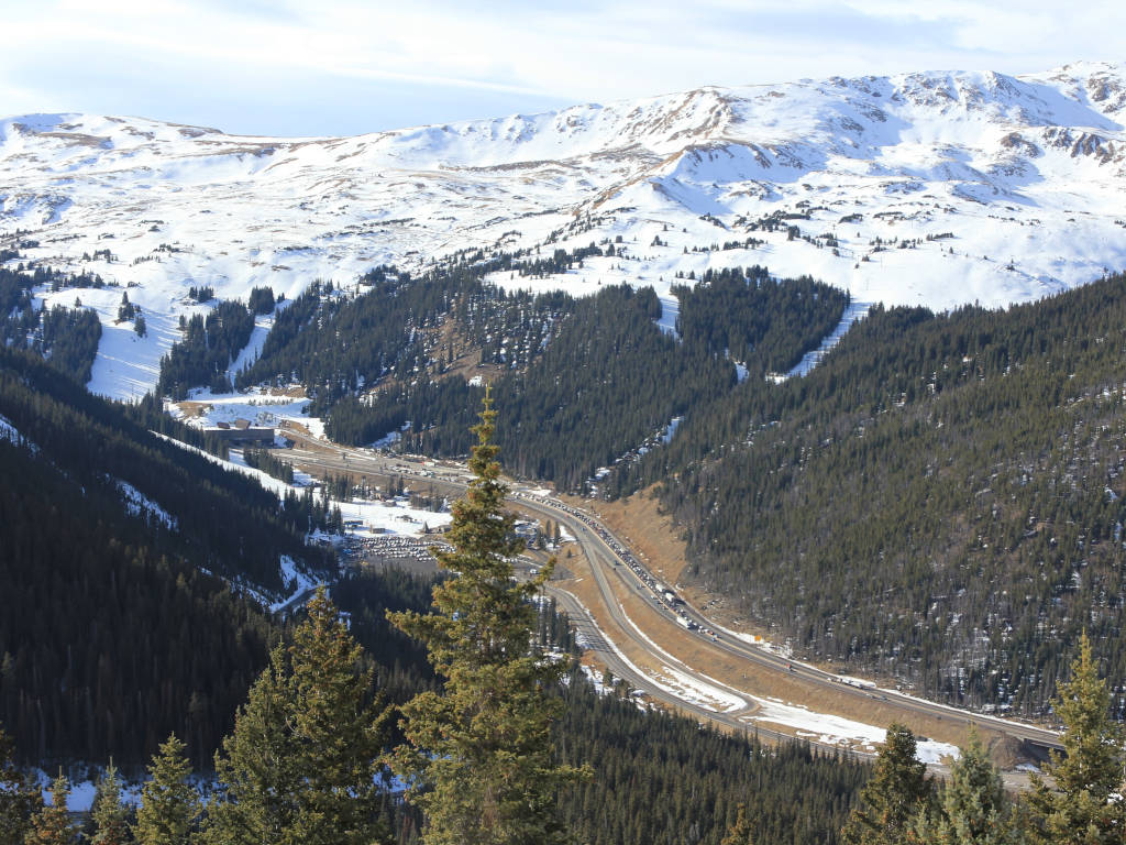
The tunnel will close throughout the year. If it is closed because of an accident, drivers can use US Highway 6 which travels over Loveland Pass (this route begins just prior to entering the tunnel). If the tunnel is closed for weather, it will be closed lower down the slope, and Loveland Pass will almost certainly be closed as well. There is no quick alternate route in that case.
Frequently Asked Questions
This depends on the season. The most common shutdowns are for weather during the winter. It’s not a shock to see the tunnel close more than once per week during the winter when the weather is bad, but during the summer it will be mostly smooth sailing. Vail Pass is much more likely to close, and this is about a 30-minute drive past the tunnel.
The original pilot bore was started in 1962 and completed just after Thanksgiving in 1964. The first tunnel was to be completed in late 1967, but construction would not begin until 1968.1
Former President Dwight D. Eisenhower and Edwin C. Johnson, former Colorado Governor and United States Senator.

Did You Know?
Your beer may have tunnel water. Water seeps into the tunnel and is discharged into Clear Creek, which descends the Front Range towards Denver. Among the first large users of this water is the Coors brewery in Golden, CO.
The tunnel runs as deep as 1,470 feet below the earth’s surface. The tunnel runs more than 1/4 mile below the surface of the mountain as it goes below the Continental Divide.
The tunnel’s actual clearance is approx 16′ 4″ and in some parts of the tunnel the bore is up to 48′ high. The inside of the tunnel is a small portion of the actual hole that is drilled through the mountain. Water irrigation, ventilation, and electrical infrastructure are among the things hidden above and below the tunnels that drivers pass through.
This was supposed to be a toll tunnel. The initial intention was to build a tollway through the divide and charge each vehicle to pass through. Initial discussions planned for a toll that would have cost between $.50 and $2.50 per car.2
How does the tunnel stop overheight vehicles from damaging it?
The Eisenhower Tunnel uses a series of lasers to check the height of each vehicle as it approaches the tunnel. A stop light is triggered if a vehicle is too high for the tunnel.
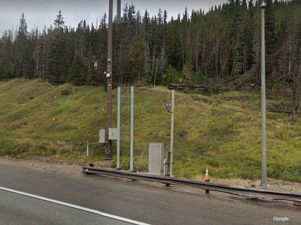
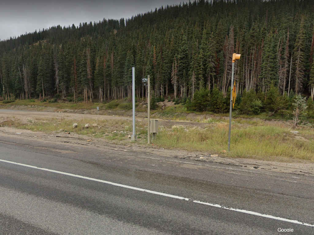
You can see the stoplight below that will turn red if a truck is over-height. This isn’t the only time that the stoplight gets used. It can be used to pause the flow of traffic for a number of reasons, including to close the tunnel. However, if you hear that the tunnel is closed because of the weather, it is likely closed much further down the slope than this stoplight.
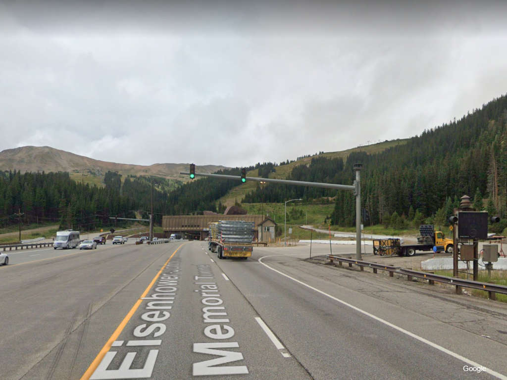
In 2007, the Colorado Transportation Commission voted to raise the height limit from 13′ 6″ to 13′ 11″. Prior to the height limit being raised, approximately 10,000 trucks would trigger the alarm each year indicating that they were too high. It was estimated that 80% of these instances could be eliminated. New lights and signage inside the tunnel also made it possible to raise the height limit.3
Tunnel History
It was more than 10 years from the time that the initial pilot bore was started until the first tunnel was opened to the public. At least seven men died while building the tunnel. Before its existence, Highway 6 over Loveland Pass was the main route to the other side of the divide.
The tunnel was referred to as the Straight Creek Tunnel during most of its construction. This is the name of the creek that descends towards Denver from this part of the Continental Divide.
The construction of the tunnel came largely as a result of the interstate system, which needed a path through Colorado. Loveland Pass already existed and this highway was already capable of bringing people into the mountains… but not like the interstate could do it.
This was not the only tunnel location that was being considered or lobbied for. Berthoud Pass was another potential site for building the tunnel and interstate.
The tunnel has provided an economical boom for the state. On the way into the mountains you’ll see tourists that are ready to spend money, while on the way out you’ll see some of Colorado’s natural resources being carried to the rest of the world. This includes mining ore from the mountains and oil from the Western Slope.
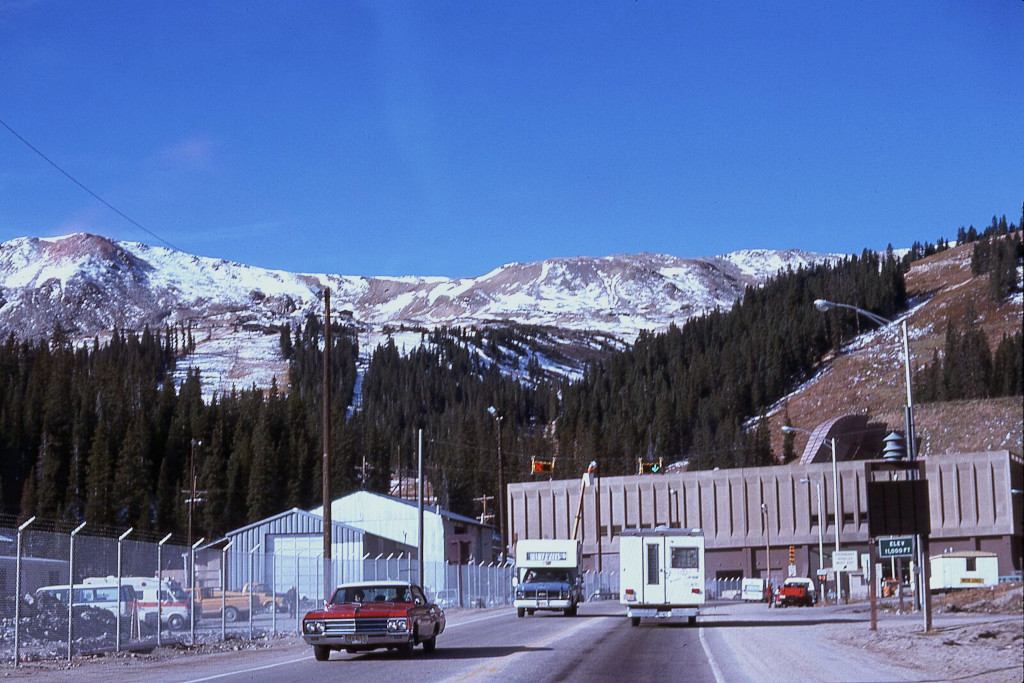
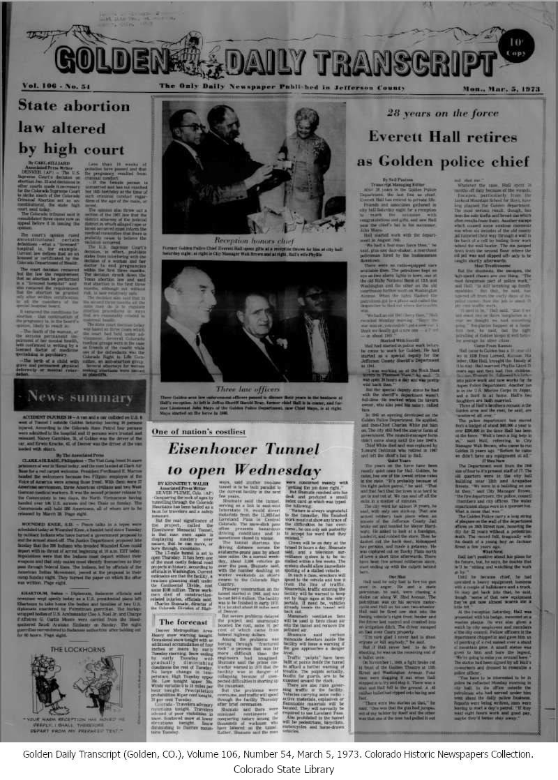
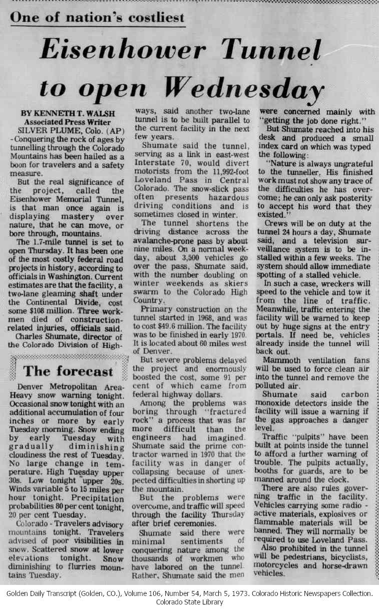
The Eisenhower tunnel was opened in 1973, and the Johnson Tunnel, heading in the opposite direction opened in 1979. The photo below was taken in 1974, when only one tunnel bore was open to traffic.
References & Credits
1. Lewiston Morning Tribune (Lewiston, ID), 1964.
2. The Eagle Valley Enterprise (Eagle, CO), Volume 54, Number 16, February 4, 1954. Colorado Historic Newspapers Collection. Colorado State Library.
3. Colorado raises height limit on I-70 tunnel. ccjdigital.com. November 19, 2007.
Images Credits: Coloradohistoricnewspapers.org, Center for Land Use Interpretation, Google Maps | More info
