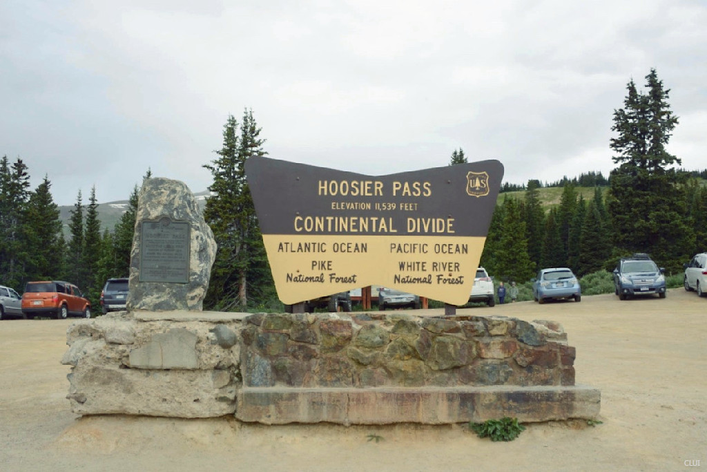
Hoosier Pass
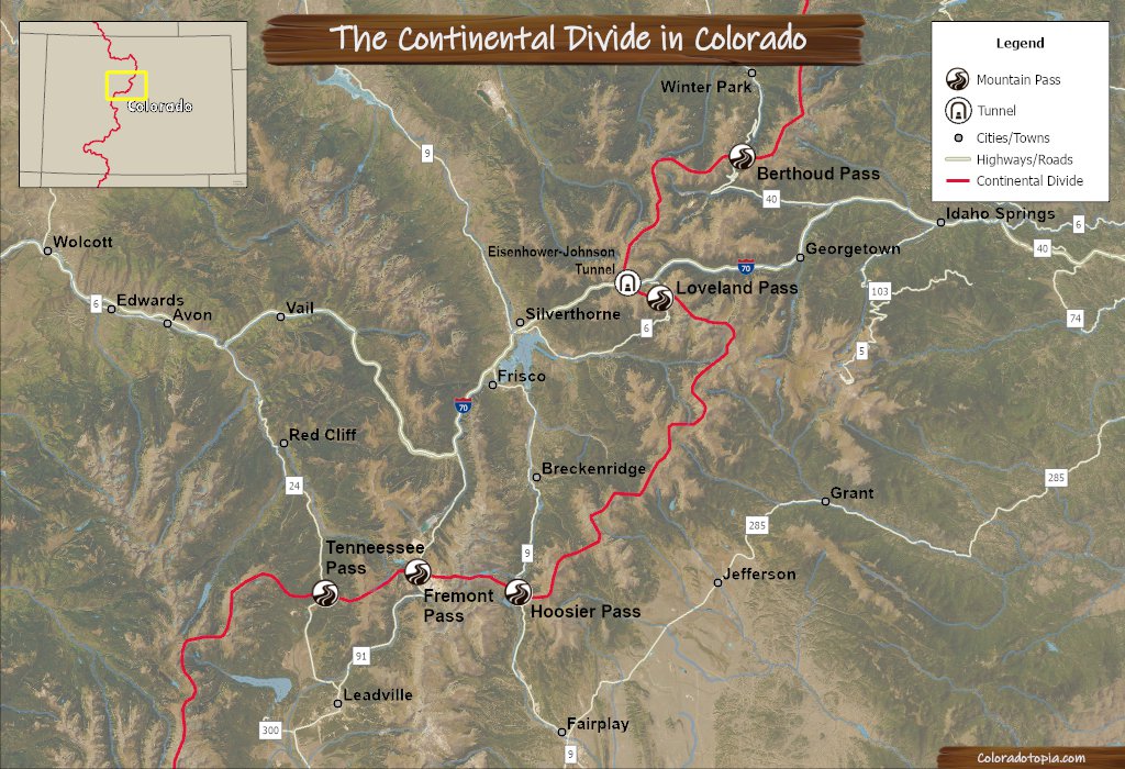
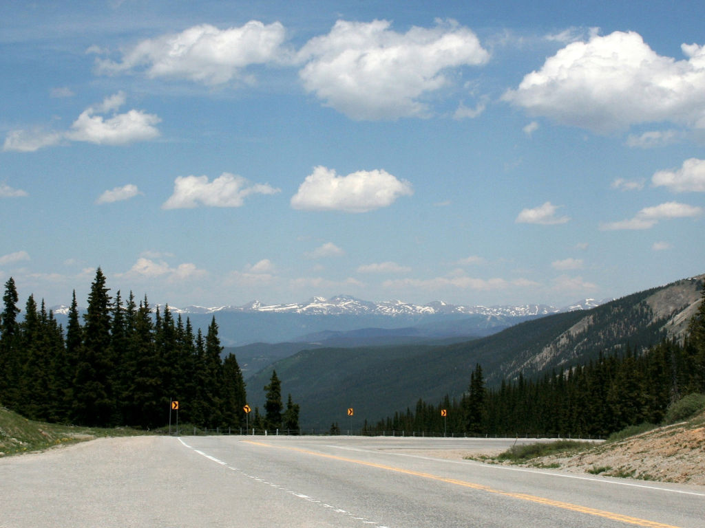
Keep driving south on Colorado Highway 9 from Breckenridge, and you will cross the Continental Divide on Hoosier Pass. This is the primary route between Breckenridge and Alma, CO. The route runs parallel with the Ten Mile Range (a subrange of the Mosquito Range).
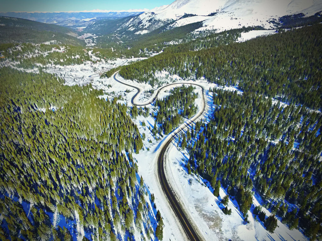
The northern side of this pass has several hairpin turns, and this is the more difficult side of the pass to drive.
Seasonal Info
Hoosier Pass is open year-round.
Hoosier Pass Stats
- Max Road Elevation: 11,539'
- Surface: Paved
- Mtn Range: Mosquito Range
- Max Grade: 8%
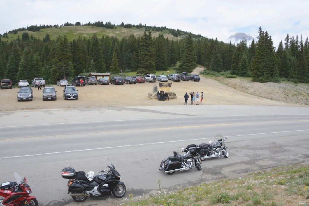
There is a large pull off area at the top of the pass. This is where you will find the Continental Divide sign and trailheads on both sides of the highway.
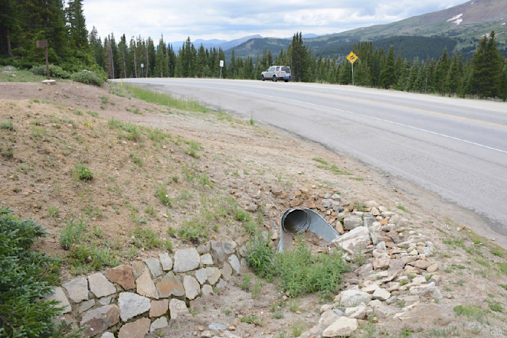
Alternate Routes – HWY 91, starting south at Copper Mountain and heading over Fremont Pass, is usually the best alternate route. Boreas Pass is a dirt road alternative that is open during the summer, located just to the east of Hoosier Pass.
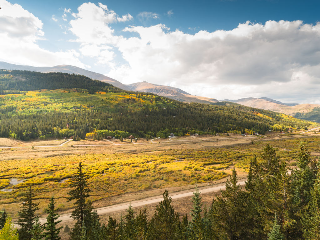
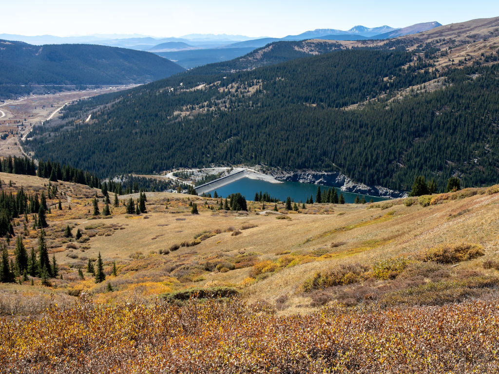
The photo above looks north over Hoosier Pass into Summit County. If you look closely, you can see some of the Keystone ski trails far off in the distance.
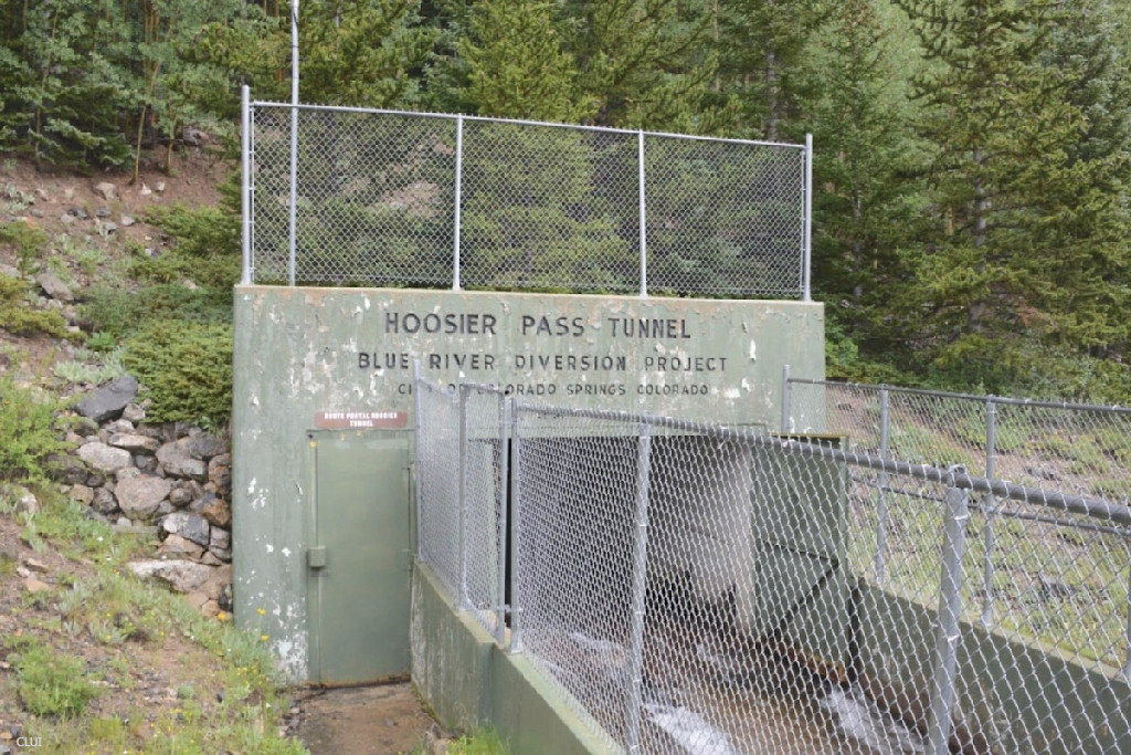
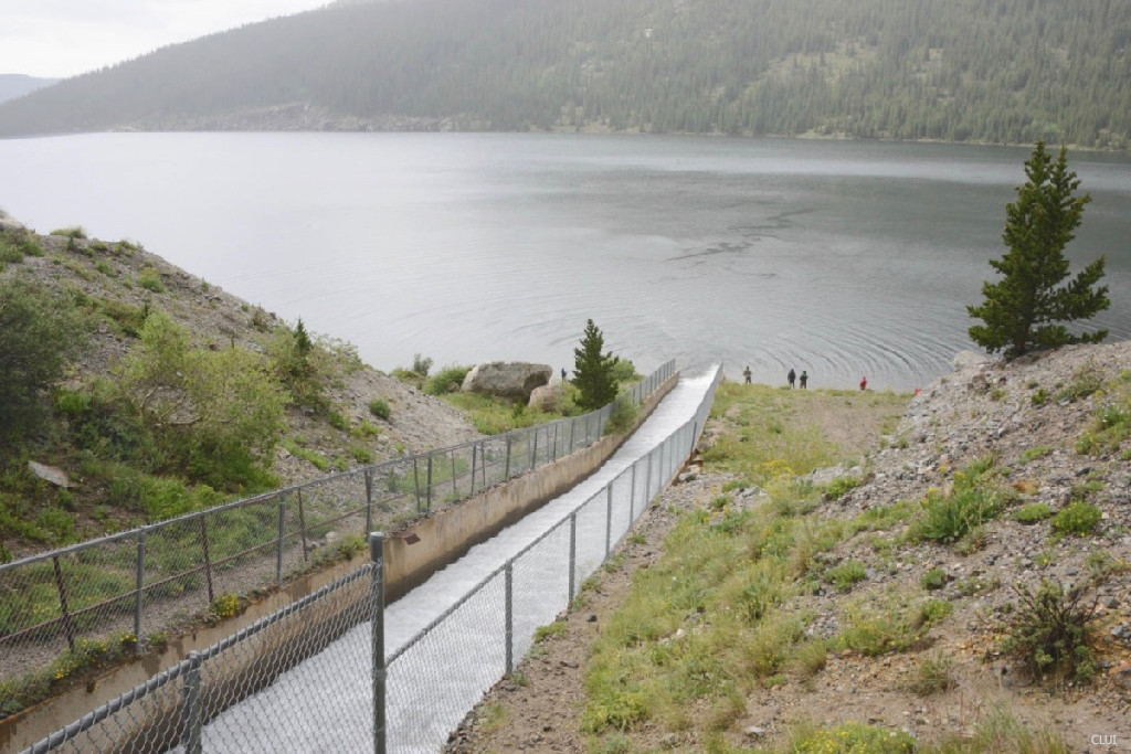
Irrigation and Water Diversion On Hoosier Pass
The Montgomery Dam is part of the Blue River Diversion Project, aka the Continental-Hoosier water collection system. This system of reservoirs and tunnels is powered entirely by gravity, and does not need any pumps. Water flows through more than 70 miles of irrigation tunnels and pipes in order to bring water from the western side of the Continental Divide near Hoosier Pass, down to the Colorado Springs area. This water diversion project functions alongside of the Homestake water collection system, which brings water to Colorado Springs from the Independence Pass area.
Recreation on Hoosier Pass
Hoosier Pass is a popular spot for recreation in the summer and winter. It is close to Breckenridge, there is a trailhead right at the top of the pass, and this is a convenient spot for locals to go in order to be outside.
Summer
- Cycling & Mountain Biking
- Hiking
- Fishing
- Camping
Winter
- Backcountry Skiing & Snowboarding
- Cross-Country Skiing
- Snowshoeing
- Snowmobiling
Summer
- Cycling & Mountain Biking
- Hiking
- Fishing
- Camping
Winter
- Backcountry Skiing & Snowboarding
- Cross-Country Skiing
- Snowshoeing
- Snowmobiling
Hoosier Pass FAQ
The first modern highway was completed in 1915. This was not the first roadway over the pass, but it was greatly improved over the previous wagon road, and widely used by automobiles.
Alma to Breckenridge measures approximately 17 miles. Some of this route is easy driving, and the actual mountain pass is shorter than this distance.
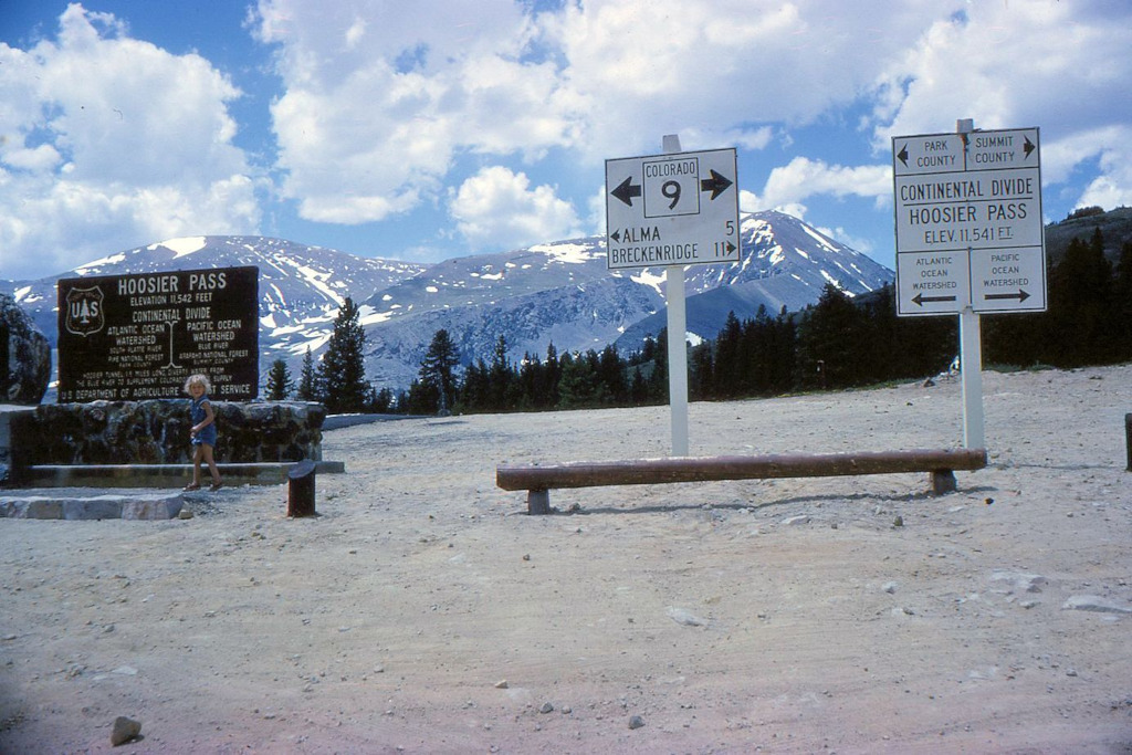
Hoosier Pass is located on the Continental Divide to the south of Breckenridge, CO. The southern side of the pass is in Park County, and the northern side is in Summit County.
The current elevation is stated at 11,539 feet, but this hasn’t always been the case. Before that, Hoosier Pass was measured at 11,542 feet. There is still a marker next to the sign at the top of the pass that has the old elevation measurement.
Hiking. The Bemrose Trailhead and Hoosier Pass Trailhead are located at the top of the pass on opposite sides of the road. The Quandry Peak Trailhead can be found on the northern side of Hoosier Pass. Quandry Peak is one of the more popular 14ers to hike in Colorado. Additional trailheads can be found on the northern side of the pass including: Blue Lakes Trailhead, Quartzville Trailhead, and the McCullough Gulch Trailhead. Hikers should try the Hoosier Pass Loop.
Cycling & Mountain Biking. Hoosier Pass is located on the TransAmerica Trail. This is also the highest point on the entire route, and a landmark for cyclists on their way across the country. Mountain bikers are allowed on the Hoosier Pass Loop that starts at the top of the pass.
Backcountry Skiing. There was once a ski area on Hoosier Pass, and skiers still hike up here to access the terrain.
Nordic Skiing. The Bemrose Trail makes up a part of what is referred to as the “ski circus”. This is a large network of trails that is popular among cross-country skiers and snowshoers. The Bemrose Trail is closed to snowmobilers, while the Hoosier Pass Trail is not.
Camping. The closest campground to Hoosier Pass is the Kite Lake Campground. To get here, head north out of Alma and take a left on Buckskin St. (Co Rd. 8). Follow the road past the old mills and mines until you arrive at this high alpine mountain lake. The Kite Lake Campground is tent camping only. The Kite Lake Trailhead is found in the same spot.
Fishing. Fishing is allowed in the Montgomery Reservoir, and this reservoir is stocked with fish. Expect to find Rainbow trout, cutthroat trout and brown trout here.
Snowmobiling. Snowmobiles are allowed on the Hoosier Pass Trail via the Hoosier Pass Trailhead at the top of the pass. There is a reasonable amount of parking at the top of the pass for sled trailers.
Directions from Denver
How to get to Hoosier Pass from Denver?
- I-70 Westbound
- Take Exit 203 at Frisco
- South on HWY 9, through Breckenridge, up Hoosier Pass.
Did You Know?
The summer tourism season of 1921 saw 1,749 cars go over Hoosier Pass. Data estimates were considered “conservative”. Tennessee Pass logged 2,577 motorists in the same season.1
There are two Hoosier Passes in Colorado. The second Hoosier Pass is located in Teller County, near Pikes Peak in the Front Range.
Hoosier Pass History
A trail over Hoosier Pass for horses and men existed here by the early 1860s.2 Railroad surveys here were being done by 1866.3 Surveys would be done many times over the next 50 years for railroads, but no railroad over the pass would ever be built.
October 9, 1879, the Georgetown Courier newspaper writes: “A report states that Breckenridge has been burned and many of its inhabitants slaughtered, and that the Indians are crossing Hoosier Pass”.4
Discussions of a toll road over Hoosier Pass took place in 1880, a time when mining activity in the area was picking up.5 A wagon road over Hoosier Pass to the Monte Cristo mine already existed before this. 6, 7
The Alma & Breckenridge Toll Road Co. was incorporated in February 1880 for the purpose of building a toll road over Hoosier Pass.8 However, there is no mention of the company again that we have found, and there is no mention of any tolls ever being charged on the Hoosier Pass wagon road.
The first automobile to drive over Hoosier Pass was driven by Mr and Mrs. Geo. H. Evans and Mr. Wm. J. MacConnell of the Snowstorm Hydraulic Co. on July 25th, 1904. They drove a car that was capable of 30 horsepower, and it took about 3 hours to drive over the pass from Alma to Breckenridge. Hoosier Pass had a maximum grade of 30% at the time.9
Within a few years, the pass was generally referred to as a wagon road that was in terrible shape, and sometimes driven by autos as well.
In June 1912, discussions began between the Secretary of the Fairplay Chamber of Commerce and the Breckenridge Chamber of Commerce, to build a “modern highway” over the pass.10 Remember, a modern highway in 1912 was a bit different from the interstates of today. While some “oiling” was done in the early 1900s, all the mountain highways in Colorado were still dirt roads in 1912. Construction on this road would begin before the winter. The new route would follow the Platte River for 12 miles before crossing over the Continental Divide onto the Breckenridge side of the pass.11
Road inspectors in the fall of 1914 widely reported that the road was almost done and it was in great shape, with completion first projected for August 1914, but later pushed back to 1915. Hoosier Pass opened for the first time in 1915 during the week of July 2nd. This is when the first cars of the year came over the pass.12
By 1915, automobile travel into the mountains had become a popular recreational activity. Hoosier Pass was the main route to Breckenridge from Denver at this point, so this made it a popular road… much more popular than it is today, when traffic from Denver will generally head up I-70 and through the Eisenhower Tunnel. A wagon road did exist on Loveland Pass, but Hoosier Pass was the preferred route.
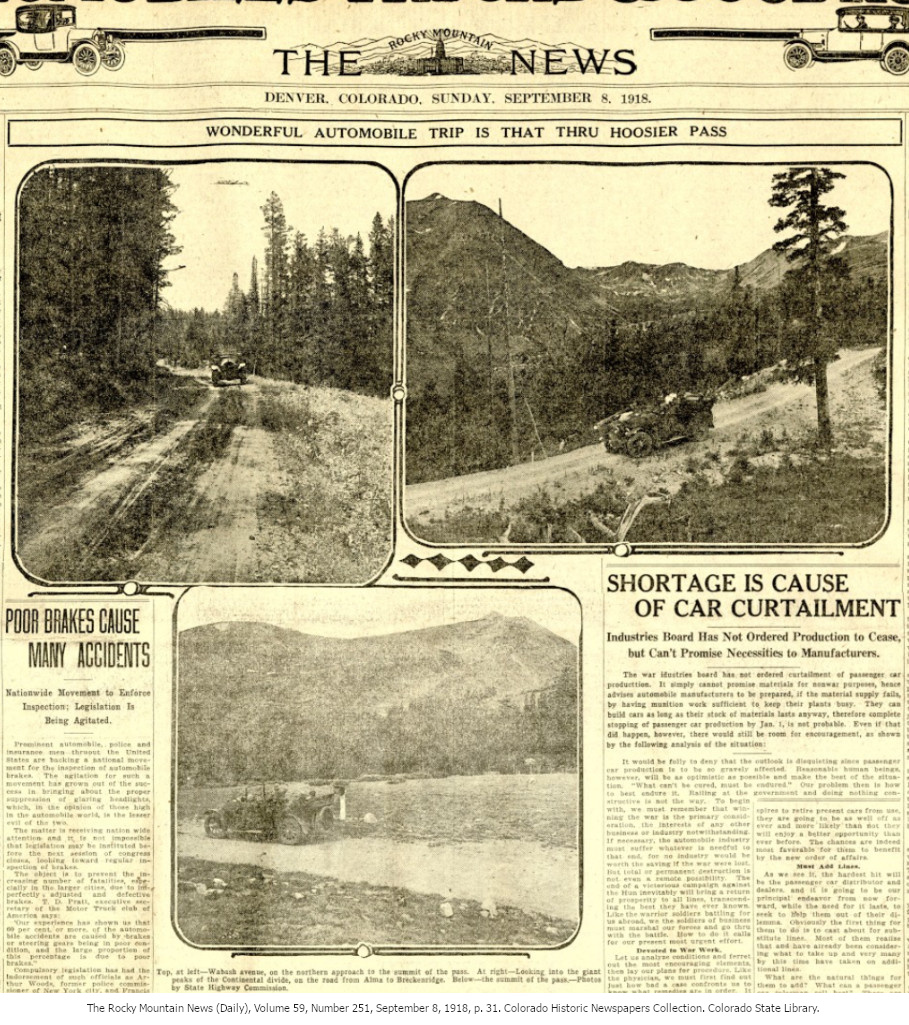
The newspaper spread below from 1918 shows the growing interest in automobile excursions into the mountains. Auto clubs were much more popular at this point in time, and in Colorado, some of them even seem to have had some clout.
References & Credits
1. The Summit County Journal, November 19, 1921, p. 4. Colorado Historic Newspapers Collection. Colorado State Library.
2. The Rocky Mountain News (Daily), Volume 2, Number 107, December 30, 1861, p. 2. Colorado Historic Newspapers Collection. Colorado State Library.
3. The Rocky Mountain News (Daily), Volume 6, Number 247, June 1, 1866, p. 1. Colorado Historic Newspapers Collection. Colorado State Library.
4. Georgetown Courier, October 9, 1879, p. 3. Colorado Historic Newspapers Collection. Colorado State Library.
5. The Fairplay Flume, February 5, 1880, p. 3. Colorado Historic Newspapers Collection. Colorado State Library.
6. The Fairplay Flume, May 13, 1880, p. 3. Colorado Historic Newspapers Collection. Colorado State Library.
7. The Rocky Mountain News (Daily), Volume 21, May 23, 1880, p. 3. Colorado Historic Newspapers Collection. Colorado State Library.
8. The Rocky Mountain News (Weekly), Volume 22, March 3, 1880, p. 6. Colorado Historic Newspapers Collection. Colorado State Library.
9. Park County Bulletin, July 29, 1904, p. 1. Colorado Historic Newspapers Collection. Colorado State Library.
10. The Fairplay Flume, June 28, 1912, p. 1. Colorado Historic Newspapers Collection. Colorado State Library.
11. The Summit County Journal & Breckenridge Bulletin, March 21, 1913, p. 4. Colorado Historic Newspapers Collection. Colorado State Library.
12. The Fairplay Flume, July 2, 1915, p. 1. Colorado Historic Newspapers Collection. Colorado State Library.
Images Credits: Coloradotopia Archives, Coloradohistoricnewspapers.org, Center for Land Use Interpretation | More info