Lizard Head Pass
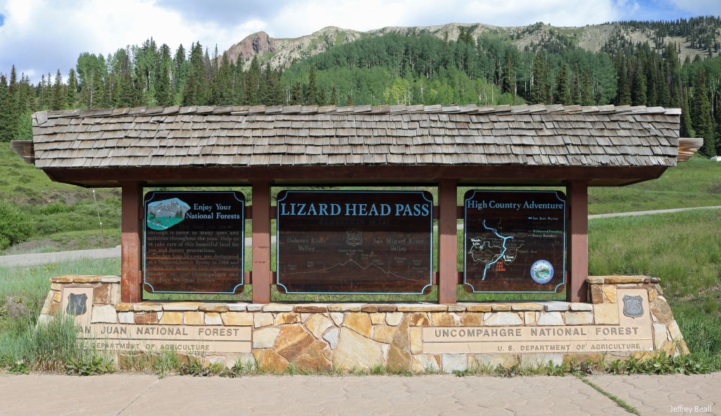
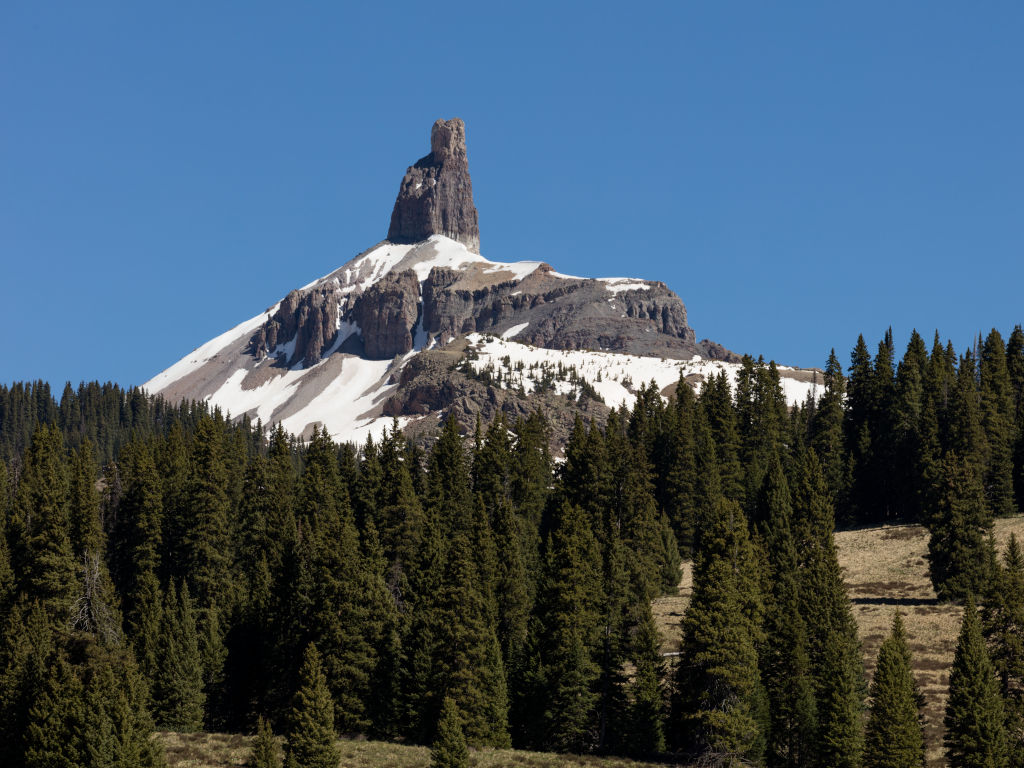
Lizard Head Pass is a high mountain pass (10,246 ft) located in southwest Colorado. The pass roughly connects the northwestern San Juan Mountains with the southwestern San Juans, as well as the Four Corners region and the desert beyond. The pass is located on CO Highway 145; the closest towns are Telluride to the north and Rico to the south. It gets its name from Lizard Head Peak (13,119 ft), a towering spire located above the pass.
From a geological perspective, the pass connects the Wilson Massif (home to Colorado’s three westernmost 14’ers) with the heart of the San Juan mountain range.
Seasonal Info
Lizard Head Pass is open year-round. You can expect the pass to close temporarily during the winter for severe snowstorms – there is a gate on either side enforcing the closure.
Lizard Head Pass Stats
- Max Road Elevation: 10,246'
- Lizard Head Peak Elevation: 13,119'
- Surface: Paved
- Mountain Range: San Juan Mountains
Alternate Routes – The only immediate alternate routes are dirt roads which will be closed in the winter. The next closest route to the east is US 550, but this is a significant detour.
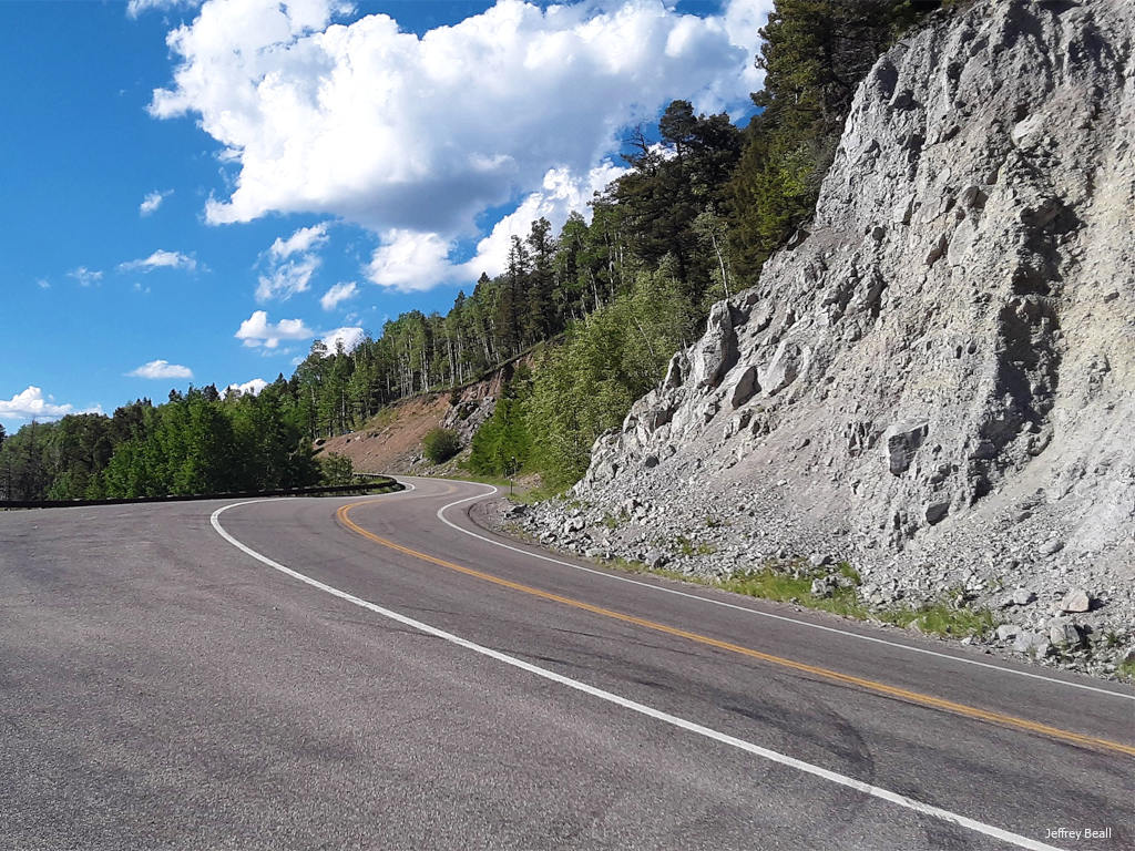
Lizard Head Pass is not overly difficult. Most of the road winds through the area at a steady grade, avoiding the steep switchbacks commonly found on roads like Red Mountain Pass.
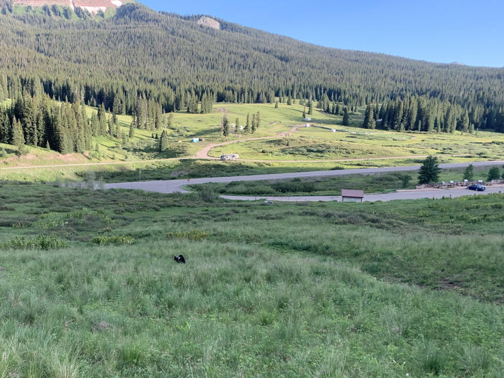
Below: A view of the main US Forest Service camping available at Lizard Head Pass. This photo shows the top of the pass, looking east. The flanks of Sheep Mountain are visible in the upper left. Be warned, these are coveted camping sites, and it’s difficult to find a place here, especially in July and August. Like most dispersed camping on Forest Service land, these spots are available on a first-come-first-served basis.
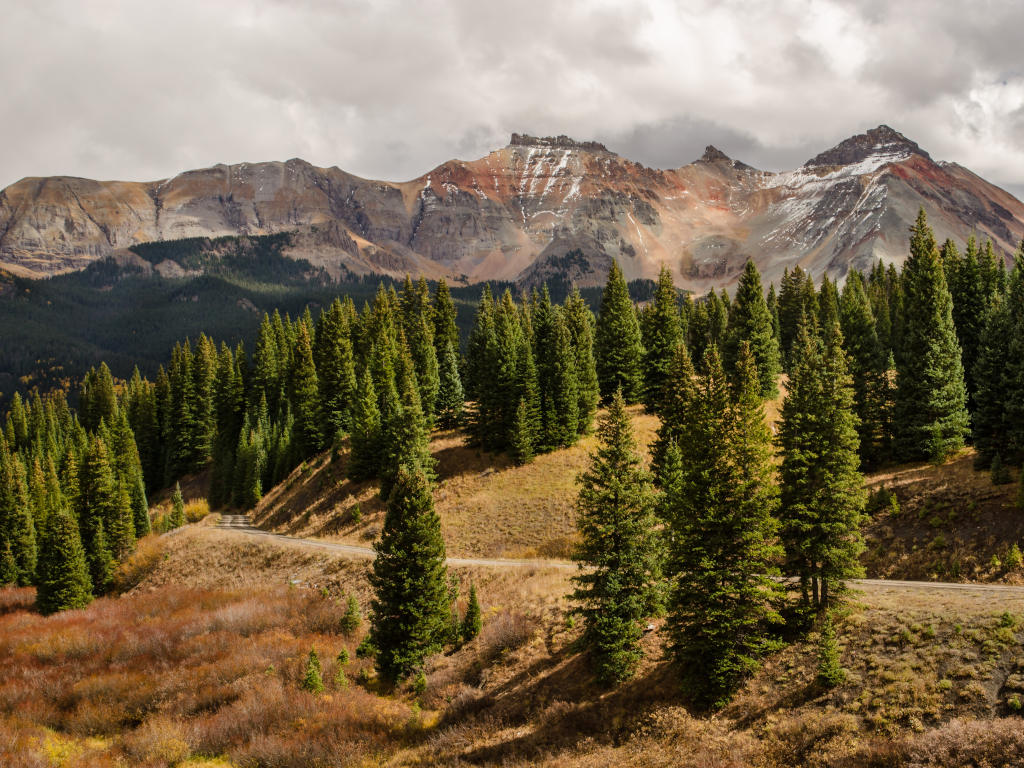
Below: Late summer on Lizard Head Pass with golden meadows, as the monsoon season comes to a close and an Indian summer settles in. This view looks north toward Telluride. The peak in the center-left is Pilot Knob, a 13,738 ft behemoth overlooking the village of Ophir on it’s north side.
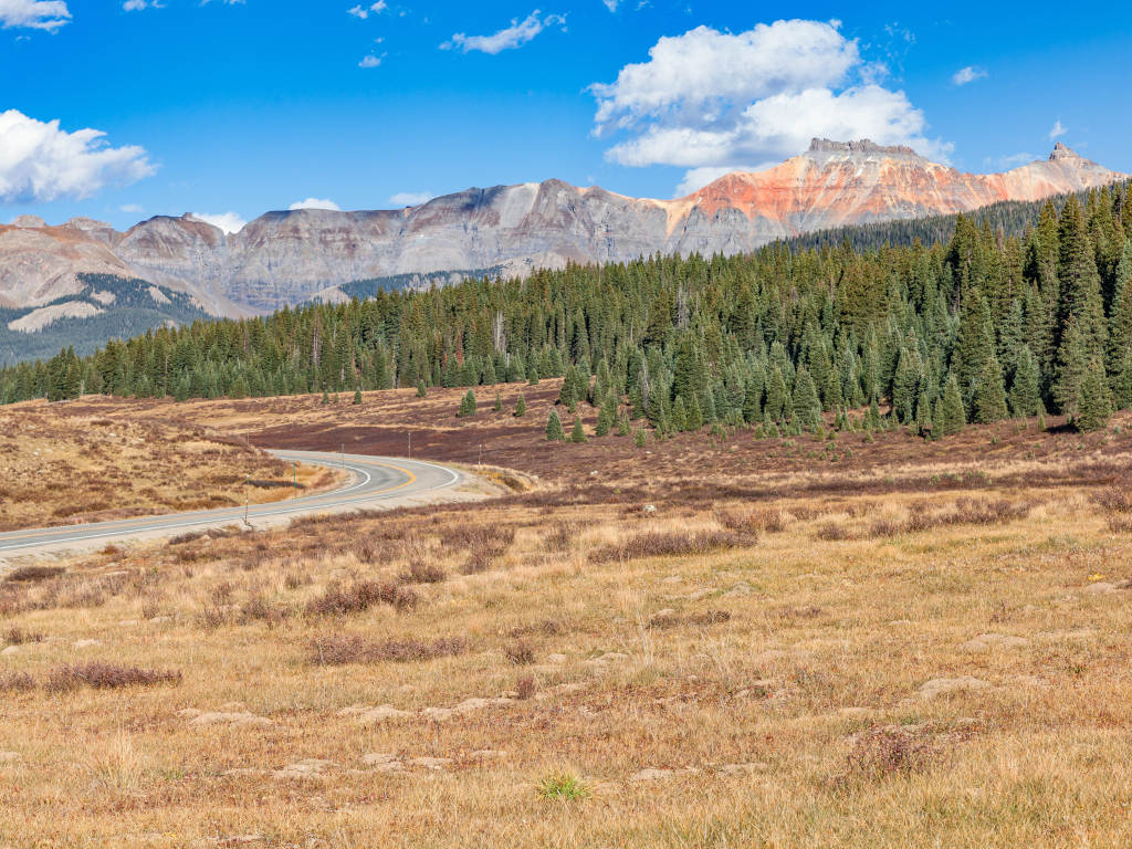
Lizard Head Pass is part of the San Juan Skyway, a 236-mile loop that includes the towns of Durango, Dolores, Ridgway, Ouray, Silverton and Telluride. Lizard Head Pass is fairly gentle as far as Colorado mountain passes go; the average grade is 2.4°, while the steepest is 7.8°. The pass never reaches 10°. The view from the top features the skyline of the San Juans. From left to right, the mountains below are Pilot Knob (center), Golden Horn, and Vermillion Peak.
Lizard Head Pass is only 8 miles from Red Mountain Pass as the crow flies, yet it’s about 3 hours of driving.
Recreation on Rabbit Ears Pass
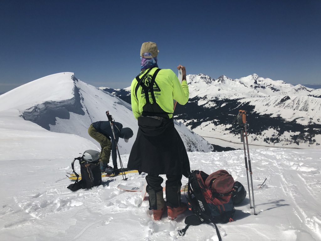
Lizard Head Pass is a popular destination for outdoor activities year-round. Many alpine meadows extend around the pass and are perfect for camping, cross-country skiing, and mushroom foraging. This makes it an ideal place for snowshoeing and cross-country skiing. A bit further afield, the pass serves as the starting point for several backcountry ski tours, including the route to Sheep Mountain.
Here are some examples of popular activities:
Summer
- Camping
- Cycling & Mountain Biking
- Fishing
- Hiking
- Horseback Riding
- Mushroom Foraging
- Rock Climbing
Winter
- Skiing & Snowboarding
- Cross-Country Skiing
- Snowmobiling
- Snowshoeing
- Ice Fishing
Summer
- Camping
- Cycling & Mountain Biking
- Fishing
- Hiking
- Horseback Riding
- Mushroom Foraging
- Rock Climbing
Winter
- Cross-Country Skiing
- Skiing & Snowboarding
- Snowshoeing
- Snowmobiling
- Ice Fishing
Rabbit Ears Pass FAQ
Lizard Head Pass measures approximately at 73.1 Miles. This measurement starts at the town of Dolores, CO, on the southern side of the pass. It ends at Placerville, CO, about 16 miles past Telluride.
Lizard Head Pass is located to the southwest of Telluride, crossing the San Juan Range.
There are no services or amenities such as gas stations at the top of the pass, but there are plenty of parking areas, trailheads and camping along the highway.
Compared to other mountain passes like Red Mountain Pass it is relatively safe. However, it is still a winding mountain road that can get lots of snow, so it can be hazardous at times.
There are no tolls or fees for this mountain pass.
Yes, but it can be closed temporarily in the winter months during the worst snowstorms.
Placerville to Dolores is about an hour and a half, while Telluride to Rico is 40 minutes.
Lizard Head Peak sits right at this photo’s center. Taken from the top of Wilson Peak (14,023 ft), the view showcases the great summits of the San Juan’s. The cloud on the horizon is the historic 416 fire burning out of control just north of Durango, CO.
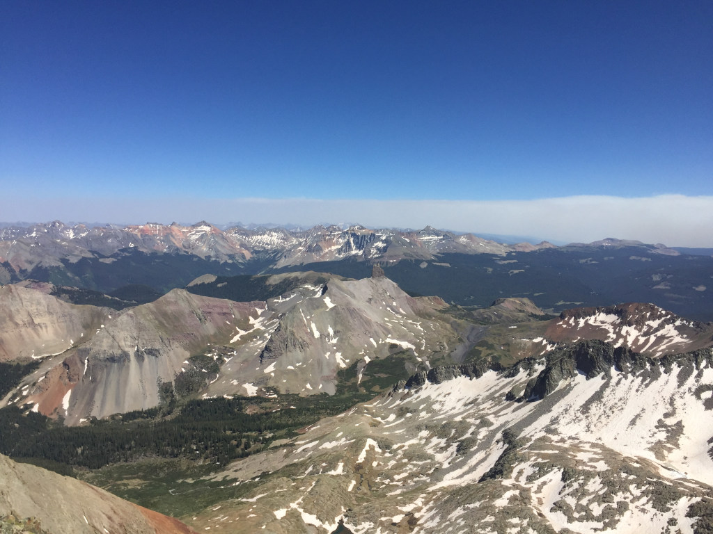
The easiest route up Lizard Head Peak is 5.8, making it the hardest thirteener in Colorado by it’s easiest route.
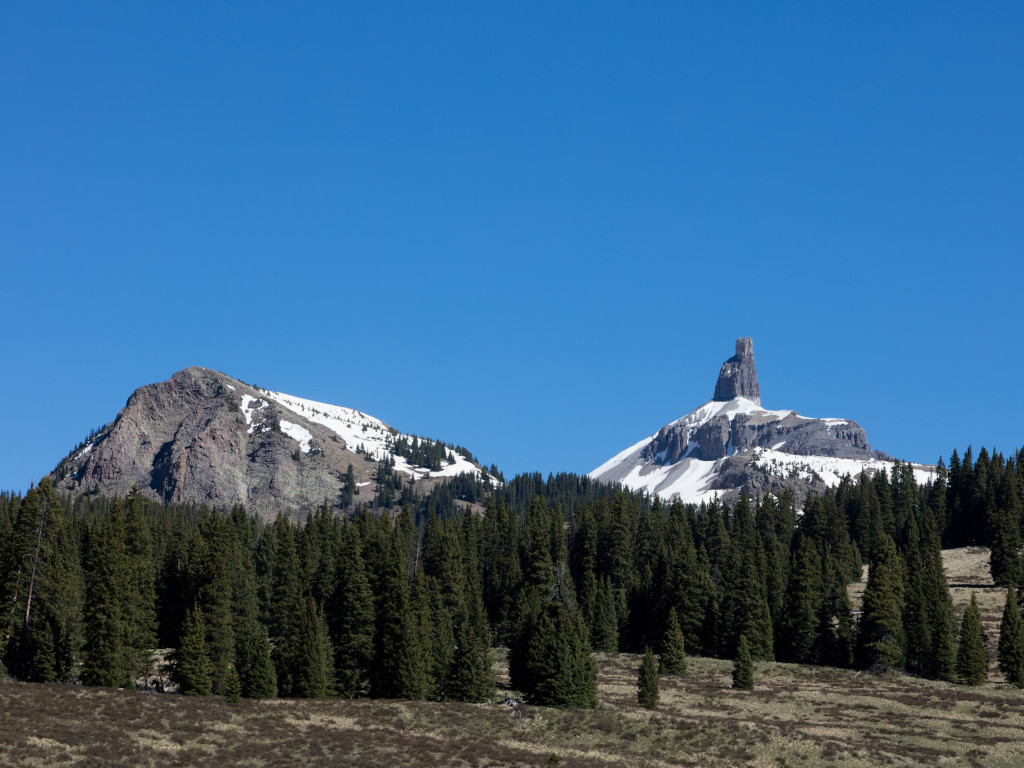
This landmark was given its name long before a railroad was ever built over the pass. It was used by the natives as a place for meetings and battles. The Navajo tribes would meet with local Colorado tribes here every year to trade blankets for horses and ponies that had been stolen from the settlers.1
Lizard Head Pass History
Settlers had built a wagon trail over Lizard Head Pass by the 1870s, when the silver mining boom in this area was picking up steam.2
Like most of Colorado’s infrastructure, Lizard Head Pass began as a mining road that was used to take ore out of the mountains.
Railroad History
The Grand Valley Star reported in August of 1890 that the Rio Grande Southern Railroad, led by Otto Mears, had employed 2,000 men to build the railroad route between Telluride and Rico.1
The railroad was opened for business in February of 1892, earning just above $40k in revenue in its first month.3
The price of silver collapsed in 1893, and the local mining industry collapsed with it. The post office on Lizard Head Pass was officially closed on Nov. 15, 1895.4
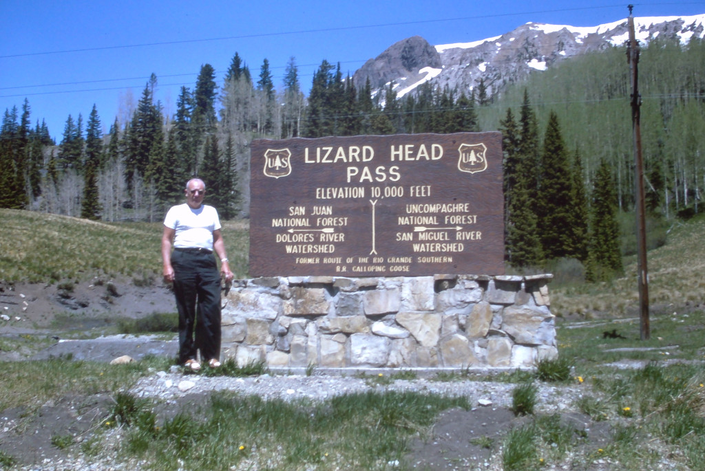
The railroad would continue to haul mail and freight until 1952. In order to remain profitable, the old locomotives would need to be replaced with something cheaper and more efficient.
The Galloping Geese
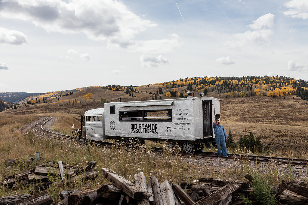
In 1931, Chief Mechanic for RGS Jack Odenbaugh began building motorized railcars out of automobile & train parts. There were 7 of these railcars. The RGS company developed these in order to support their local mail and freight carrying operations on this route in the early 1900s. They were called “motors” at the time, but were later referred to as the galloping geese.
One of the original Galloping Goose locomotives still runs on a scenic route between Silverton and Durango. This route follows a different narrow gauge railroad line through the San Juan Mountains, alongside the Animas River. This route was just one of Otto Mears’ accomplishments in Colorado. He is also known for building the Million Dollar Highway between Silverton and Ouray.
The site of the original Narrow Gauge railroad is a now a hiking and mountain biking route. The paved road follows a slightly different trajectory.
Auto Road History
The Ophir Loop Triangle, a good roads association, gained cooperation from Dolores County in committing to built a new auto road over the pass in 1916.5 The idea had been suggested in the previous month by Jack Kearney, Genial Superintendent of the Western Colorado Power Company.6
A state highway had been completed over Lizard Head Pass by December of 1917.7
Tourism associated with Mesa Verde National Park was a big driver of improvements to the state’s highway system in SW Colorado around this time. The highway was maintained (at least in part) by Dolores County during the 1920s. It had a reputation for being in good shape, except for when severe storms would damage the roadway. It would close during the winters.
The road was “graveled” in 1933.8
The highway over the pass was still not paved in 1956. E.J. Rippy & Sons of New Castle was awarded a contract for $289,508 to gravel 5.14 miles of the surface over Lizard Head Pass, with work scheduled to start in Sept of 1956. Their bid was the lowest of 9 bids.9
While the pass was unpaved in the first half of the century, it did receive an oiled surface at some point.10
In 1962, the Department of Highways called for bids to finally pave Lizard Head Pass.11
Directions from Denver
How to get to Lizard Head Pass from Denver?
- I-70 Westbound
- Exit 37 at Clifton
- US-50 E to Montrose
- Stay straight onto US 550.
- CO-145 in Ridgway.
- CO-145 to the top of the pass.
Did You Know?
Lizard Head Peak is the most difficult thirteener in Colorado by it’s easiest route. It requires two pitches of technical climbing rated at 5.8, although the approach, altitude, route finding, and loose rock mean this classic is somewhat more involved than your typical crag 5.8.
References & Credits
1. Grand Valley Star, Volume 2, Number 33, August 16, 1890, p. 2.
2. Lizard Head Pass. Cyclepass.com. http://cyclepass.com/t_p_Lizard_Head.html
3. The Rocky Mountain News (Daily), Volume 34, January 1, 1893, p. 8.
4. The Rocky Mountain News (Daily), Volume 36, Number 306, November 2, 1895 IIIF issue link, p. 5.
5. The Daily Journal (Telluride), May 4, 1916, p. 2.
6. The Daily Journal (Telluride), April 19, 1916, p. 4.
7. The Rocky Mountain News (Daily), Volume 58, Number 364, December 30, 1917, p. 24.
8. The Rico Item, Volume 24, Number 50, July 29, 1933, p. 1.
9. Craig Empire Courier, Volume 65, Number 26, September 26, 1956, p. 11.
10. Ebay. (2024). Available at: https://web.archive.org/web/20240630141335/https://www.ebay.com/itm/285790467651 [Accessed 30 Jun. 2024]
11. Cervi’s Rocky Mountain Journal, Volume 13, Number 42, July 4, 1962, p. 26.
Images Credits: Jeffrey Beall | More info
