US Highway 6 is the roadway that traverses Loveland Pass over the Continental Divide. This was the main path over the divide before the Eisenhower Tunnel was built, and this is still a gorgeous scenic drive today. It is a popular place for hiking during the summer, and a well-known spot for backcountry skiing during the winter.
Beware of hazardous material transportation trucks. Trucks containing hazardous materials are not allowed through the Eisenhower Tunnel, so you will see these trucks heading over the pass throughout the winter and summer months. Give them some extra space when you can.
Seasonal Info
Loveland Pass is open year-round with temporary closures for weather.
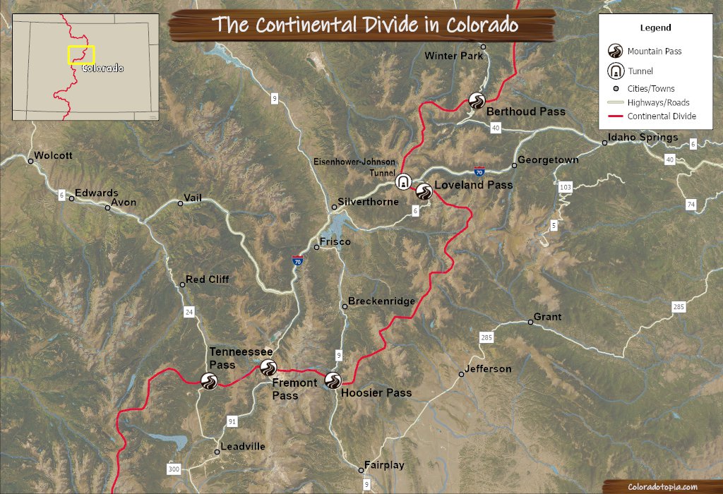
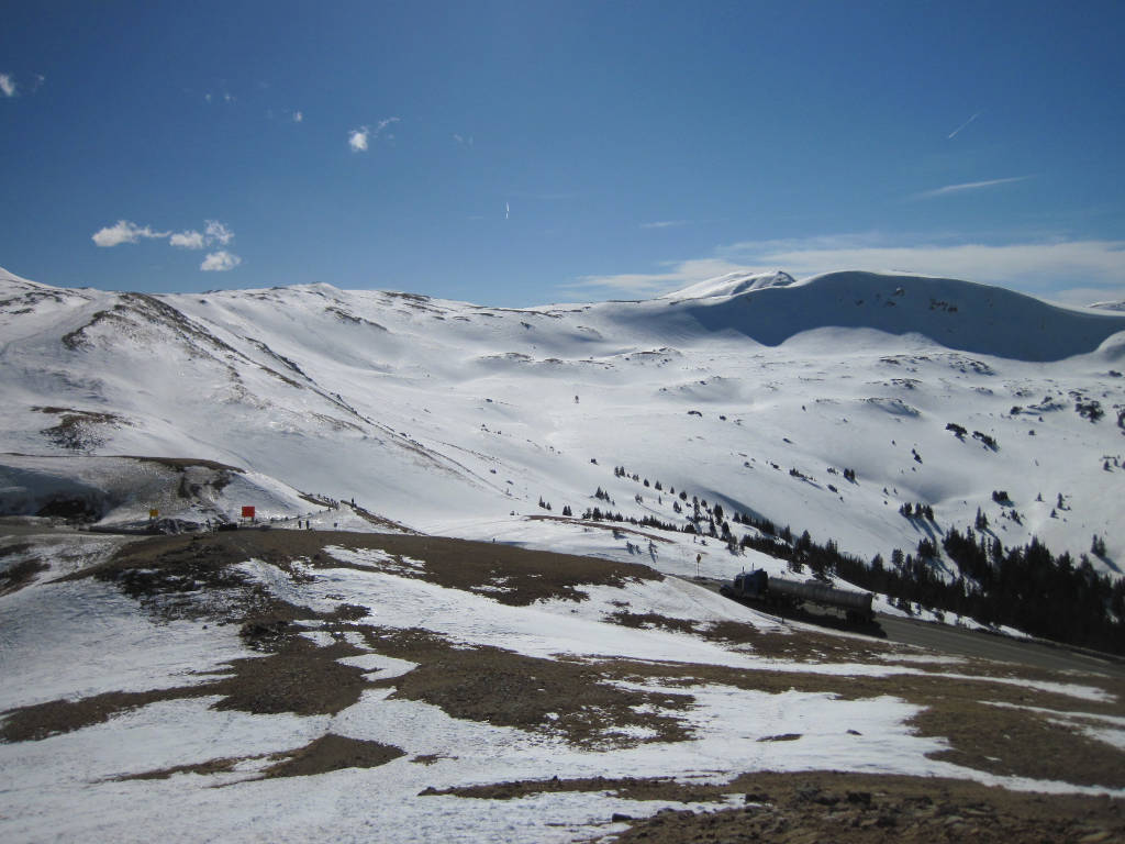
Above: You can see the electronic signs that are located just prior to the Keystone Ski Resort entrance, where Loveland Pass begins. The gates on Highway 6 can close just past this point or they can be closed above Arapahoe Basin (5 miles ahead).
Alternate Routes – Loveland Pass is considered to be the alternate route for I-70 and the Eisenhower-Johnson Tunnel through the Continental Divide. If Loveland Pass is closed, check to see if I-70 is open. If the tunnel and the pass are both closed for weather, you will just need to wait. Highway 40 to the north via Berthoud Pass would be considered the alternate route to the north. That pass may also be closed if the tunnel and Loveland Pass are both closed. Guanella Pass is the next paved road to the east, but this road closes during the winter season.
Loveland Pass - Western Side
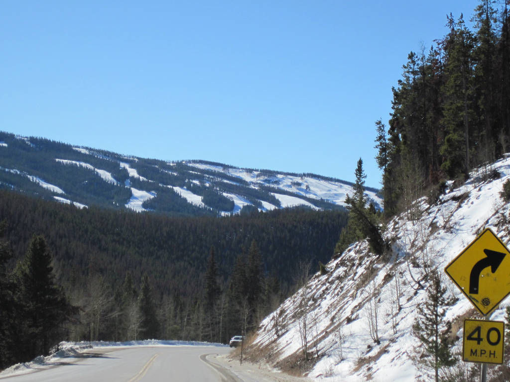
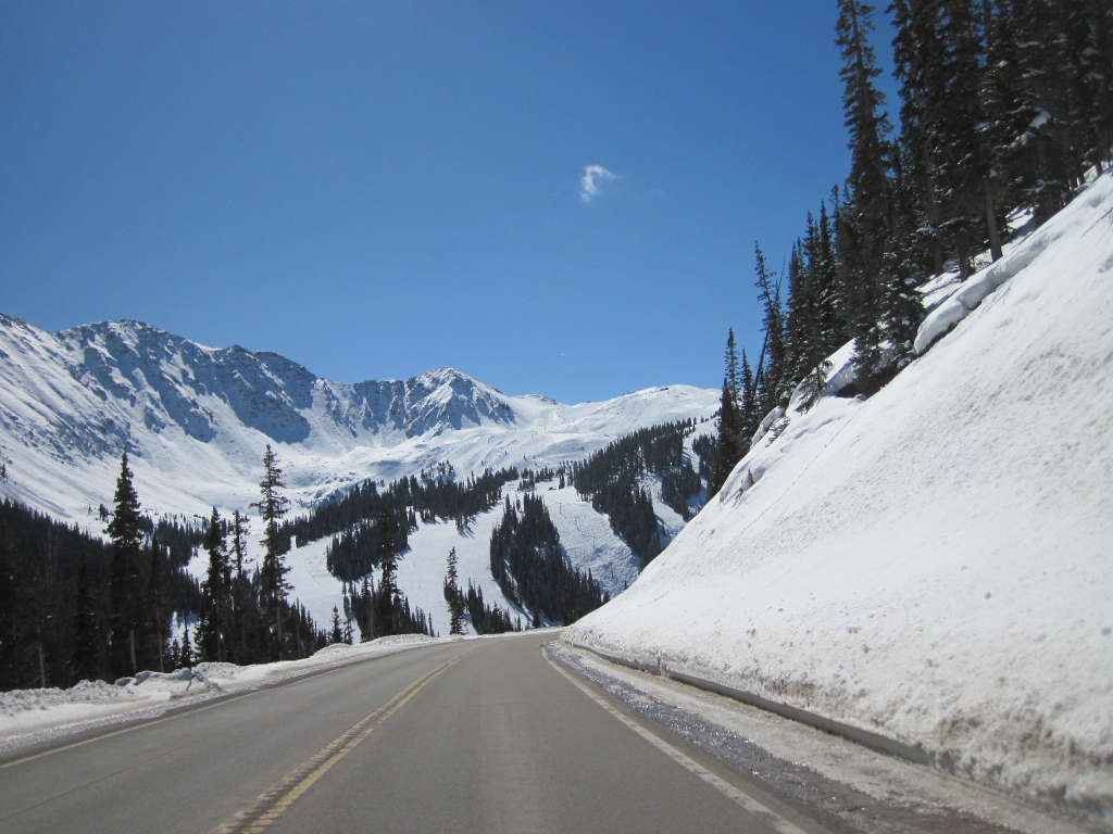
This photo, taken from the Keystone Ski Resort, shows the pass ascending up the western side of the Continental Divide towards A-Basin. This part of the highway begins to get steeper, but most trucks can still keep a reasonable pace on the way up. There are a few passing lanes in this section, and there are no switchbacks until you get past A-Basin.
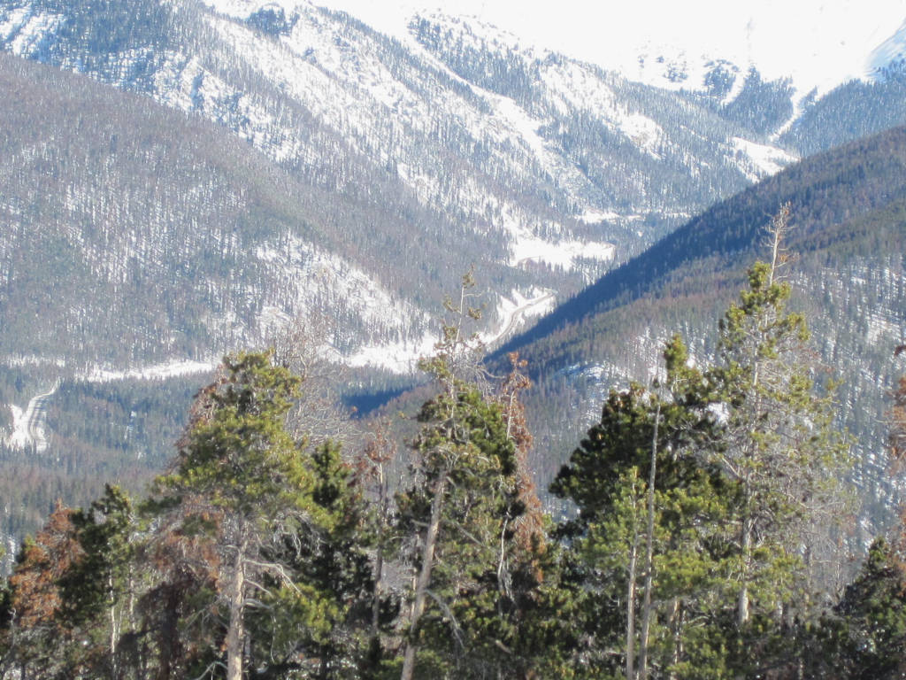
The Keystone Ski Resort can be seen in the background of the photo below. This shows the front side of Dercum Mountain, including the Area 51 Terrain Park in the upper-right portion of the photo, with the Loveland Pass highway in the foreground.
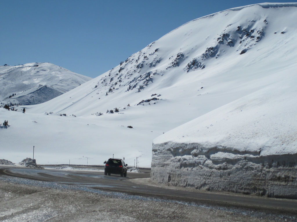
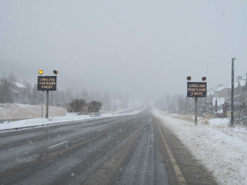
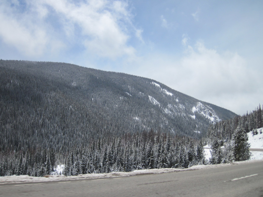
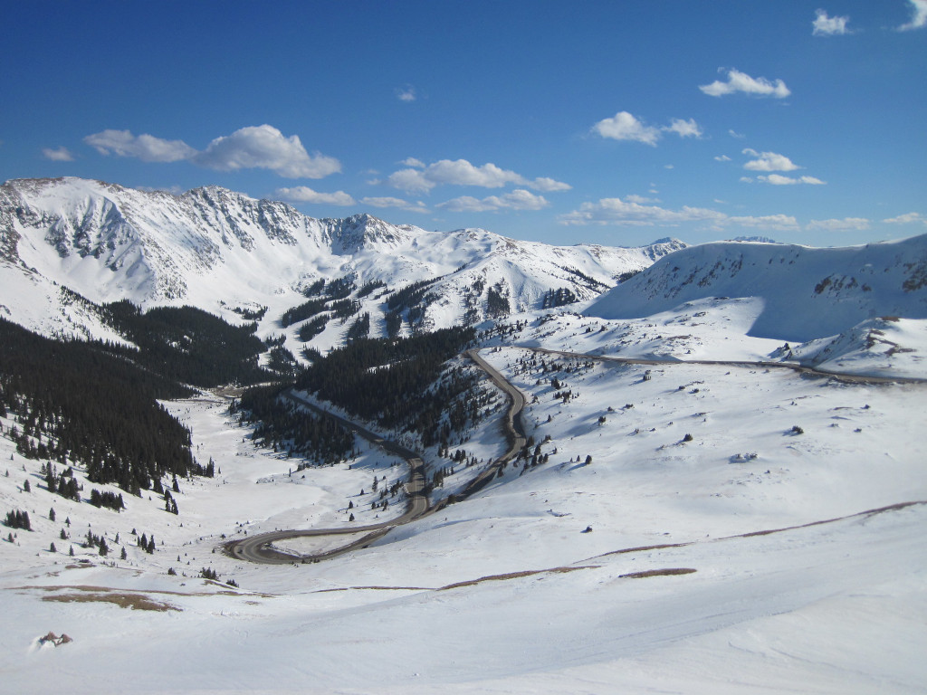
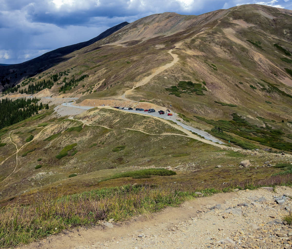
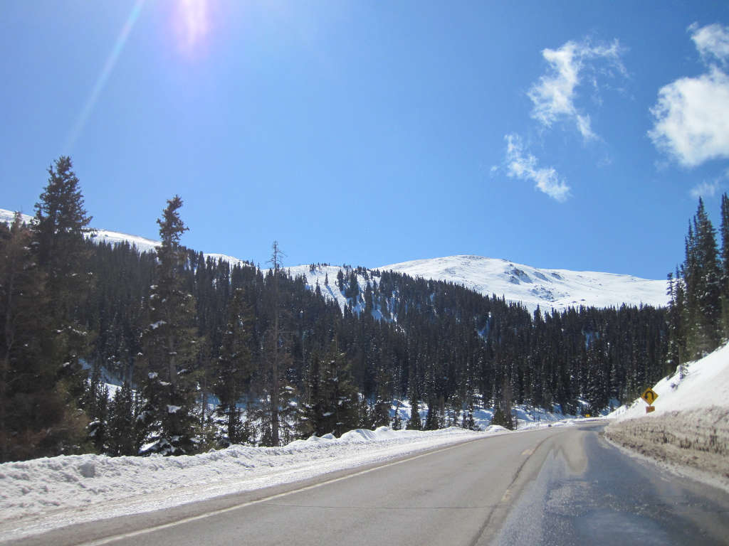
Above & below: Highway 6 weaving up towards Arapahoe Basin after passing by Keystone. Expect a low grade, but heavy snowfall during storms because of the elevation. This section of road will be plowed often when the snow is falling, but it can still be dangerous.
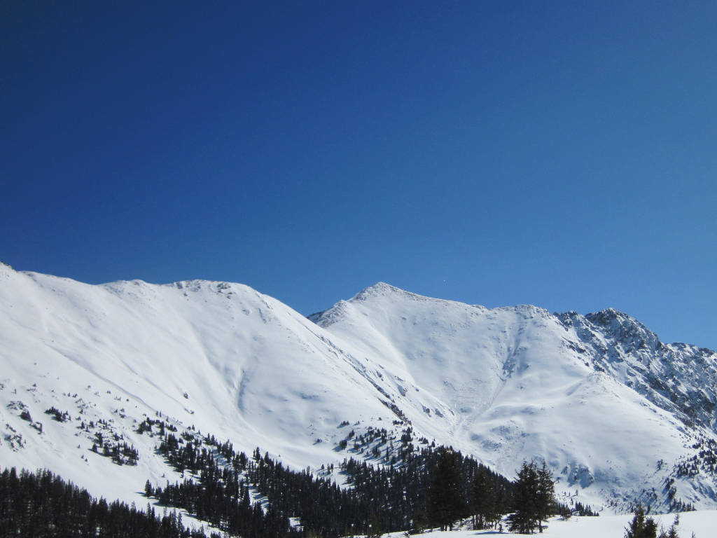
Arapahoe Basin above Loveland Pass
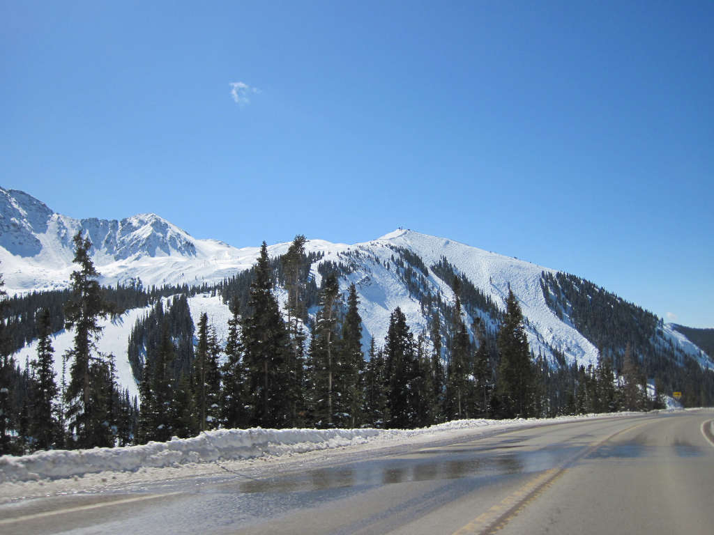
Above: You can see Arapahoe Basin looming in the background above Highway 6 on Loveland Pass. The elevation above the base of the ski mountain where this photo was taken from is approx. 11,200′.
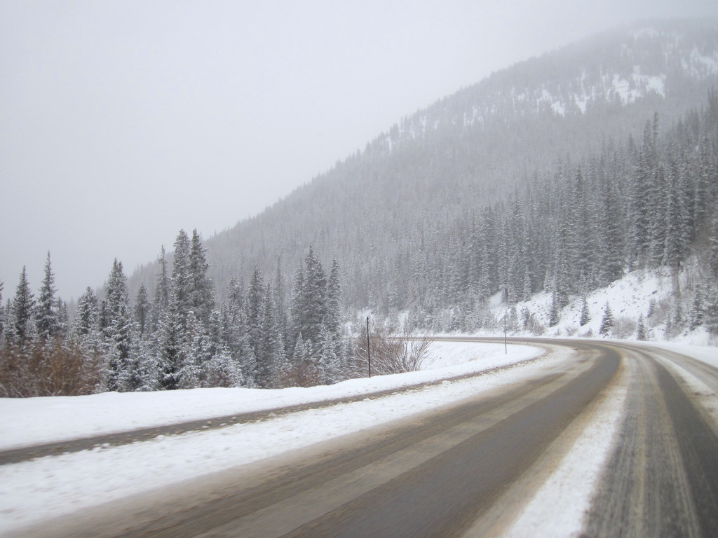
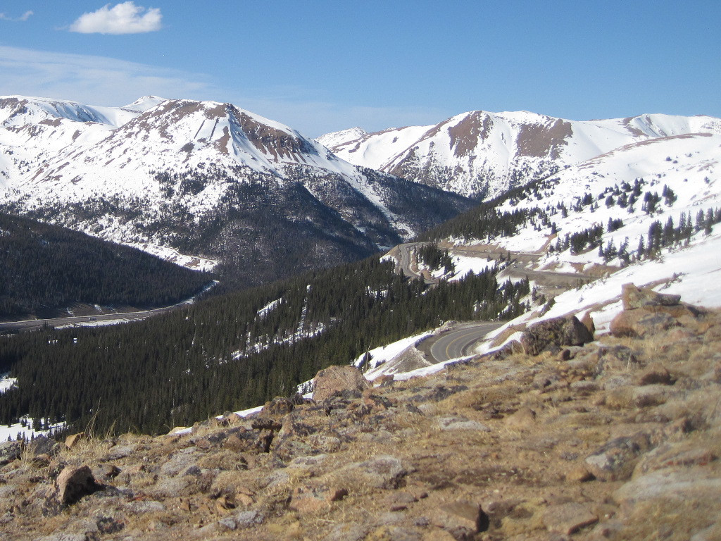
Below: The photo below was taken while looking westward from the top of the divide. The section of road that is seen here can be fun, but is likely among the most dangerous parts of the drive when the weather gets bad.
Loveland Pass - The Summit
There are trailheads heading off in both directions along the Continental Divide at the summit of the pass. There are wooden timber steps to get you started, but this can be a harsh environment for hiking, so be prepared.
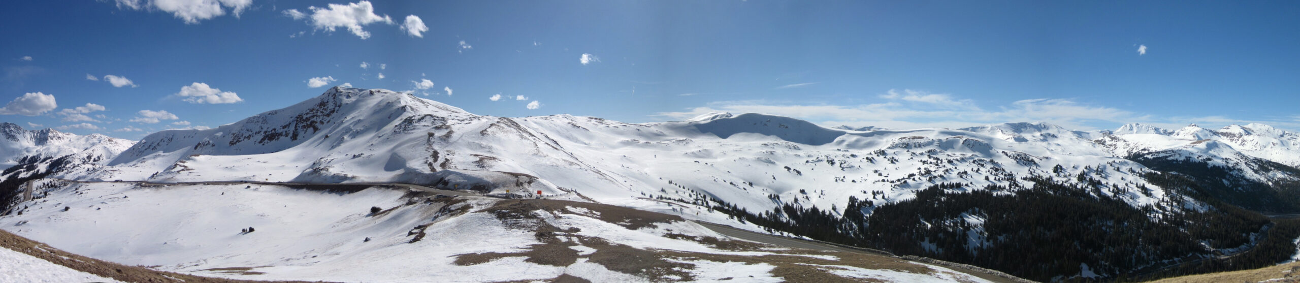
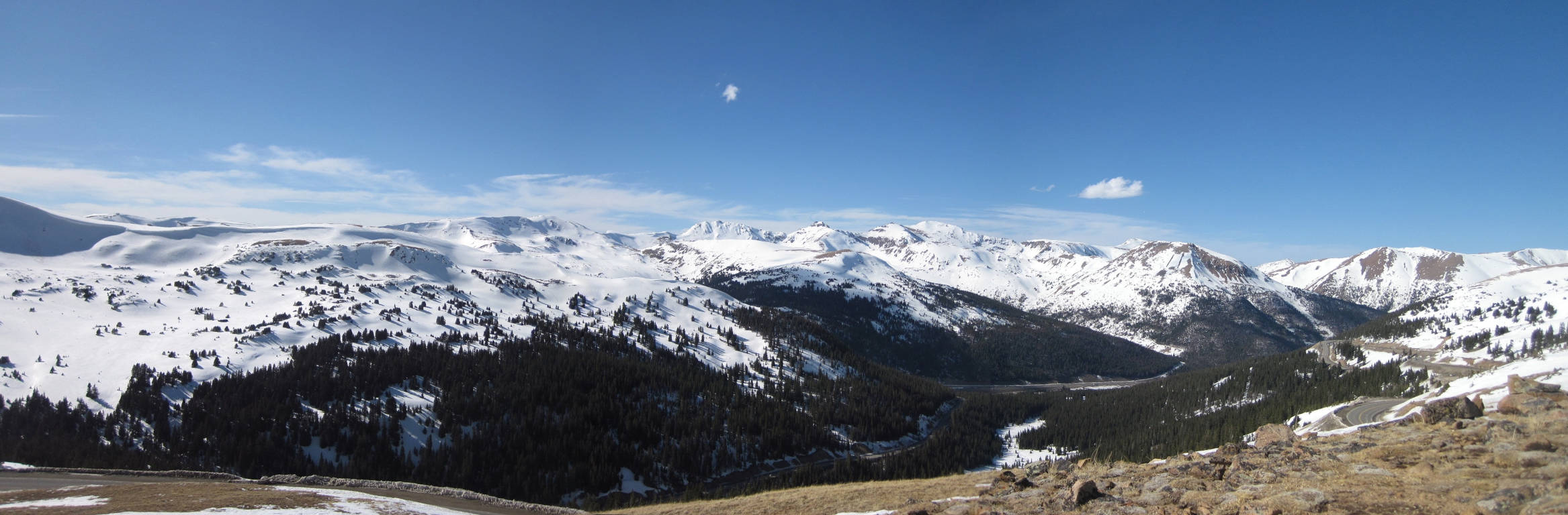
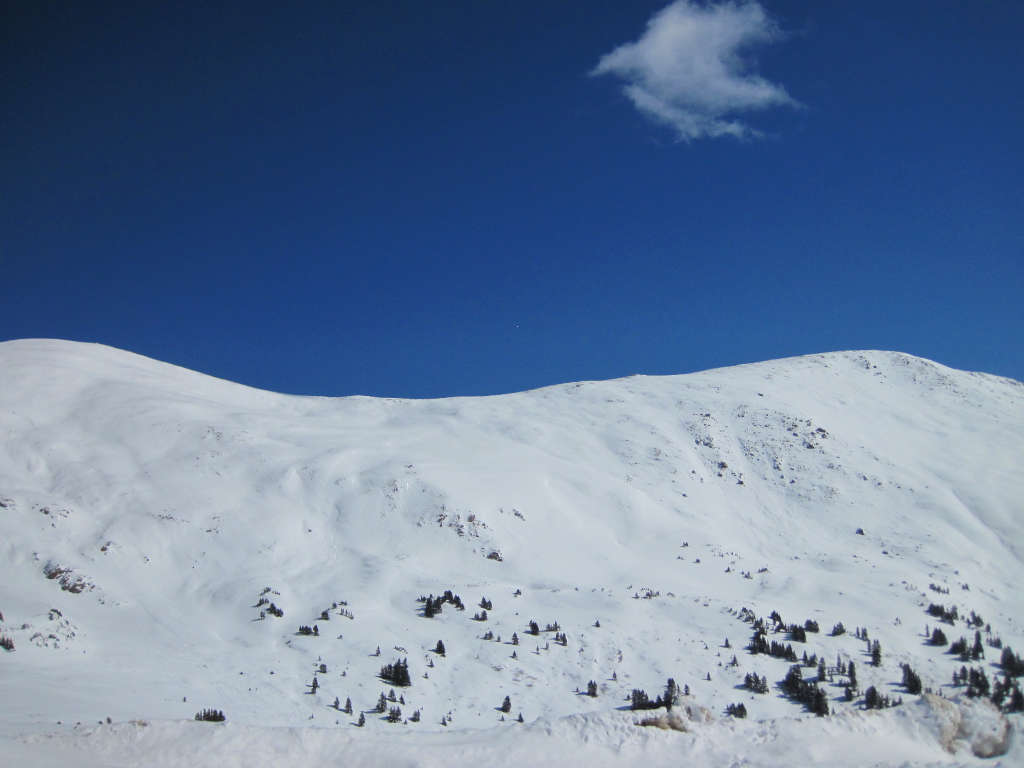
Above: Panorama from the top of the Continental Divide with the western side of the divide on the left, eastern side on the right.
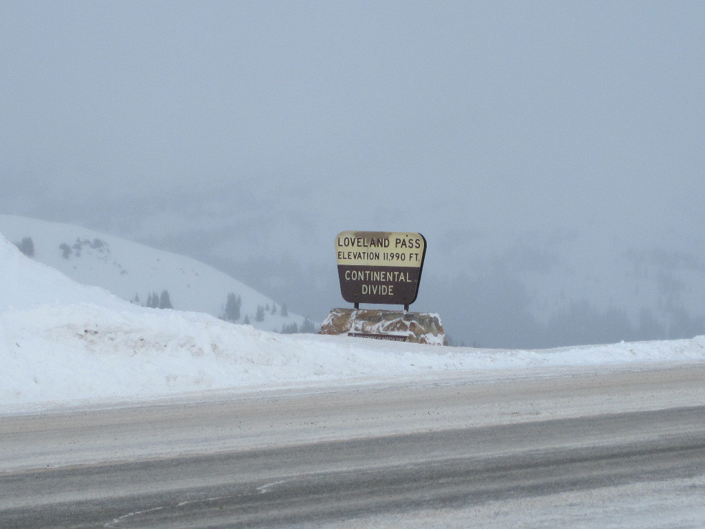
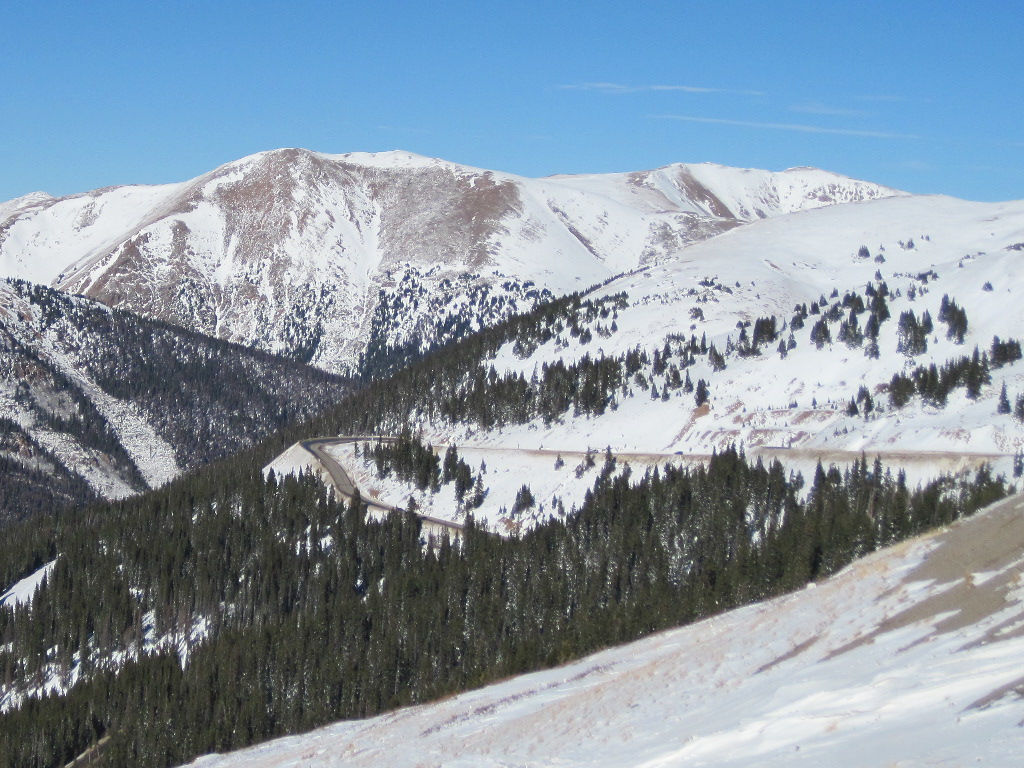
Above: signs at the top of Loveland Pass. Below: Highway 6 descending down the western side of Loveland Pass.
Loveland Pass summit parking lot on the Continental Divide
Loveland Pass - Eastern Side
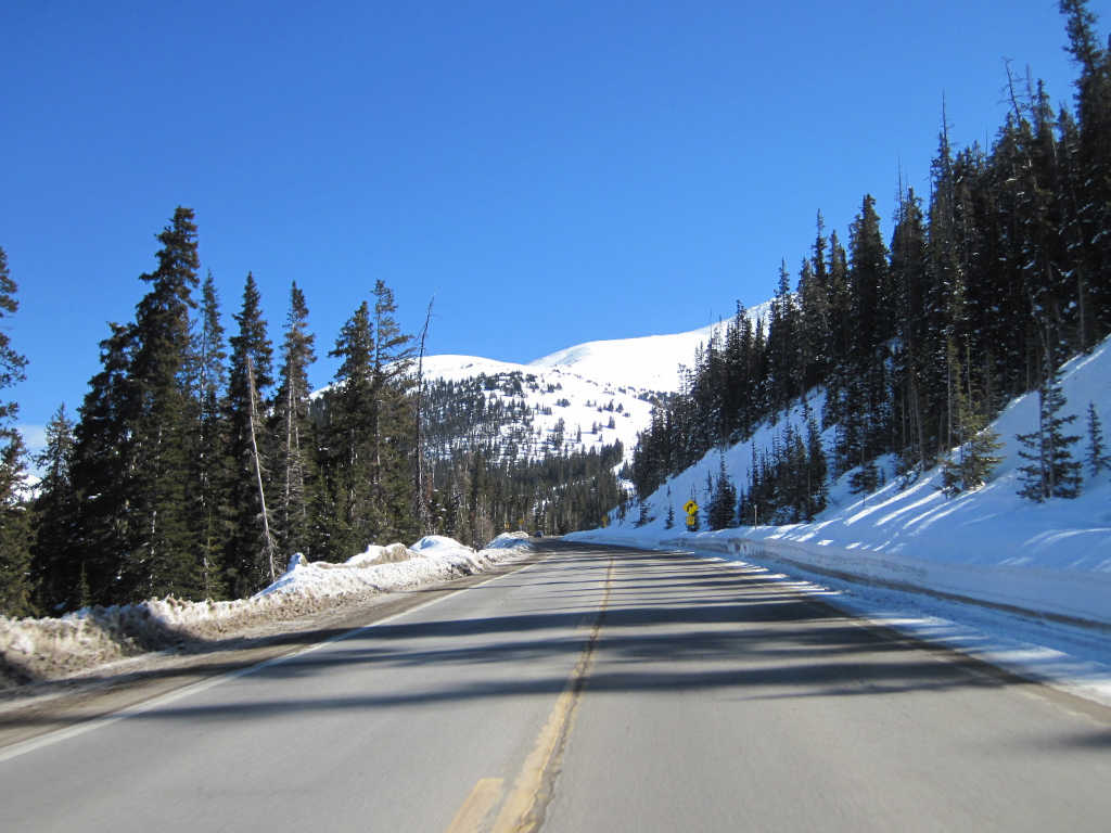
Loveland Pass begins just before the Eisenhower Tunnel on this side, and there is an exit from the interstate right before the tunnel that you can use to access the pass. The photo below shows several curves on the eastern side of the pass, as well as Interstate 70 in the distance.
Below: An early winter season’s look at the eastern side of Loveland Pass. The Front Range of the Rocky Mountains on the eastern side of the Continental Divide can be seen all around. Mount Bethel is the first large peak shown here (on the northern side of I-70 with the avalanche mitigation barriers).
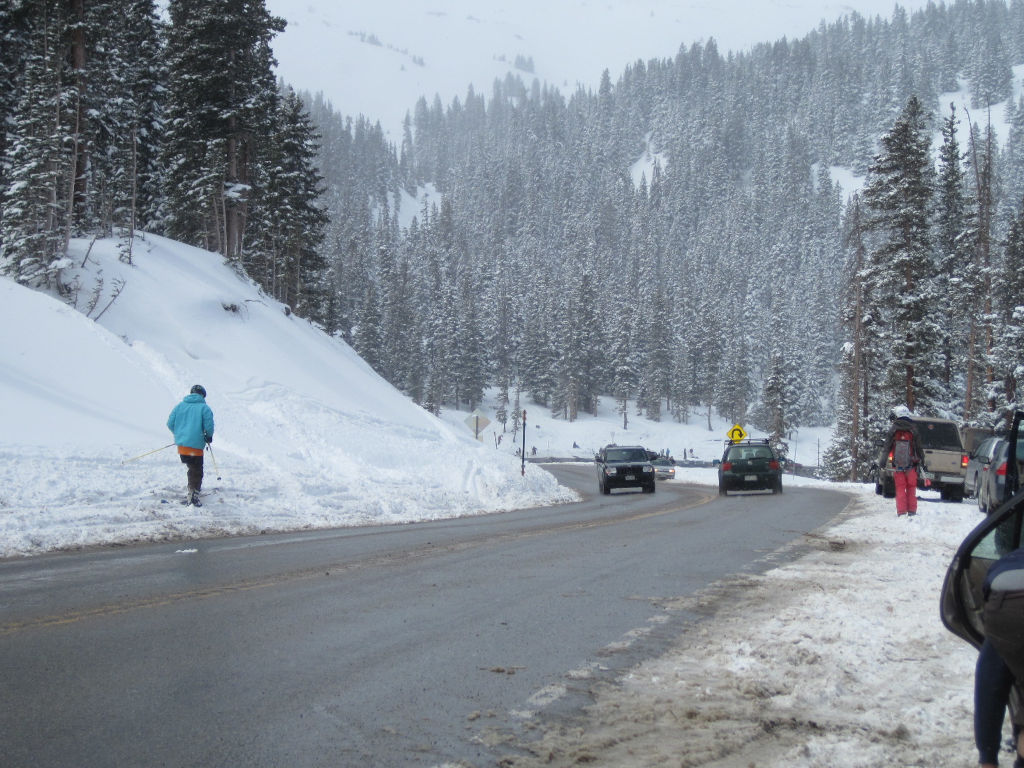
Below: A hairpin turn on the eastern side of Loveland Pass. The most popular area for skiing is between the upper and lower part of this switchback.
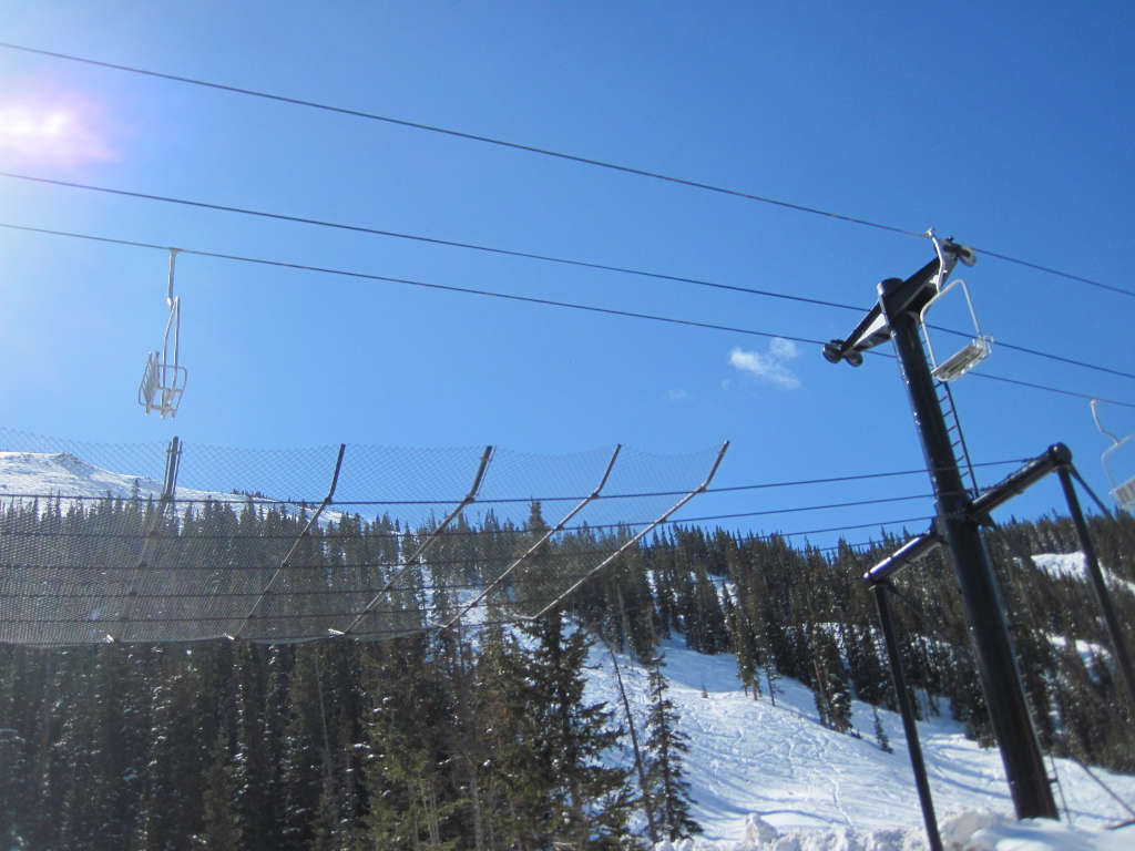
Above: The old chairlift that used to connect Loveland Ski Area’s two base areas. The chairlift no longer runs, and it has been replaced by a shuttle service.
Above: Ascending Loveland Pass from the east. The photo with the hairpin turn road sign also shows the area that people ski the most frequently. The pickup point for skiers who are hitchhiking back to the top is right ahead at the hairpin turn.
Below: Here you can see another one of the Loveland Pass hairpin turns in the upper part of the photo. Below the road, you can see a traverse that is part of the Loveland Ski Area. Look for the brown sand color in the snow to identify which is the highway. This sand is from the roadway, and it gets thrown over the embankments by the snowplows. If you see brown on the downhill side of an area, that is the edge of the roadway. If it looks more like a groomed ski trail with white snow, that is the ski area traverse.
Loveland Pass Skiing
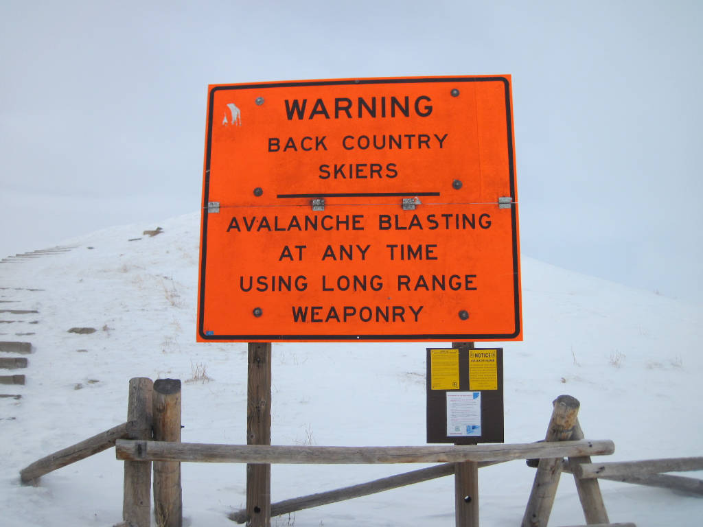
Backcountry Skiing Can Be Deadly. Avalanches and tree wells are just the start. Learn about avalanche safety and know the conditions and the terrain. Never ski alone. Be prepared.
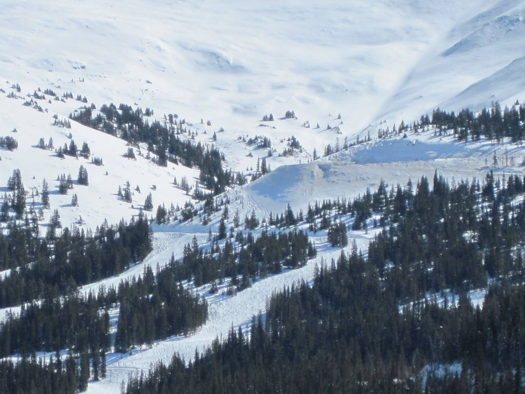
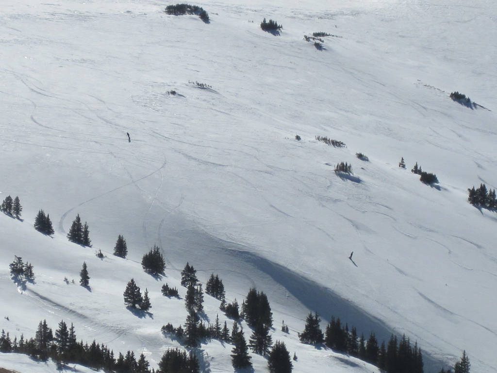
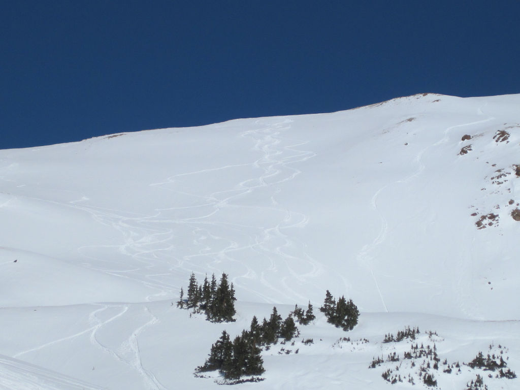
Western Side – There is plenty of skiing on the western side of Loveland Pass, but you will need to hike along the divide in order to get your turns in here. You’ll find the best skiing on this side by hiking southwest along the ridgeline towards Arapahoe Basin from the top of Loveland Pass. Using the summit parking lot as a drop-off point, is how most plans start.
Eastern Side – The eastern side of Loveland Pass is where you will find the most people skiing and snowboarding. It is easy to get dropped off at the summit parking lot where you can descend down to a pickup point. You are essentially just skiing between the switchbacks and meeting up with the roadway down below. It’s not uncommon to see 10-20 skiers hitchhiking back to the top, hoping for a pickup truck to come along.
Directions from Denver
How do you get to Loveland Pass from Denver?
I-70 Westbound
Take Exit 216 at the Eisenhower Tunnel for HWY 6
Did You Know?
The Loveland Pass Toll Road first opened to wagons in 1879. The mountain pass is named for William A.H. Loveland, who was the President of the Colorado Central Railroad.
Loveland Pass History
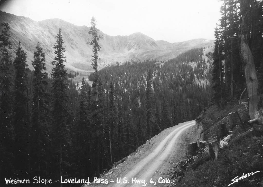
Loveland Pass, c. 1930s, Harold Sanborn. Coloradotopia Archives, CL-SS92.
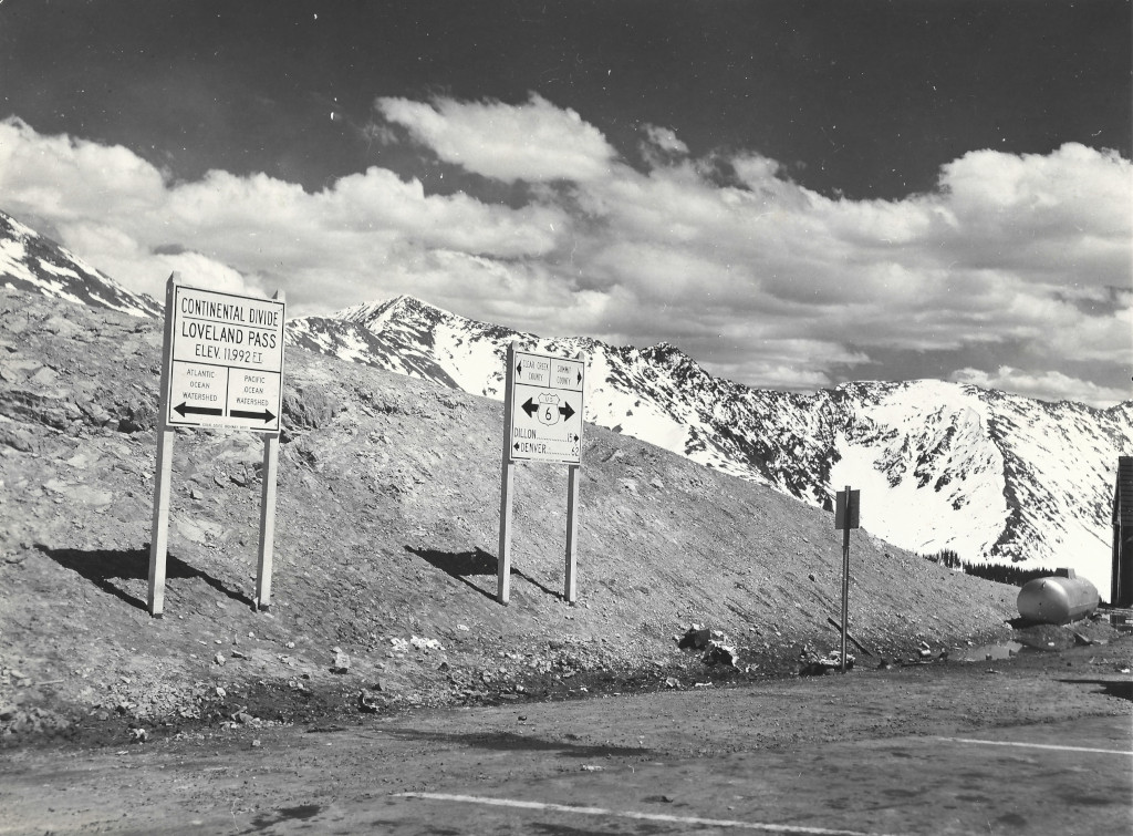
The first toll road over Loveland Pass was completed in 1879. There are links below to the in-depth history and timeline of Loveland Pass, as well as the Loveland Pass Continental Divide sign archive. The archive contains a collection of photographs that document the signs at the top of the pass over the last 100 years.
Loveland Pass History & Timeline
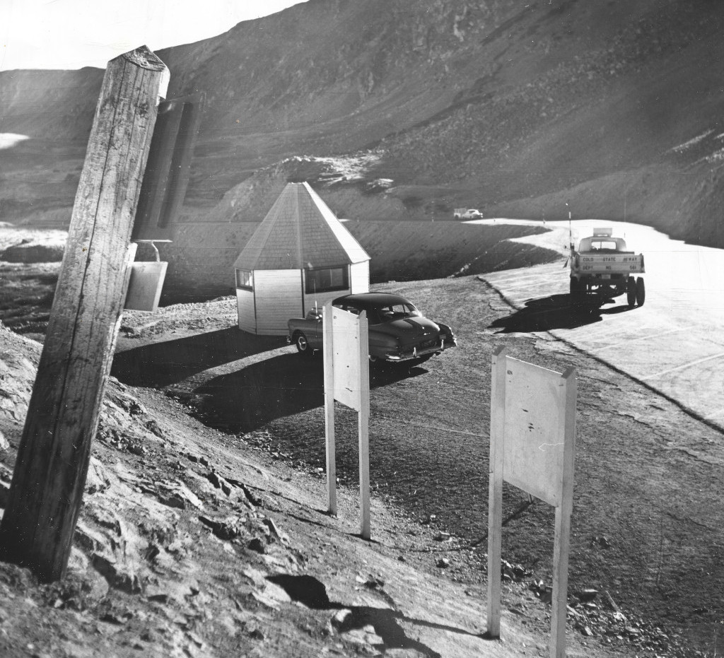
Loveland Pass, 1952, David Mathias/Denver Post. CL-UIN-53-094.
