Muddy Pass
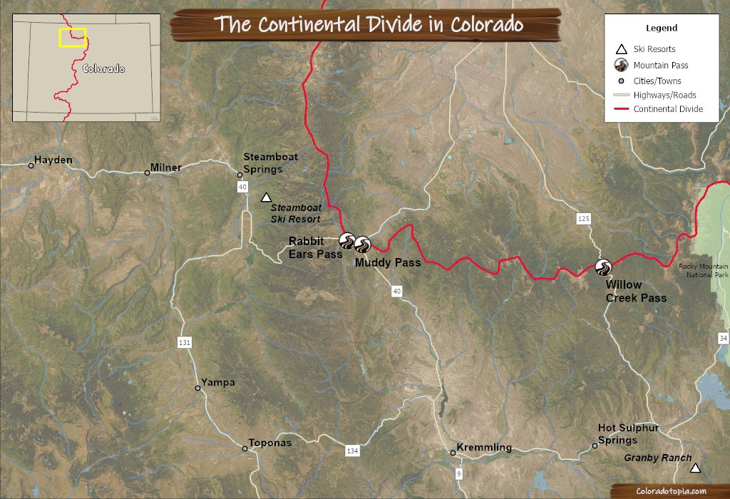
Muddy Pass is located on the southeast side of Rabbit Ears Pass. Both of these passes are located on HWY 40, and both go over the Continental Divide just to the southeast of Steamboat Springs. Muddy Pass is now unmarked, and it is by far less celebrated than Rabbit Ears Pass. You’ll find Muddy Pass at the junction of US HWY 40 and CO HWY 14. Historically, the roadway over Muddy Pass has continued up the path of the modern HWY 14 route to North Park, CO.
Seasonal Info
Muddy Pass is open year-round, with temporary closures as necessary.
Muddy Pass Stats
- Elevation: 8,772'
- Surface: Paved
- Mtn Range: Park Range, Rabbit Ears Range
Alternate Routes – A combination of CO HWY 134 & CO HWY 131 will bypass Muddy Pass, and take you through a lower section of the Gore Range if you need to go to Steamboat Springs. Willow Creek Pass may also be a good alternate route to the east of Muddy Pass if you are headed north/northeast towards North Park, instead of towards Steamboat Springs and the Steamboat Ski Resort.

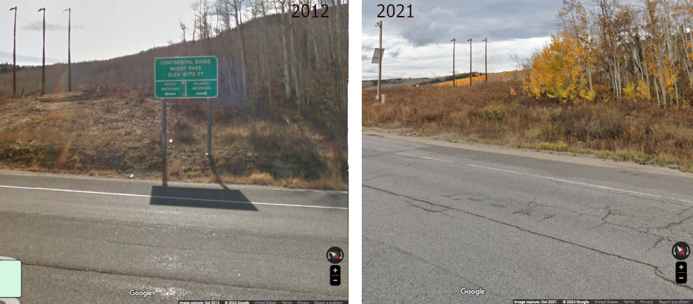
This pass was not always unmarked. You can see the old Muddy Pass Continental Divide sign in the 2012 Google Street View screenshot on the left below, and you can see it removed in 2021 on the right.
Recreation Near Muddy Pass
Muddy Pass is the footstep for all the recreation on Rabbit Ears Pass. Winter recreation here includes skiing, snowmobiling, Nordic skiing and more. Check out the breakdown of recreation for this area on the Rabbit Ears Pass page here.
Directions from Denver
Start on Interstate 70 and head west into the foothills. Exit from I-70 at Silverthorne and head north on HWY 9. Take HWY 9 into Kremling and then turn left onto HWY 40.
- I-70 Westbound
- Exit 205
- HWY 9 to Kremling
- HWY 40 to Muddy Pass
Muddy Pass FAQ
The drive from downtown Steamboat Springs to Muddy Pass is almost exactly 25 miles.
No gas stations. There is a pull-off area near the intersection of the two highways on Muddy Pass, right across from where the old Muddy Pass Continental Divide sign used to be located.
Any Colorado highway is dangerous during a snowstorm when there is low visibility. Muddy Pass is short, and it is located at a lower elevation than Rabbit Ears Pass. There are no switchbacks, hairpins, or sharp curves, so it can be considered a relatively easy mountain pass by Colorado’s standards.
No, this pass is open year-round unless it is closed for accidents, weather, or another reason.
This pass is nestled between the Park Range to the north/northwest and the Rabbit Ears Range to the east.
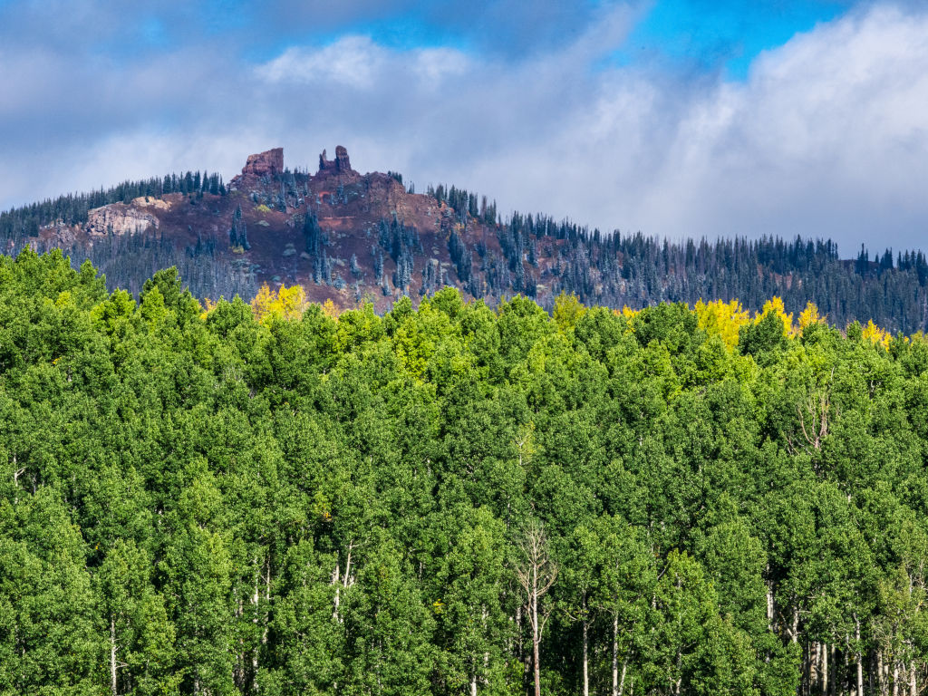
The photo above shows the Rabbit Ears formation as seen from the southeast near Muddy Pass. This has been an important land marker along the Muddy Pass route for more than 150 years.
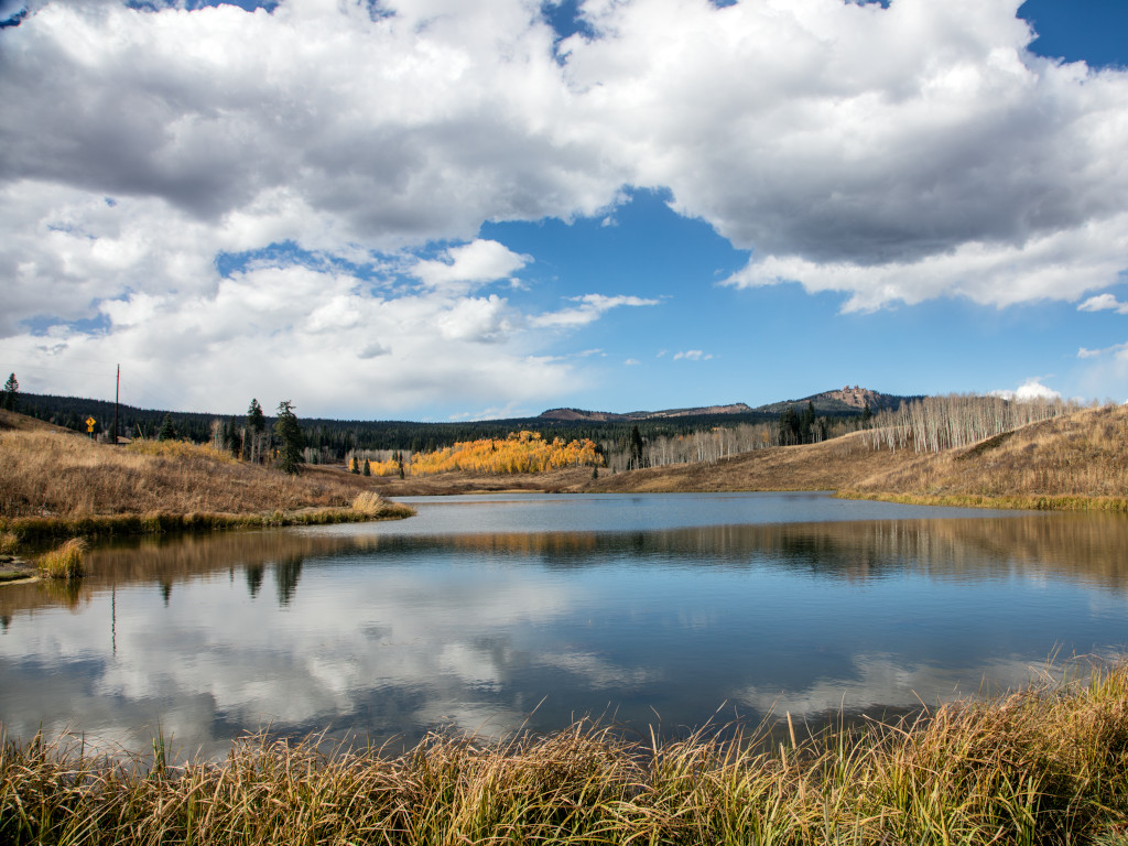
Muddy Pass Lake is located just north from the junction of US HWY 40 and CO HWY 14. You can see the Rabbit Ears formation in the distance of the photo above. A sign from US 40 can be seen on the left.
Muddy Pass History
Mentions of Muddy Pass in Colorado’s newspapers can be found as far back as 1876.1 Settlers used this road to get to North Park from the south.
While Muddy Pass is almost synonymous with Rabbit Ears Pass now, there was a time when Muddy Pass was the only wagon road through the area. A combination of Muddy Pass and Buffalo Pass were used to get to Steamboat Springs instead. It’s worth mentioning that Willow Creek Pass was completed in 1905, and now this is the next closest paved road over the Continental Divide to the east of Muddy Pass.
The pass was also referred to as Big Muddy Pass and Grand Muddy Pass in the 1800s.2, 3
By the 1920s, US Highway 40 ran through Colorado and over a portion of Muddy Pass.
In 1928, the Colorado section of US HWY 40 consisted of the following: 20 miles of “concrete pavement”, 38 miles of gravel surfacing, 287 miles of graded and drained earth road, and 167 miles of improved road.4
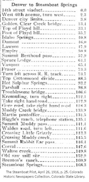
Denver to Steamboat Springs way back when...
An article from the Steamboat Pilot in 1916 gives the mileage for certain points along the drive to Steamboat Springs. The distance from Denver to Muddy Pass at marked at 141 miles.
1. The Rocky Mountain News (Daily), Volume 17, September 5, 1876, p. 4. Colorado Historic Newspapers Collection. Colorado State Library.
2. The Rocky Mountain News (Daily), Volume 22, March 15, 1881, p. 3. Colorado Historic Newspapers Collection. Colorado State Library.
3. The Rocky Mountain News (Daily), Volume 22, August 26, 1881, p. 5. Colorado Historic Newspapers Collection. Colorado State Library.
4. The Steamboat Pilot, June 29, 1928, p. 5. Colorado Historic Newspapers Collection. Colorado State Library.
Images Credits: Library of Congress Prints & Photographs Division/Carol M. Highsmith [LC-DIG-highsm-35092], Coloradohistoricnewspapers.org, Center for Land Use Interpretation, Google Maps | More info
