North Pass/North Cochetopa Pass
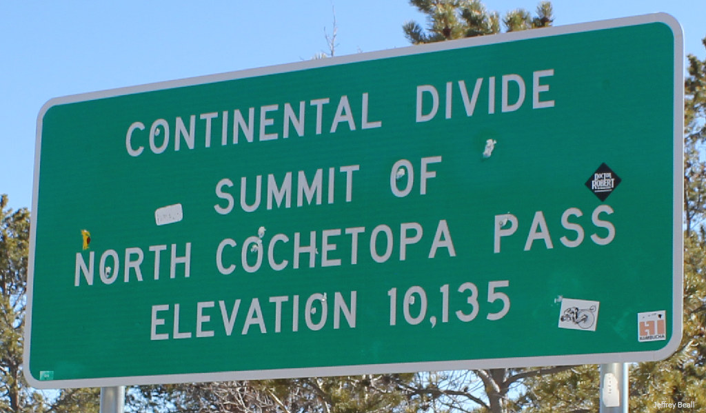
North Pass, also known as North Cochetopa Pass, crosses the Continental Divide in southern Colorado at 10,135 feet. The next paved road across the divide to the north is Monarch Pass, and the next paved road to the south is Spring Creek Pass.
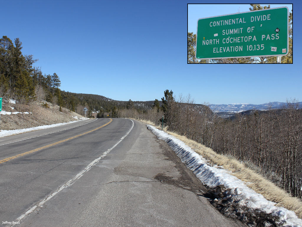
The pass is traversed by CO HWY 114, and it is located in the Cochetopa Hills. You can see the sign at the summit refers to this as North Cochetopa Pass. The reason for the two names is explained a bit further down this page.
Seasonal Info
North Pass is open year-round.
North Pass Stats
- Max Road Elevation: 10,135'
- Surface: Paved
- Mtn Range: San Juan Mountains
There are no hairpin turns or runaway truck ramps on North Pass. This highway is relatively tame compared to some of the other CO mountain passes over the Continental Divide.
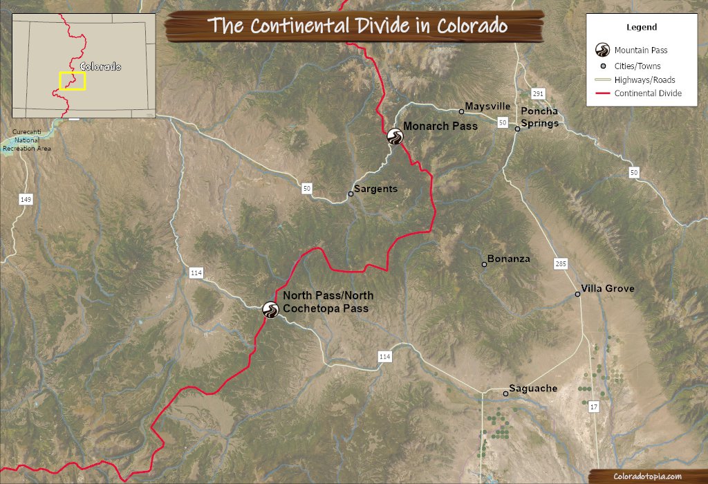
Alternate Routes – Alternate routes to North Pass include: Spring Creek Pass to the south, and Monarch Pass to the north. Cochetopa Pass is located about 3 miles to the south, and this is a dirt road alternative.
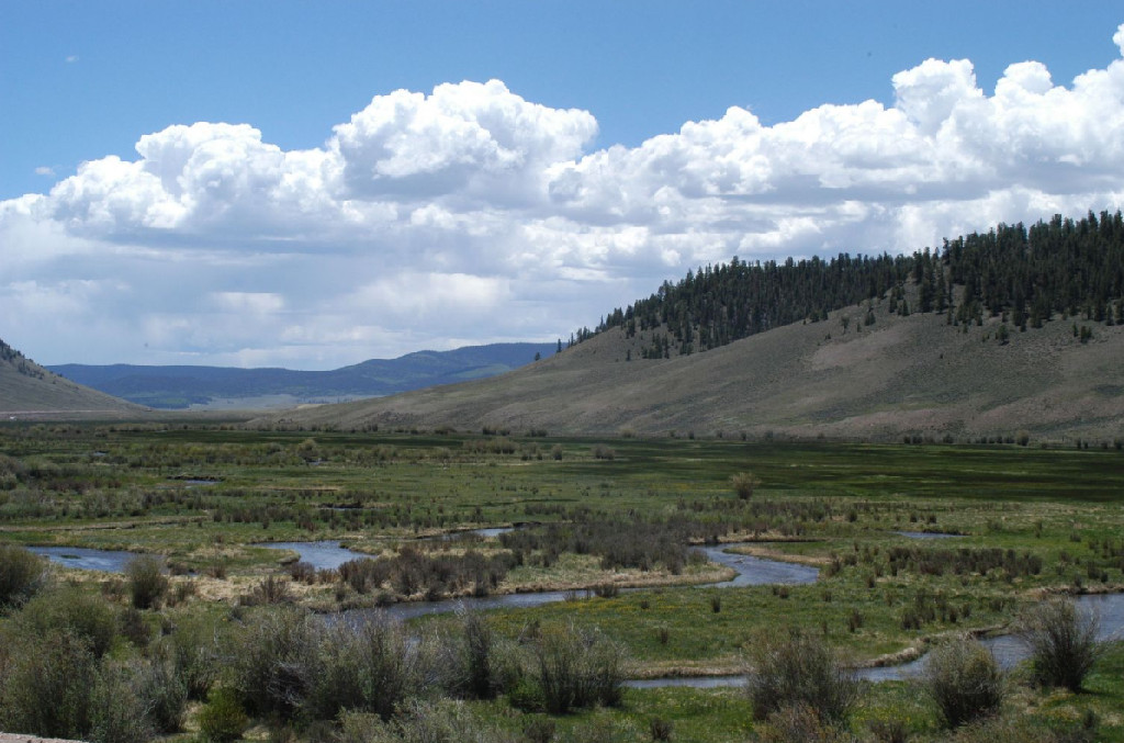
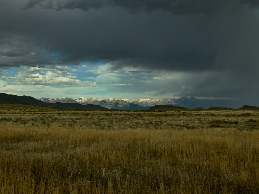
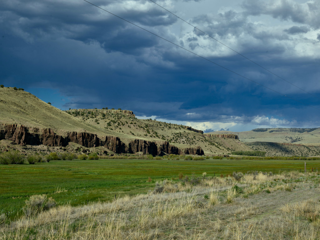
Above & below: Storm clouds and the view from North Pass
Directions from Gunnison
North Pass is just under a 1-hour drive away from Gunnison, CO. Drive east on US HWY 50 out of Gunnison. Take a right on CO HWY 114 and this will take you to North Pass.
- US HWY 50 East
- CO HWY 114 South/Southeast
Recreation on North Pass
Colorado Trail Segment 18 crosses North Pass just to the north of the summit. This trail runs congruent with the Continental Divide Trail through this section. Segment 18 measures 13.6 miles, and the hiking primarily consists of back roads, open alpine meadows and farmland. You should bring plenty of water and expect streams to be polluted by farming along the way.
Mountain biking is allowed on this section of the Colorado Trail.
North Pass FAQ
Yes. Both names have been used since at least as far back as the 1950s. North Pass is the official name, but North Cochetopa Pass is an officially recognized variant that incorporates the historical names and the historical development of this road. Cochetopa Pass still exists as a dirt road, located just to the south of North Pass.
This drive is relatively easy compared to Loveland Pass or Independence Pass. Any road can be dangerous in the winter, and this is still a winding mountain road, but this is not the steepest, highest, or curviest of Colorado’s mountain passes.
This mountain pass is located in Saguache County, to the southeast of Gunnison, CO.
North Pass History
Cochetopa Pass (located just to the south of North Cochetopa Pass) was the first wagon road of significance through this territory, but paths through these hills existed long before that road was built. Cochetopa Pass has a history that includes failed expeditions, cannibalism, and attacks by the indigenous tribes.
The road on Cochetopa Pass was built in 1916.1
Work on the realignment of Cochetopa Pass had begun by 1959. The new highway was built about 3 miles north of the previous Cochetopa Pass route. This new route was to be called North Pass.
In June 1959, a contract to complete grading of the new route was awarded. Work was scheduled to begin in June, and was expected to take 5 months.2
This highway was designated as North Pass by the USGS, effective on January 1, 1963.3 The name “North Pass” was approved for use in maps by the United States Department of the Interior Board of Geographic Names in 1964.4
North Cochetopa Pass was officially recognized as a name variant for this pass in 1981.3
Did You Know?
Cochetopa Canyon is located to the north of this pass. This is a fun drive on winding canyon roads between North Pass and Gunnison. The highway runs alongside of Cochetopa Creek for approx. 16 miles through the canyon.
References & Credits
1. The Salida Mail, Volume 42, Number 68, February 9, 1923, p. 1. Colorado Historic Newspapers Collection. Colorado State Library.
2. Saguache Crescent, Volume LXXX, Number 26, June 25, 1959, p. 2. Colorado Historic Newspapers Collection. Colorado State Library.
3. Summary Report. (1981, December 31). US Geological Survey. Retrieved January 14, 2024, from https://edits.nationalmap.gov/apps/gaz-domestic/public/search/names/190057
4. The La Jara Gazette, Volume 48, Number 40, January 24, 1964, p. 1. Colorado Historic Newspapers Collection. Colorado State Library.
Images Credits: Denver Public Library Special Collections/Rocky Mountain News [RMN-020-7919], Library of Congress Prints & Photographs Division/Carol M. Highsmith [LC-DIG-highsm- 38079][LC-DIG-highsm-38078], Jeffrey Beall | More info