Brief Description
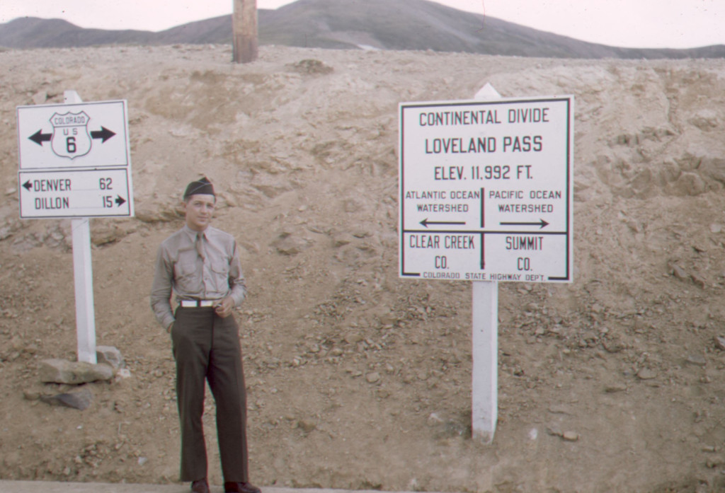
This photo shows 10th Mountain Division soldier William A. ‘Bill’ Southworth atop the Continental Divide on Loveland Pass, sometime between 1943 and 1944. The signpost for another Continental Divide sign can be seen extending out of frame in the upper middle. This image is currently held in the Denver Public Library.
Info
- Date: Circa 1943-'44
- Subject: William A. "Bill" Southworth
- Photographer: Unknown
- Medium: Kodachrome Slide + Photograph
- Size: 35mm Slide, 8" x 10" Photo
- ID: DPL-TMD-736
- Repository: Denver Public Library, 10th Mountain Division Resource Center Collection
Digital copy provided by the Denver Public Library. No cropping or enhancements.
Undetermined.
Image Dating Comments
This image has been dated by the Denver Public Library to 1943-1944.
Comments & Discussion
The main sign has been enlarged and cropped in the image below. This sign and signpost would be replaced by 1948. The directional arrows indicate that this sign was located on the southern side of Highway 6.
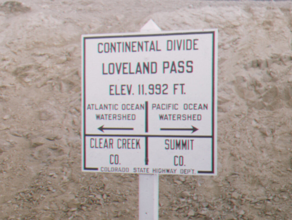
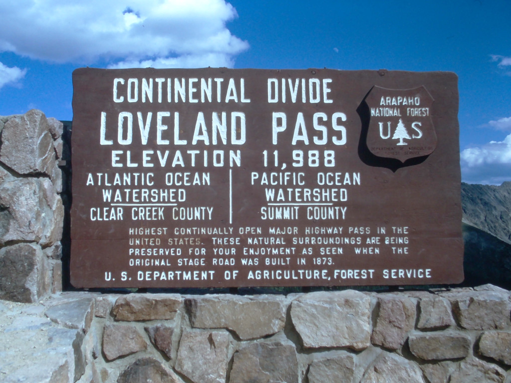
Take note that the elevation of 11,992′ is displayed on this sign. This would be adjusted to 11,988′ on the sign that was erected during the late 1950s here. It would later be changed again to 11,990′ (sometime between 1974 and 1983) and this is the elevation listed here today.
About the Coloradotopia Archives Collection. The Coloradotopia archives hold a large collection of historical images and items that document Colorado’s automobile history in the mountains. You can read more about the collection here.

