Info
- Date: Circa 1940
- Photographer: Unknown
- Medium: Postcard
- Size: 3 3/8" x 5 3/8"
- ID: CMO-ECOLO33
- Acquisition Date: February 2024
- Repository: Coloradotopia Archives
Scanned with basic cropping, no enhancements.
Image use restricted.
Image Dating Comments
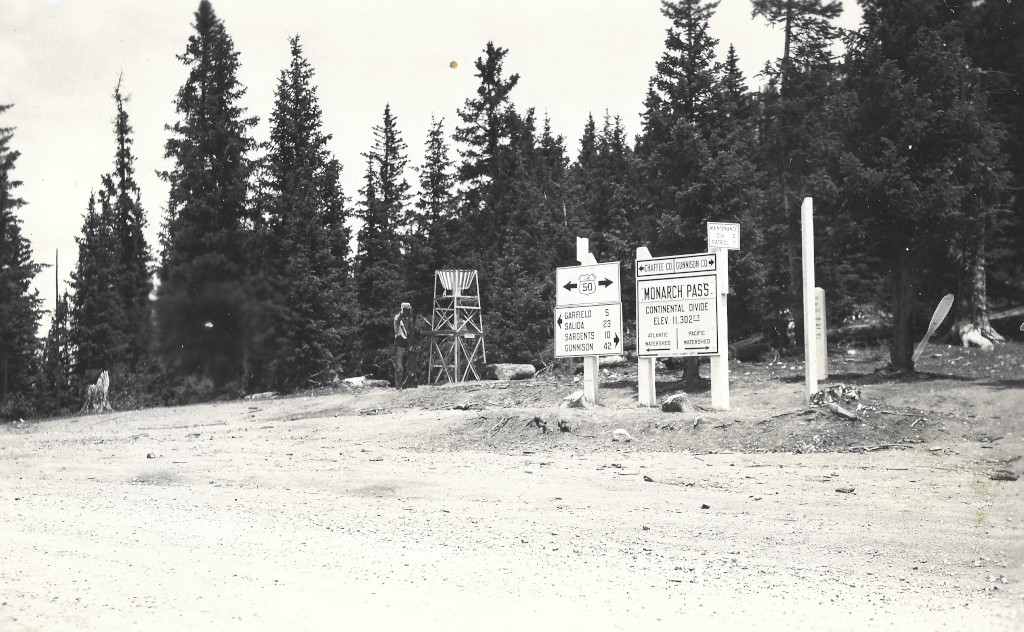
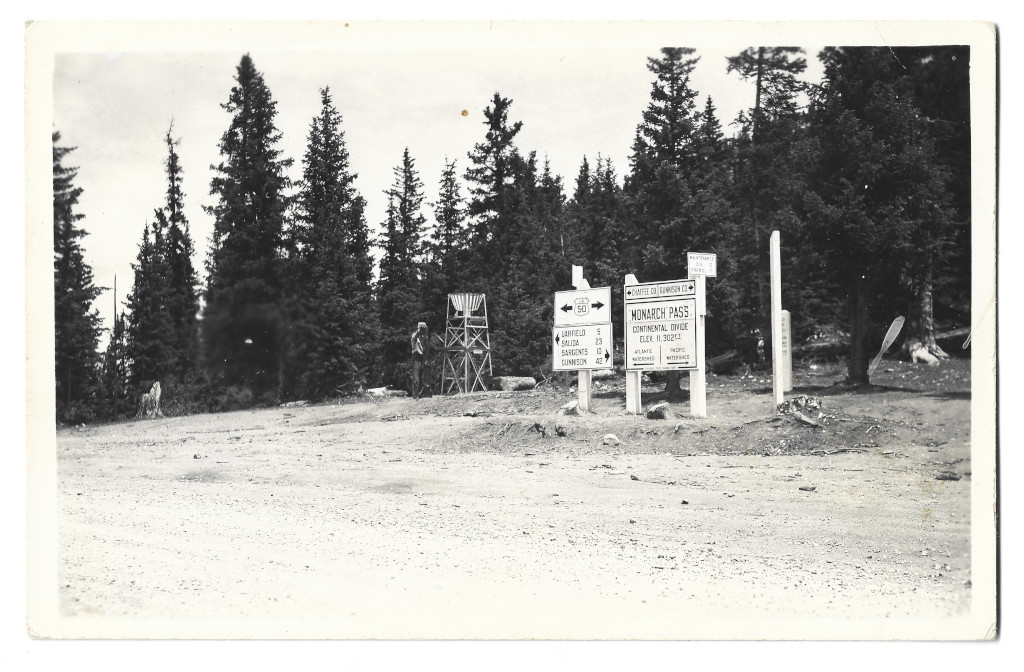
These signs have been dated based on historical knowledge of the pass’s construction, and a comparison to other photos from the era. This spot is located along the new route for the pass which was completed in 1939. Paving of the route was completed in 1940.
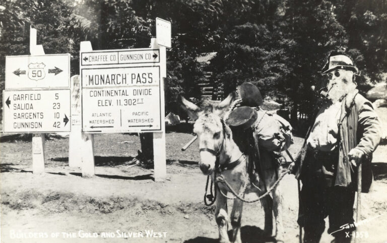
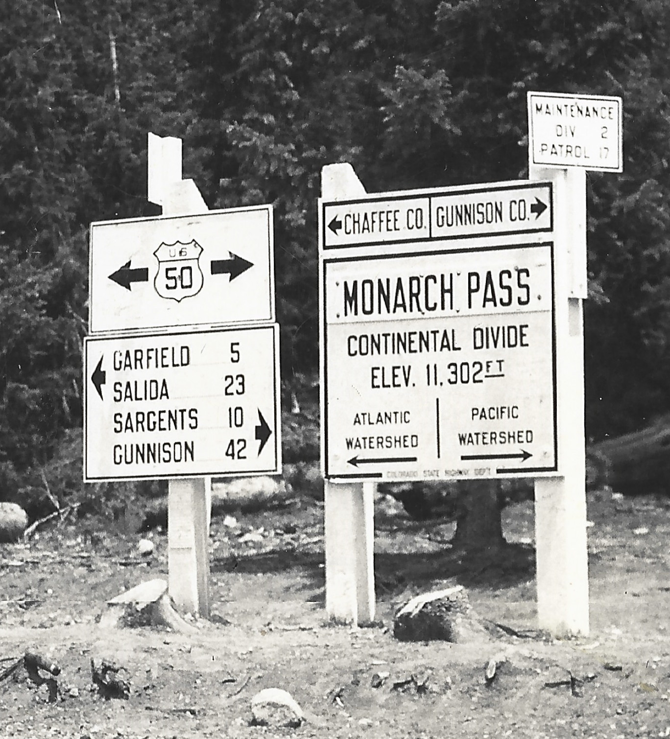
Enlarged images of this sign show that the Monarch Pass label is actually riveted on. That’s because this sign originally said Vail Pass when it was put up. After politics ensued and the governor intervened in November of 1939, the name was officially designated as Monarch Pass. This postcard (CMO-W-1580) shows that the name on the sign was still Vail Pass when snow began to fall in 1939. Since this sign has the updated name and there is no snow on the ground, it is almost certainly a 1940 or later photograph.
Backside
Full Scan
Comments & Discussion
Along with the Continental Divide sign and directional sign, a precipitation gauge sits off to the left in the background. Behind the empty post on the right, there is a thicker marker which can also be seen in many other photos from this archive.
The detail and quality of this postcard is notable. The image retains a significant amount of detail when the viewing field is enlarged…
Condition, Aging & Authenticity: There are light but obvious signs of aging on the backside. There is some scratching, swirling and denting of the image’s surface, but no real cracking or spidering. There is a brown dot in the upper middle upon entry into the archive.
About the Coloradotopia Archives Collection. The Coloradotopia archives hold a large collection of historical images and items that document Colorado’s automobile history in the mountains. You can read more about the collection here.

