Loveland Pass Continental Divide Sign Image Archive Collection
There have been approximately 10 generations of Continental Divide signs on Loveland Pass over the last 100 years. The purpose of this page is to document these signs and their changes over time. The gallery can be seen immediately below. Find in-depth discussion of each image through the links lower on this page.
The Coloradotopia Archives Collection. The archives contains hundreds of photographs, slides, postcards, motion films, and small items focusing on Colorado’s Continental Divide and mountain transportation history. See the main archives page here.
1942
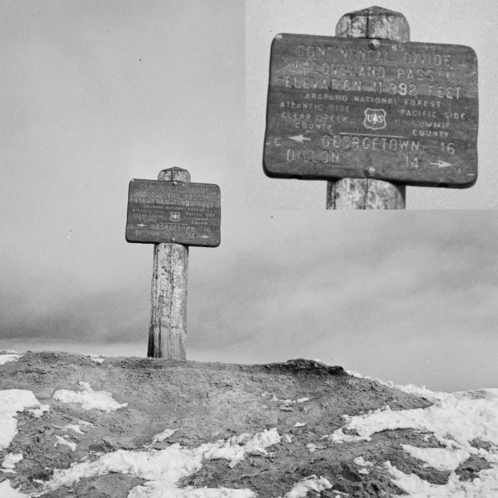
This image is currently held by the Library of Congress, and it has been dated to 1942. The enlarged window has been added for this archive.
This sign has the US Forest Service logo on it and was likely added around 1932 or later when the improved dirt highway was completed.
- Photographer: Andreas Feininger
- Archive ID: LC-DG-FSA-8D35749
c. 1943-'44
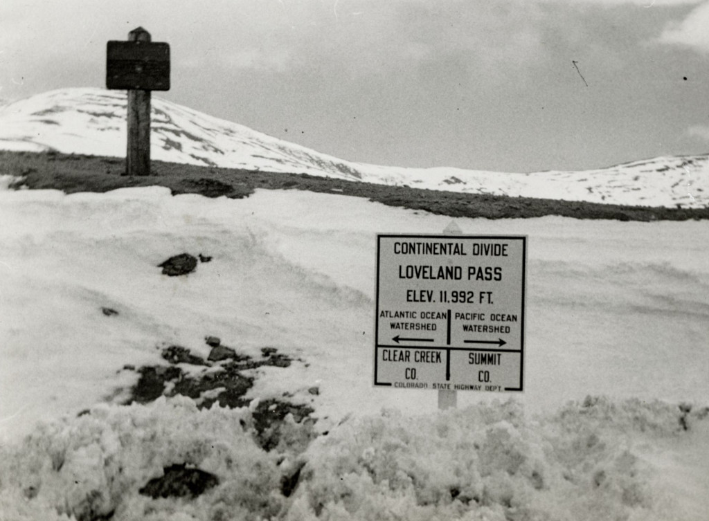
This photo from the Denver Public Library shows the old US Forest Service Continental Divide sign in the background, with a newer sign that was added by the Colorado State Highway Department in front.
- Archive ID: TMD351-2020-626
c. 1943-'44
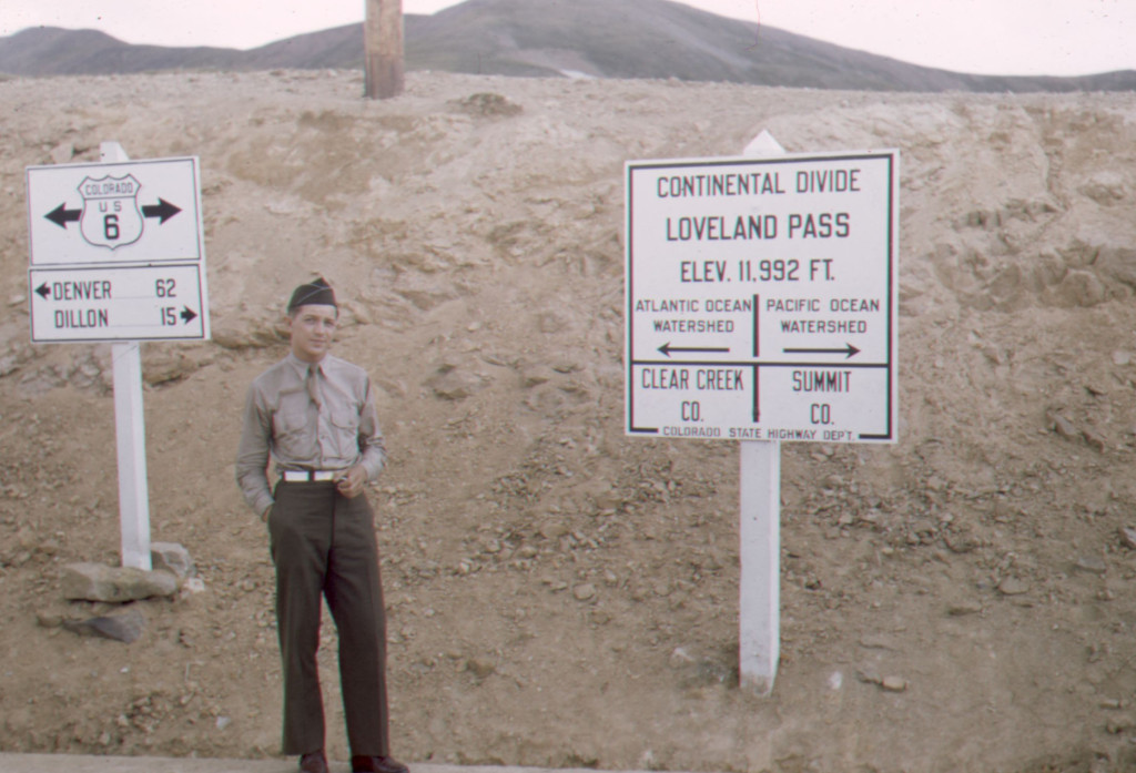
This photo from the Denver Public Library shows William A. “Bill” Southworth, a 10th Mountain Division soldier, sometime in either 1943 or 1944. The signpost for the previous sign can still be seen standing in the background.
- ID: TMD-736
c. 1940s
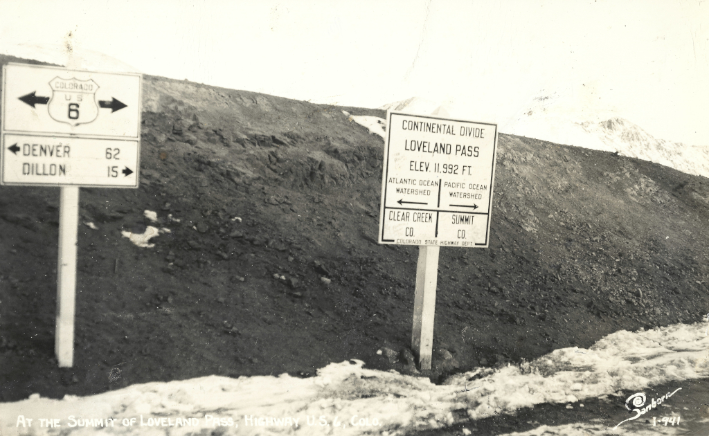
This is a scanned image of a Harold Sanborn postcard that was postmarked in 1949. It contains the same signs that existed here throughout much of the 1940s. These signs were gone by 1948.
Harold Sanborn was a well-known photographer who traveled around Colorado and neighboring states, taking photographs and creating postcards from roughly the 1920s to 1970s.
- Photographer: Harold Sanborn
- ID: CL-L-941
1948
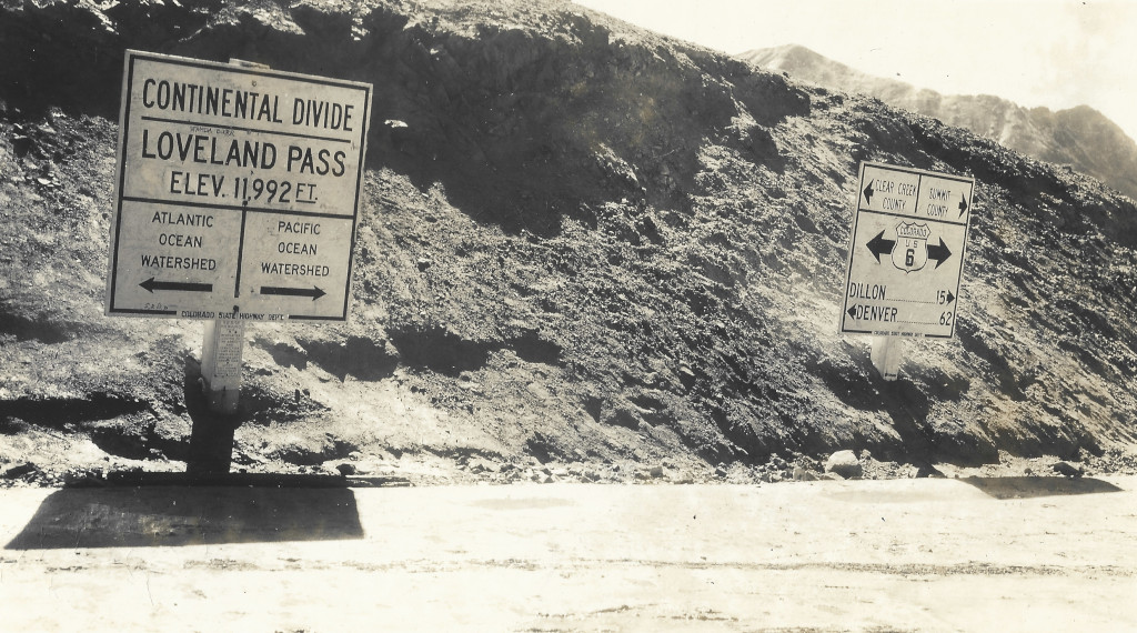
This photograph shows a new set of signs that were added here by 1948. These signs can be recognized by the thicker single-mast sign posts, the bolder arrows, and the county names added to the top of one sign as two rows.
- Photographer: Thomas B. Aldridge
- ID: CL-TA1948
1950
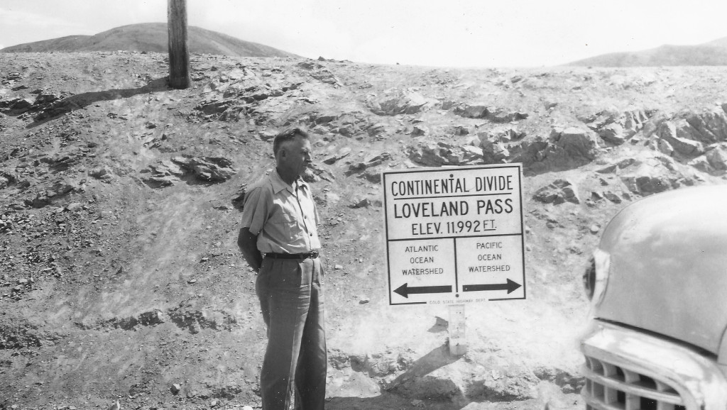
This dated photo from 1950 includes the front end of a Nash that was built in either the 1949 or 1950 model year.
- ID: CL-50283
c. 1950-'52
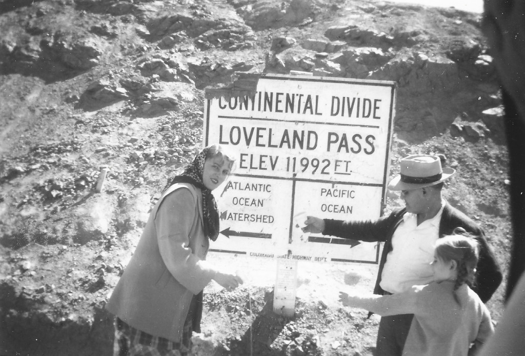
The top-left corner of the sign has gone missing in this photograph.
- ID: CL-930C
1952
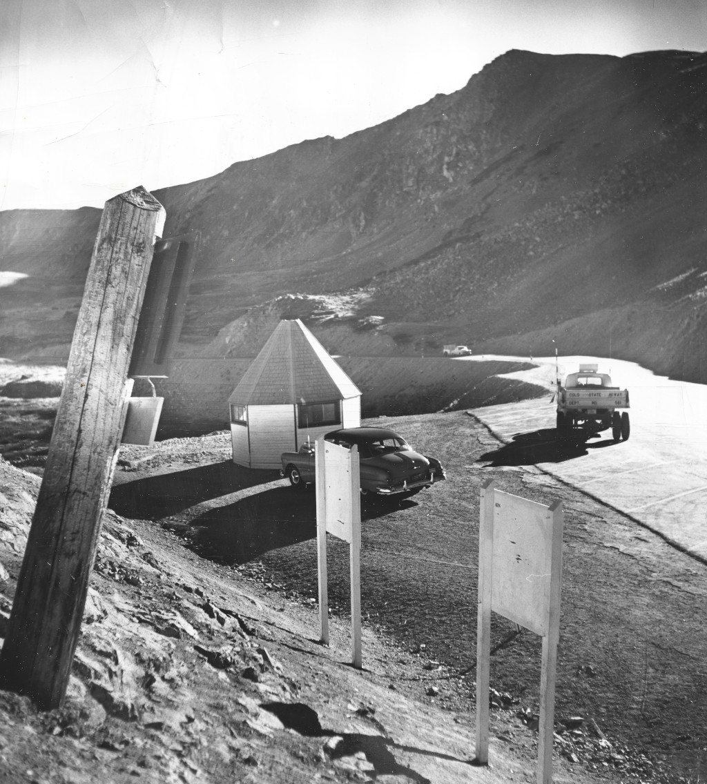
This photograph, taken while looking to the west from the summit, shows the rear view of the Continental Divide signs on Loveland Pass as well as a high altitude research center that was added around this time. That research center would only be here for a few years, and the US Forest Service would eventually build the next Continental Divide sign in that area of the summit.
- Photographer: David Mathias/Denver Post
- ID: CL-UIN-53-094
c. 1950-'52
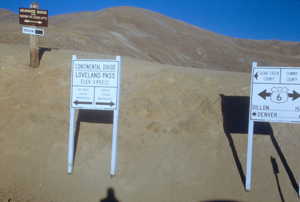
This image was likely captured around the same time as the previous image. The Continental Divide signs shown here were in place for approx. 5+ years in the early 1950’s. Some of the photos from this era can be dated based on the erosion of the dirt around the rocks in the foreground.
- ID: CL-P7
c. Early 1950s
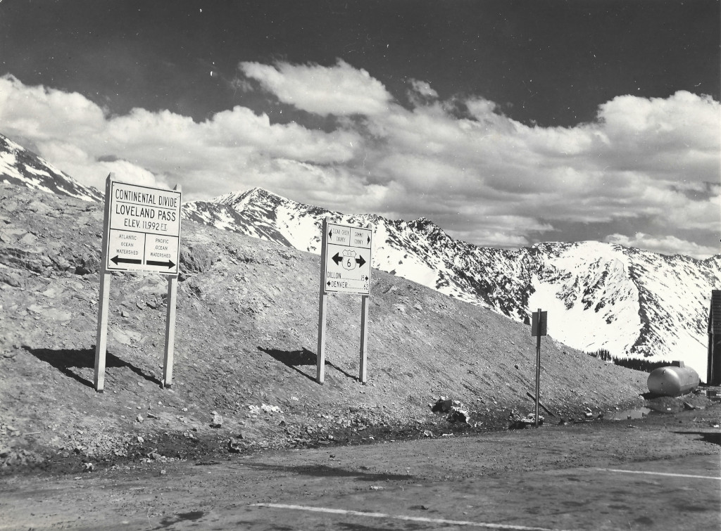
These are the same signs that are shown in other images from the early 1950s here. A propane tank and wooden structure can be seen on the right side of this photo where the high altitude research center also stood around this time.
- ID: CL-IS1
c. Early 1950s
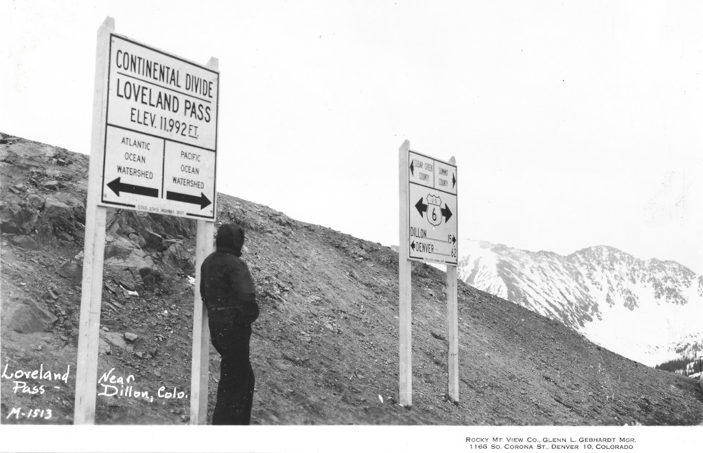
This postcard by the Rocky Mt. View Co. dates to the early 50s. This was one of the prominent producers of real photo postcards during this period in Colorado.
- Photographer: Glenn L. Gebhardt
- ID: CL-M-1513
c. Early 1950s
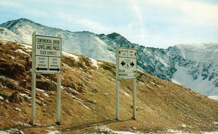
This postcard was made by the Sanborn Souvenir Co. It is unused and does not have a date outside of the estimated range in the 1950s.
- Photographer: Harold Sanborn
- ID: CL-81407
c. Early 1950s
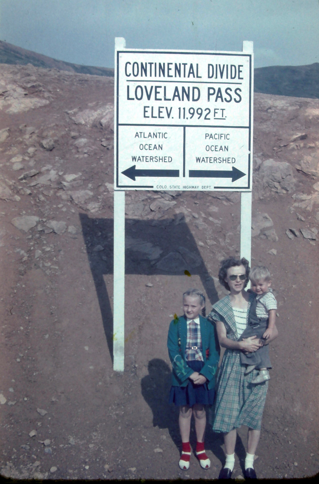
A woman and her children are shown here sometime in the early 1950s. This image is scanned from a 35mm Ansco slide.
- ID: CL-RCLA
1954
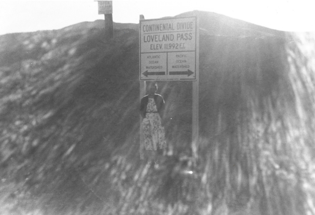
This sunburst photo from the top of Loveland Pass was taken in 1954. It shows the main Continental Divide sign, as well as the bottom of an older sign behind it for the Arapahoe Basin ski area.
- ID: CL-KVA1954
1955
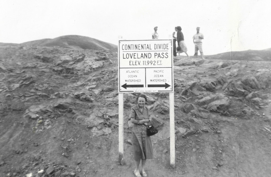
This photo shows the Loveland Pass sign in 1955, still boasting the Colorado State Highway Department text on the bottom of the sign. The name of that department was changed in 1953 and signs painted with the name after the change were labeled Colorado Department of Highways.
- ID: CL-V25
c. 1954-'55
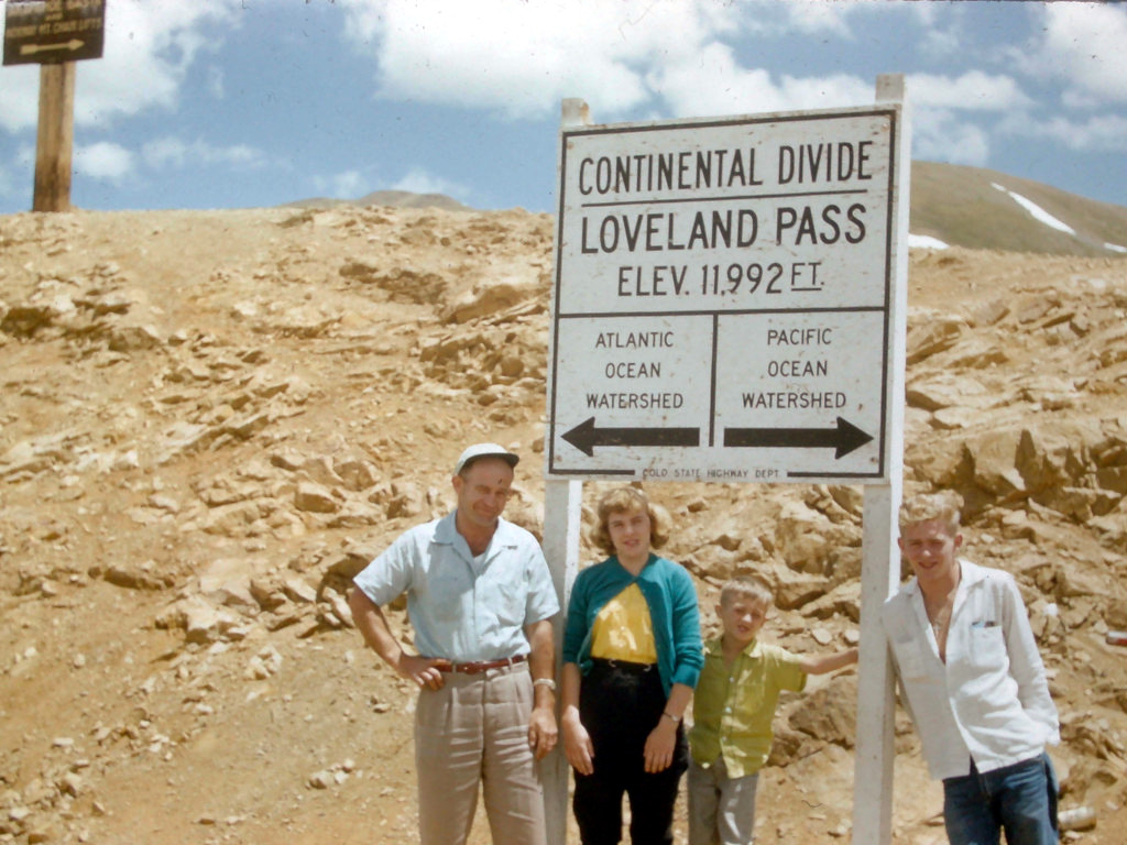
This photo is believed to have been taken in the summer of 1954 or 1955.
- ID: CL-14
c. 1957
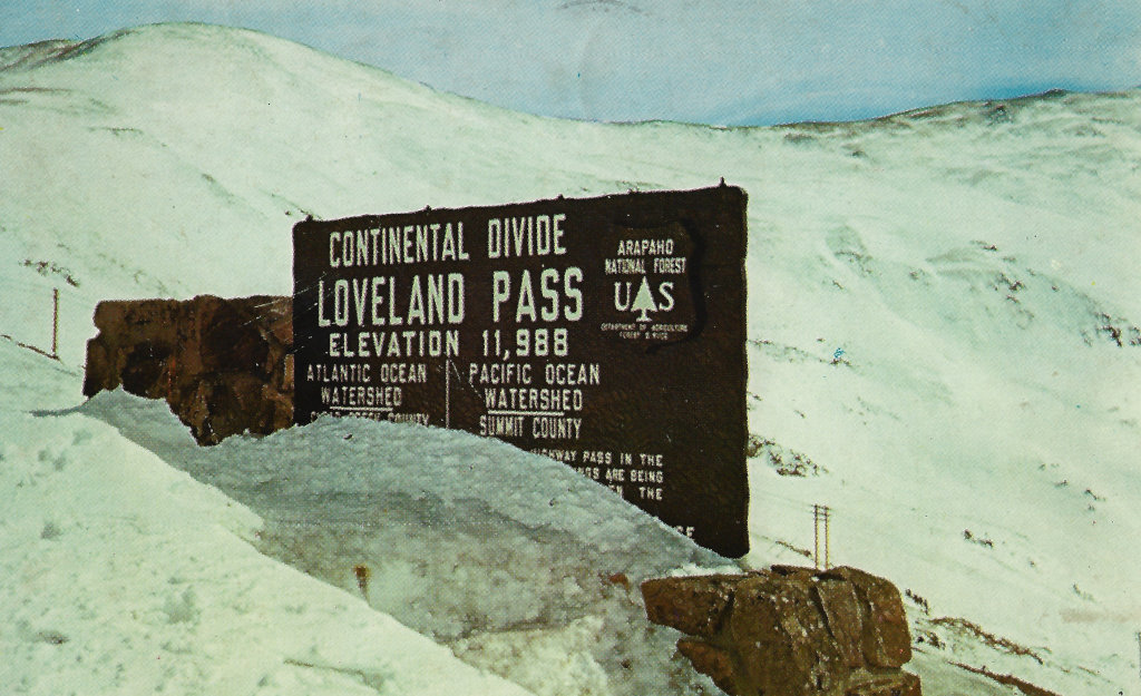
This image shows the new US Forest Service sign at the top of Loveland Pass. This is a scanned image of a postcard in the Coloradotopia Archives. The postcard is postmarked July of 1958.
This is obviously a winter photo, and this sign was erected no later than 1957.
- ID: CL-99610
1959
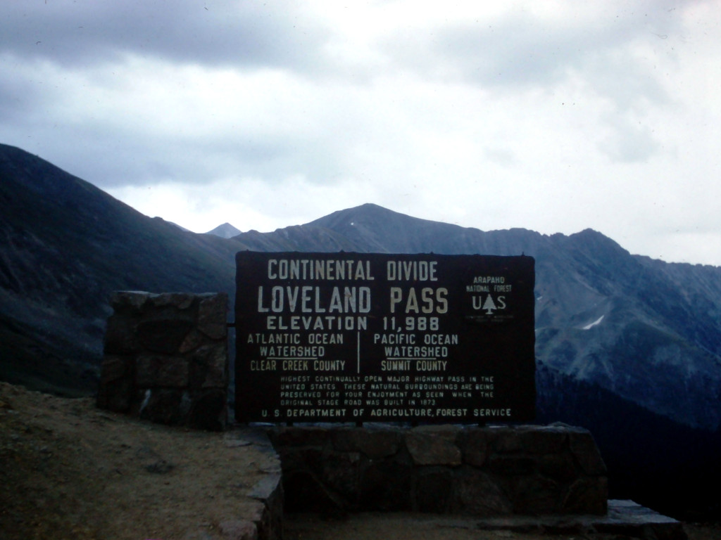
This image comes from a 35mm Kodachrome slide that is dated to August 1959. The small patch of snow in the background shows what late summer usually looks like here.
- ID: CL-18
1960
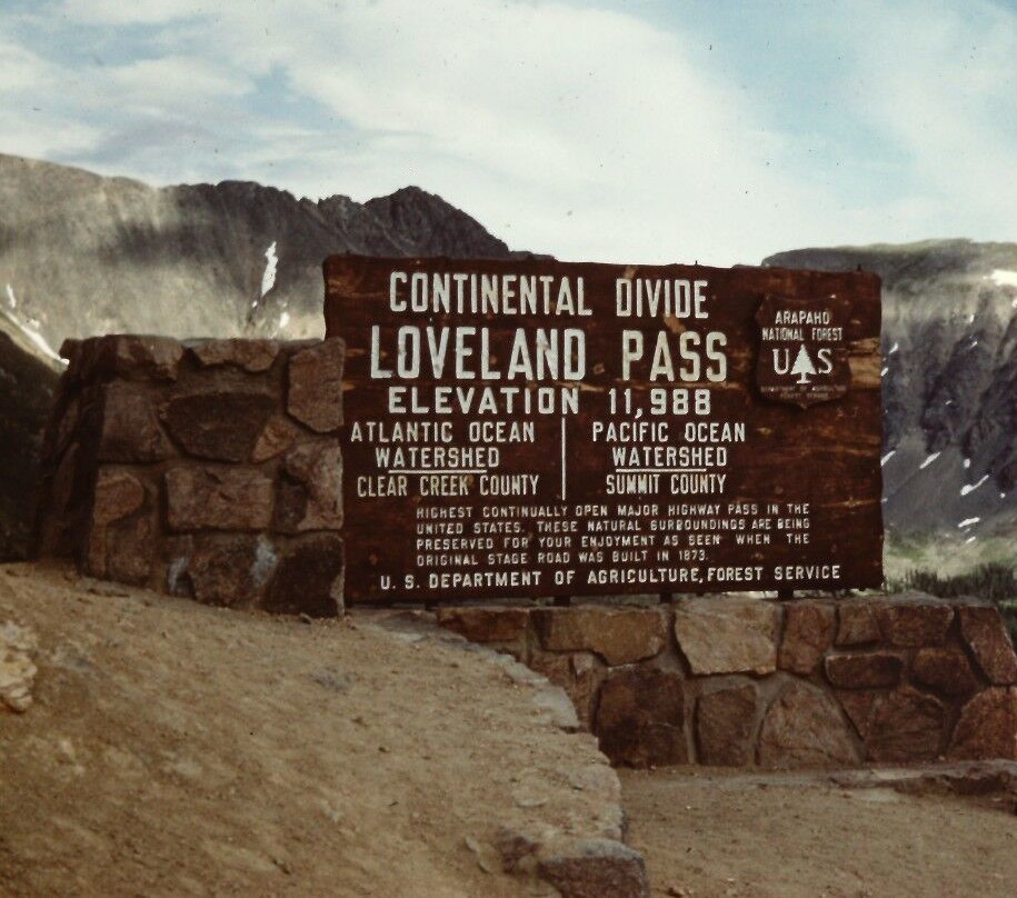
The sign was starting to show some wear at this point in 1960. This image was cropped from a much larger version that also shows two people. The sign would be repainted in the near future.
- ID: CL-2150
1963
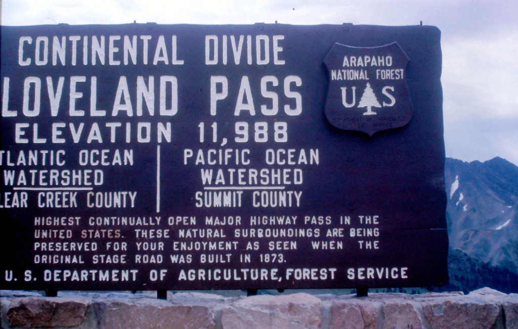
The US Forest Service sign had been repainted by the time that this photo was taken in 1963.
- ID: CL-14J
1964
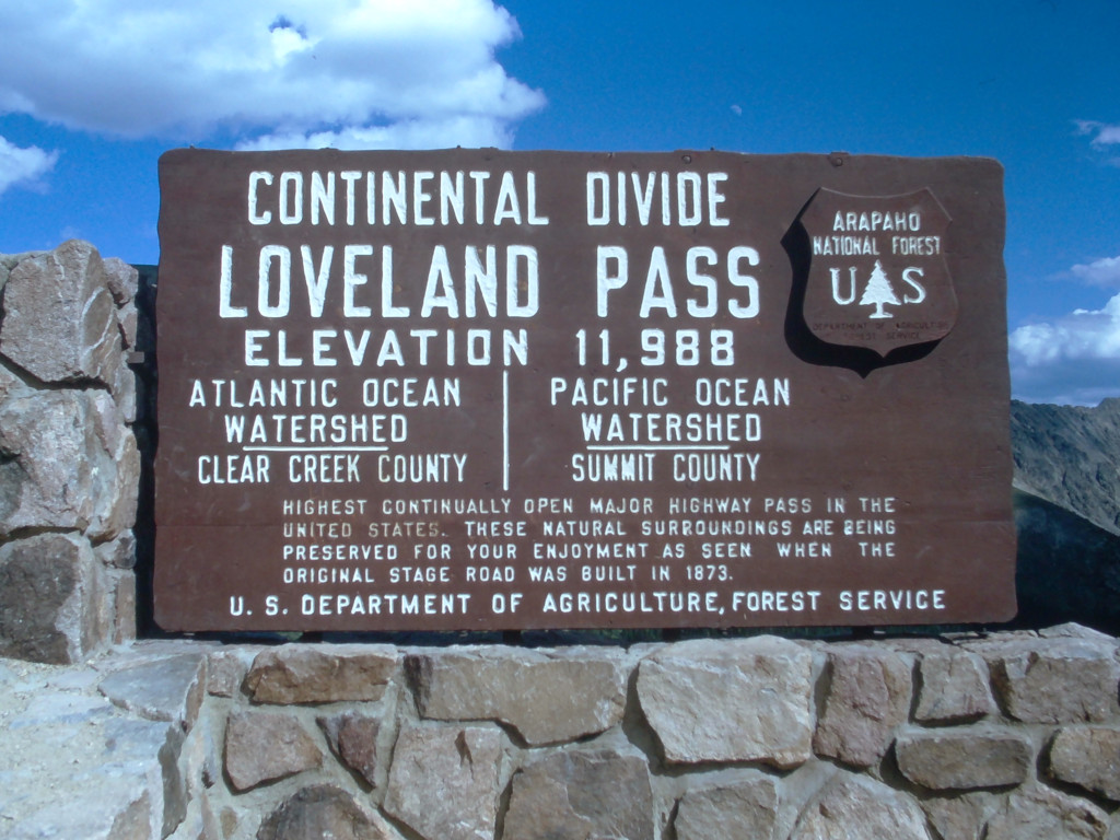
This is one of the last years that this sign existed on the top of this pass. It was replaced the next summer by a new pair of signs on the same stone base.
- ID: CL-23A
1965
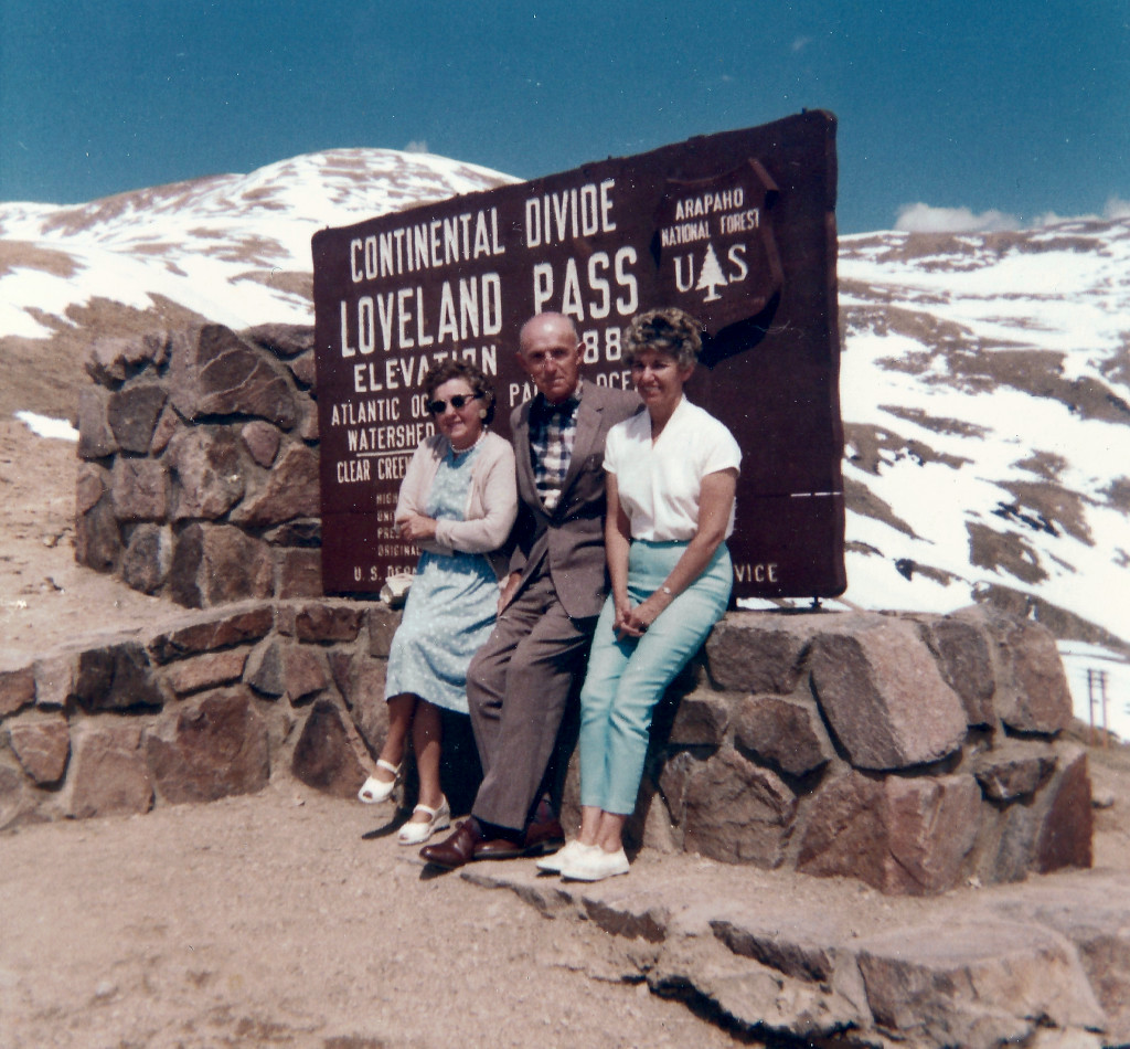
This photo has an unidentical twin photo that was taken during the same session. That one can be seen here: CL-J65RB.
- ID: CL-J65RA
c. 1957-'65
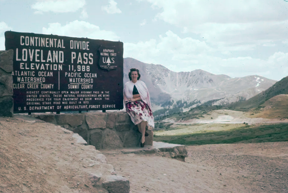
There is no date info on the slide, and it can only be dated to the general range when this sign was known to be here. The sign’s paint shows little wear in this photo, so it was likely taken early after the sign was erected, or later on after it was repainted.
- ID: CL-JPCCF
c. 1957-'65
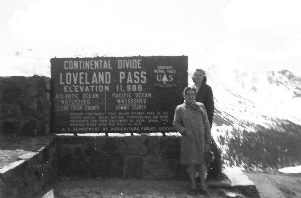
This scan comes from an undated black & white photo, and has been dated to this general era of 1957-’65. The background appears to show an early spring snowpack.
- ID: CL-N015
c. Late Summer/Fall 1965
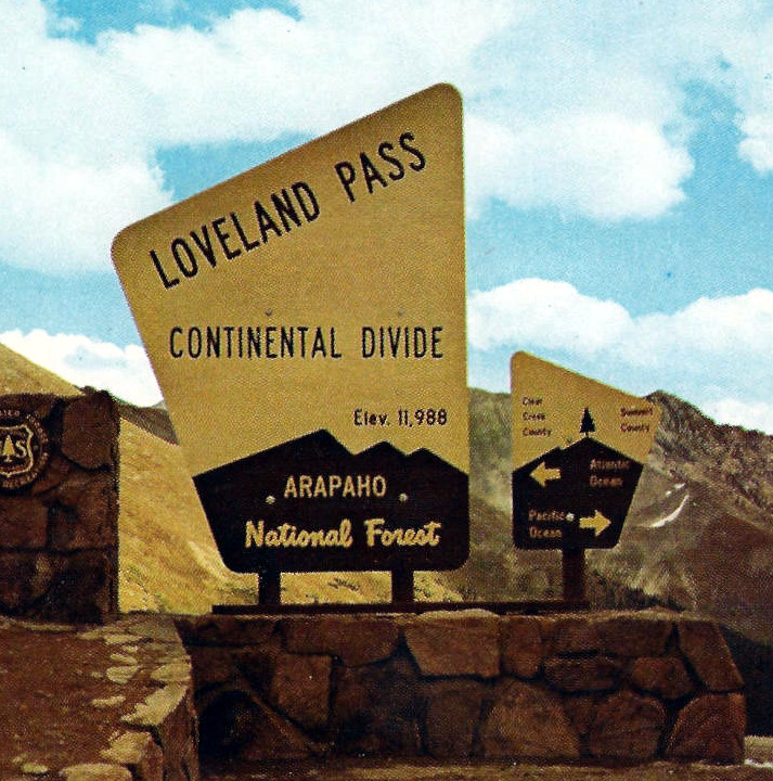
This cropped thumbnail image comes from a scanned postcard that has a postmark of 1967. The image shown on the postcard can be dated to sometime in 1965. The smaller sign shown on the right was gone by the next summer. It was likely destroyed by a snowplow within 6-7 months of being erected, so there are very few images of this sign available.
- Photographer: C.C. Patterson
- ID: CL-P-105
1966
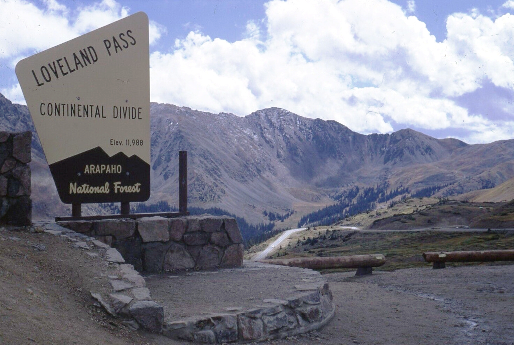
The smaller twin of this sign was missing by the time this image was captured. That sign was mounted on the empty sign post that is seen to the right of this sign.
- ID: CL-K29
c. 1969
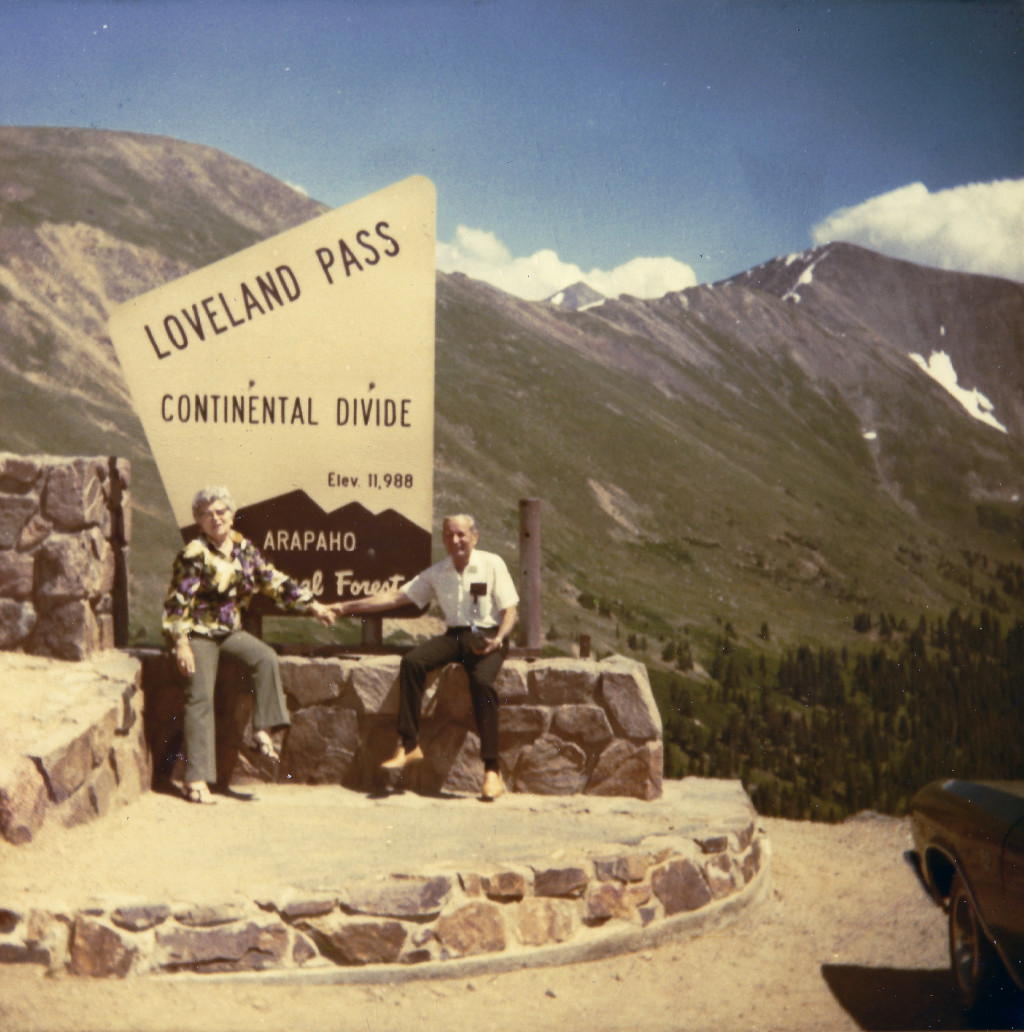
This slide was developed in April of 1970, but any local can tell you that there is no way that this photo was taken in April. This is a summer photo, so it is likely from 1969 or prior.
- ID: CL-APR70
1974
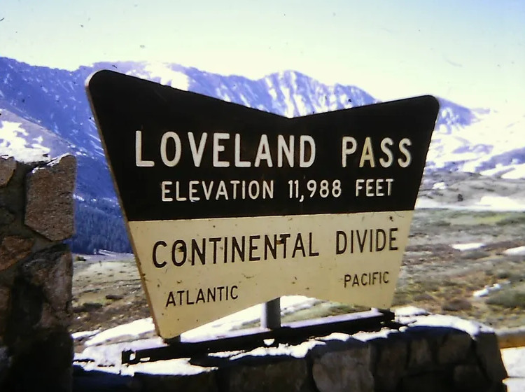
This slide is hand-labeled in pen with the date 6/74. It shows the first of several similar signs that would be put up here in the coming decades by the US Forest Service.
- ID: CL-6746
1984
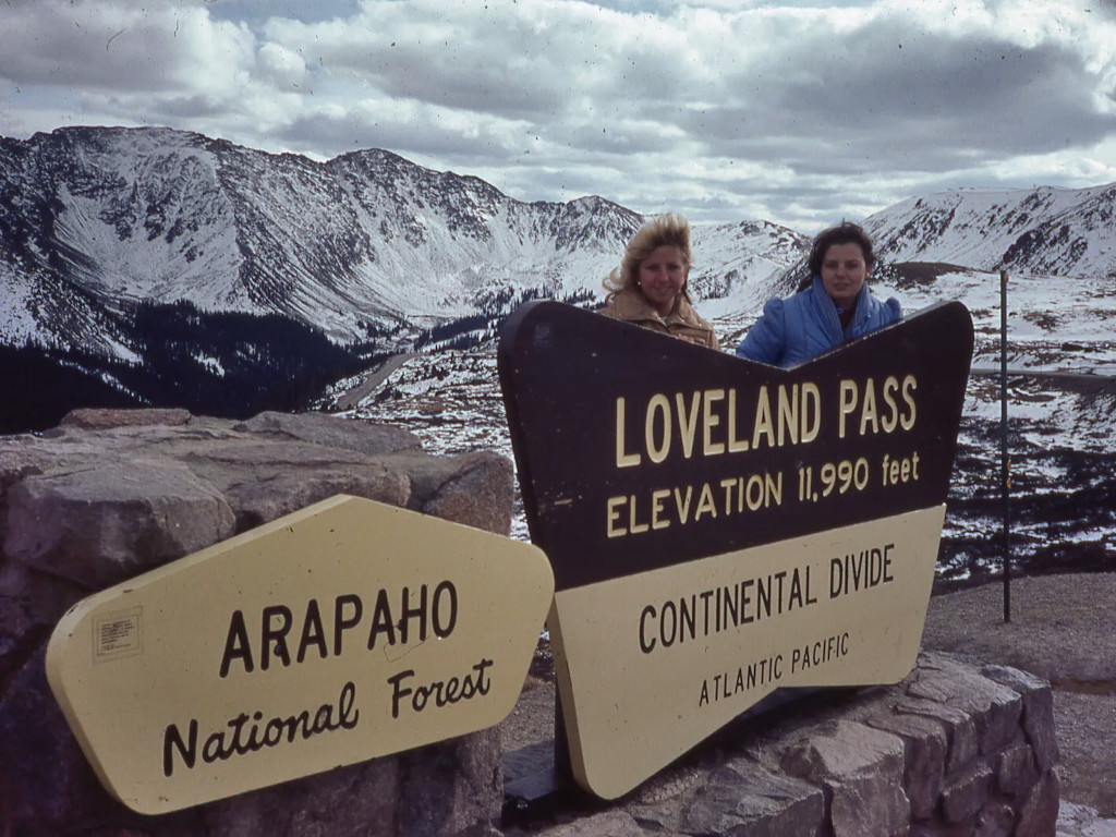
This Continental Divide sign image is captured on a 35mm slide that was developed in January of 1984. The snowpack makes it look like this could possibly be a December photo from 1983 that wasn’t developed until January.
- ID: CL-J843
2001
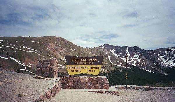
This sign, published on Flickr.com, can be distinguished from the previous one by looking at the spacing between the Continental Divide lettering and the edge of the sign. This photo shows this sign missing a chunk from the left side. This would be the first stage of destruction for this sign over the coming years.
- Photographer: Ari Herzog
- ID: FLK-474083416
2004
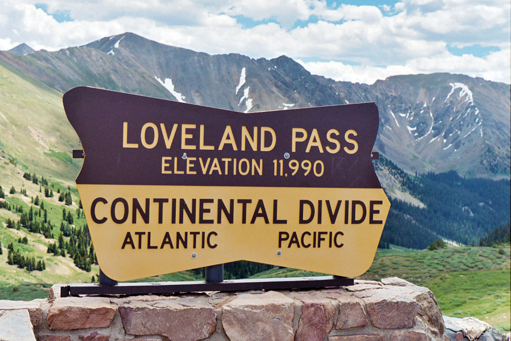
Another chunk of this sign had been taken out by 2004. This photo shows pieces missing from both sides. This photo was also originally published to Flickr.com, and only the digital version is shown in this archive.
- Photographer: Steven Martin
- ID: FLK-49777749558
2005
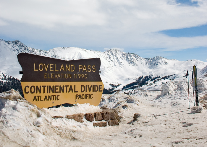
This winter photo from 2005 shows the sign with pieces missing from both sides, and snow pushed up around it by the snowplows working at the summit of the pass.
- Photographer: Christopher Morrison
- ID: WIKI-CMM
2007
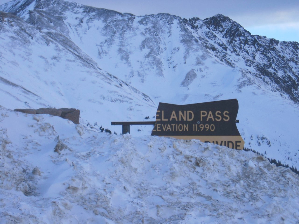
The sign at the top of Loveland Pass was broken again in 2007, this time losing the entire left side. A new sign was already in place by the time that this one was broken in January.
- Photographer: SirLyric
- ID: WIKI-J07
2010
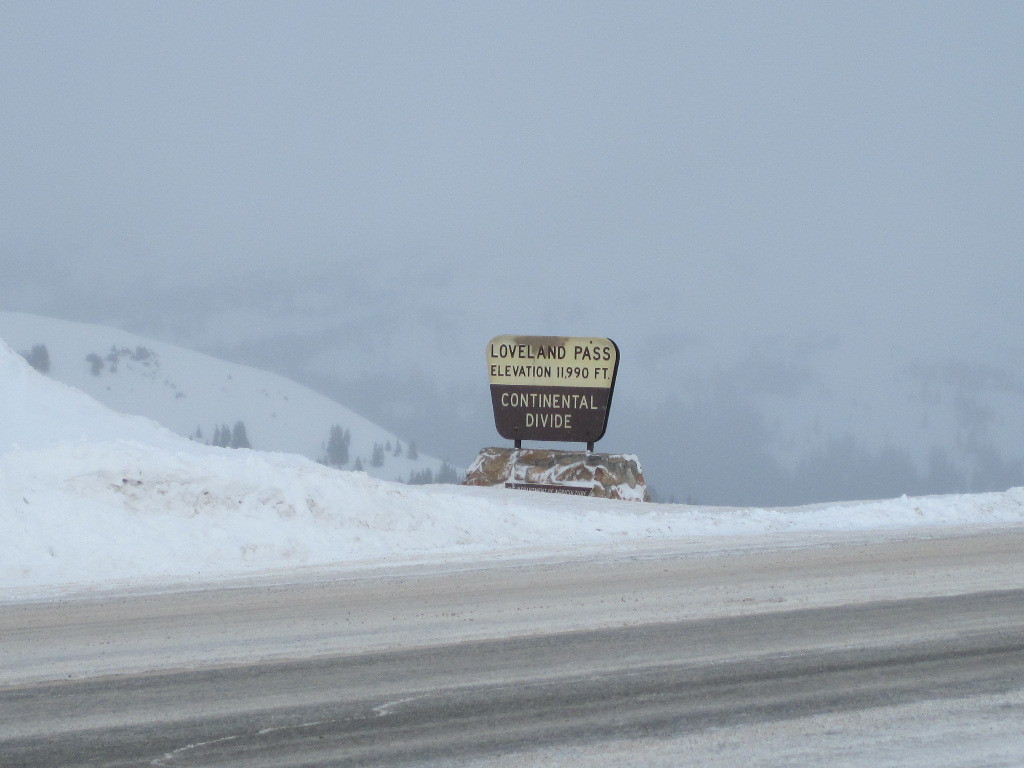
This photo was captured by Coloradotopia staff and has a digital time stamp from February 2010.
The sign on the western side of the pass was still in place when this sign was installed (circa 2007).
- ID: CL-MW2010

